Turbeville, South Carolina facts for kids
Quick facts for kids
Turbeville, South Carolina
|
|
|---|---|
 |
|

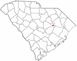
Location of Turbeville, South Carolina
|
|
| Country | United States |
| State | South Carolina |
| County | Clarendon |
| Area | |
| • Total | 1.34 sq mi (3.47 km2) |
| • Land | 1.34 sq mi (3.47 km2) |
| • Water | 0.00 sq mi (0.00 km2) |
| Elevation | 125 ft (38 m) |
| Population
(2020)
|
|
| • Total | 760 |
| • Density | 567.16/sq mi (219.05/km2) |
| Time zone | UTC-5 (Eastern (EST)) |
| • Summer (DST) | UTC-4 (EDT) |
| ZIP code |
29162
|
| Area code(s) | 843, 854 |
| FIPS code | 45-72745 |
| GNIS feature ID | 1251230 |
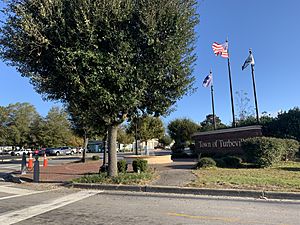
Turbeville is a small town in Clarendon County, South Carolina, United States. In 2020, about 760 people lived there. The town is known for its quiet community and local schools.
Contents
Exploring Turbeville's Location and Roads
Turbeville is in the northeastern part of Clarendon County. You can find it at these coordinates: 33°53′22″N 80°0′48″W / 33.88944°N 80.01333°W.
Major Roads and Travel
U.S. Route 301 goes through the town. This road leads northeast about 6 miles to Olanta. It also goes southwest about 18 miles to Manning, which is the main town of the county.
U.S. Route 378 also passes through Turbeville. It joins US 301 for a short distance in the town center. If you go west on US 378, you'll reach Interstate 95 in about 4 miles. It's about 20 miles to Sumter in that direction. Going east on US 378, it's about 16 miles to Lake City.
Land Area of the Town
The United States Census Bureau says that Turbeville covers about 1.34 square miles (3.4 square kilometers). All of this area is land.
Correctional Facility in Turbeville
Turbeville is home to the Turbeville Correctional Institution. This facility is for young people and adults aged 18-25. They are called "Youthful Offenders." Inmates often help clean up highways and roads nearby.
Transportation Options
There are no trains in Turbeville. For flying, the closest airport for small planes is Sumter Airport. If you need a commercial flight, Florence Regional Airport is closer. It has flights to Charlotte Douglas International Airport. Columbia Metropolitan Airport offers more flight options.
People and Population of Turbeville
| Historical population | |||
|---|---|---|---|
| Census | Pop. | %± | |
| 1930 | 210 | — | |
| 1940 | 234 | 11.4% | |
| 1950 | 271 | 15.8% | |
| 1960 | 355 | 31.0% | |
| 1970 | 442 | 24.5% | |
| 1980 | 549 | 24.2% | |
| 1990 | 698 | 27.1% | |
| 2000 | 602 | −13.8% | |
| 2010 | 766 | 27.2% | |
| 2020 | 760 | −0.8% | |
| U.S. Decennial Census | |||
In 2010, there were 766 people living in Turbeville. There were 301 households and 158 families. The town had about 478 people per square mile.
Diversity in Turbeville
The people living in Turbeville come from different backgrounds:
- About 63% were White.
- About 35% were African American.
- A small number were Pacific Islander or from other races.
- About 1.5% of the population was Hispanic or Latino.
Households and Families
Out of 301 households:
- About 27% had children under 18 living with them.
- About 44% were married couples.
- About 19% had a female head of household without a husband.
- About 31% of households were single individuals.
- About 15.5% had someone aged 65 or older living alone.
The average household had 2.40 people. The average family had 3.02 people.
Age Groups in Town
The population in Turbeville was spread out by age:
- About 25% were under 18 years old.
- About 10% were between 18 and 24.
- About 25% were between 25 and 44.
- About 26% were between 45 and 64.
- About 14% were 65 years or older.
The average age in town was 36 years.
A Look at Turbeville's History
The town of Turbeville has an interesting past.
Early Beginnings
In 1840, a man named Michael Turbeville bought 125 acres of land. He built a home about a mile north of where the town is today. Later, between 1870 and 1875, Michael's son, William J. Turbeville, bought about 200 acres. He built the first house in what is now the town of Turbeville. His brother, Clem, also bought land nearby.
The Turbeville brothers' land had many large pine trees. They built a turpentine still and ran it for about 20 years. They also had a big store where they sold many different goods for an even longer time. In those early years, the area was known as "Puddin' Swamp."
Traffic Management and Town Rules
In 2016, there was a discussion about the town's rules for traffic tickets. Turbeville has local rules that allow it to give out tickets with higher fines than state tickets. The town keeps the money from these tickets. Turbeville gives out many tickets each year, sometimes nearly 2,500. Many of these tickets are given during busy beach travel times. This is because the town is on major roads between Columbia and Myrtle Beach.
Education in Turbeville
The schools in Turbeville are part of Clarendon School District 3.
Local Schools
Clarendon County District #4 combined the Turbeville and Summerton school districts. Turbeville is served by three schools:
- Walker Gamble Elementary (located about 6 miles outside of Turbeville)
- East Clarendon Middle School
- East Clarendon High School
The school mascot for these schools is the Wolverine.
Places of Worship in Turbeville
There are seven Christian Protestant churches in the town of Turbeville:
- Horse Branch Free Will Baptist Church
- New Covenant Pentecostal Holiness Church
- Pine Grove United Methodist Church
- Pinedale Pentecostal Holiness Church
- Turbeville First Baptist Church
- Turbeville Southern Methodist Church
- Union Hill Baptist Church
See also
 In Spanish: Turbeville para niños

