Tygh Valley, Oregon facts for kids
Quick facts for kids
Tygh Valley, Oregon
|
|
|---|---|
|
Census-designated place (CDP)
|
|

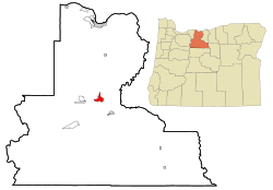
Location of Tygh Valley, Oregon
|
|
| Country | United States |
| State | Oregon |
| County | Wasco |
| Area | |
| • Total | 3.73 sq mi (9.66 km2) |
| • Land | 3.73 sq mi (9.66 km2) |
| • Water | 0.00 sq mi (0.00 km2) |
| Elevation | 1,194 ft (364 m) |
| Population
(2020)
|
|
| • Total | 236 |
| • Density | 63.25/sq mi (24.42/km2) |
| Time zone | UTC-8 (Pacific (PST)) |
| • Summer (DST) | UTC-7 (PDT) |
| ZIP code |
97063
|
| Area code(s) | 458 and 541 |
| FIPS code | 41-75500 |
| GNIS feature ID | 2409376 |
Tygh Valley is a small community in Wasco County, Oregon, in the United States. It is known as a census-designated place (CDP). This means it is a special area used for counting people by the government. In 2020, about 236 people lived there.
Contents
History of Tygh Valley
Tygh Valley gets its name from the Tenino people, a Native American tribe also called the Tygh or "Upper Deschutes."
The Barlow Road Connection
Many people think Tygh Valley was the start of the Barlow Road. This was an important path for wagon trains traveling west. These travelers would cross the Deschutes River at a place called Sherars Bridge. Then, they would head west, avoiding The Dalles.
However, the National Park Service sees the first tollgate on the White River as the true beginning of the Barlow Road.
Geography and Location
Tygh Valley is located in Oregon. According to the United States Census Bureau, the community covers about 3.73 square miles (9.66 square kilometers) of land. There is no water area within the community.
Climate in Tygh Valley
Tygh Valley has a climate with warm summers and cool winters.
| Climate data for Tygh Valley, Oregon | |||||||||||||
|---|---|---|---|---|---|---|---|---|---|---|---|---|---|
| Month | Jan | Feb | Mar | Apr | May | Jun | Jul | Aug | Sep | Oct | Nov | Dec | Year |
| Record high °F (°C) | 70 (21) |
73 (23) |
80 (27) |
90 (32) |
103 (39) |
116 (47) |
110 (43) |
109 (43) |
103 (39) |
92 (33) |
75 (24) |
67 (19) |
116 (47) |
| Mean daily maximum °F (°C) | 41 (5) |
47 (8) |
56 (13) |
63 (17) |
71 (22) |
78 (26) |
86 (30) |
86 (30) |
78 (26) |
65 (18) |
49 (9) |
40 (4) |
63 (17) |
| Mean daily minimum °F (°C) | 26 (−3) |
29 (−2) |
32 (0) |
36 (2) |
40 (4) |
45 (7) |
50 (10) |
50 (10) |
45 (7) |
37 (3) |
32 (0) |
27 (−3) |
37 (3) |
| Record low °F (°C) | −26 (−32) |
−28 (−33) |
5 (−15) |
17 (−8) |
21 (−6) |
26 (−3) |
33 (1) |
32 (0) |
24 (−4) |
8 (−13) |
−12 (−24) |
−19 (−28) |
−28 (−33) |
| Average precipitation inches (cm) | 2.1 (5.3) |
1.5 (3.8) |
1.3 (3.2) |
1.0 (2.4) |
0.8 (2.1) |
0.6 (1.5) |
0.3 (0.8) |
0.5 (1.1) |
0.5 (1.4) |
0.9 (2.3) |
1.8 (4.7) |
2.0 (5.2) |
13.4 (34.0) |
| Source: weather.com | |||||||||||||
- The average high temperature in summer is about 86 °F (30 °C).
- In winter, the average high temperature is around 41 °F (5 °C).
- The highest temperature ever recorded was 116 °F (47 °C) in June 2021.
- The lowest temperature ever recorded was -28 °F (-33 °C) in 1950.
- July is usually the warmest month.
- January is typically the coolest month.
- January also sees the most rain.
- The community gets about 13.37 inches (34.0 cm) of rain each year.
Population and People
| Historical population | |||
|---|---|---|---|
| Census | Pop. | %± | |
| 2020 | 236 | — | |
| U.S. Decennial Census | |||
In 2000, there were 224 people living in Tygh Valley. These people lived in 97 households, and 67 of these were families. The population density was about 59.4 people per square mile.
Most people in Tygh Valley are White (95.09%). There are also small numbers of Native American (1.34%) and Asian (2.23%) residents. About 1.34% of the people are from two or more racial backgrounds.
Households and Families
- About 22.7% of households had children under 18 years old.
- 54.6% of households were married couples living together.
- 10.3% of households had a female head with no husband present.
- About 29.9% of households were not families.
- 27.8% of all households were made up of single individuals.
- 13.4% of households had someone aged 65 or older living alone.
- The average household had 2.31 people, and the average family had 2.79 people.
Age Groups
The people in Tygh Valley are spread across different age groups:
- 21.4% were under 18 years old.
- 4.0% were between 18 and 24 years old.
- 20.5% were between 25 and 44 years old.
- 31.3% were between 45 and 64 years old.
- 22.8% were 65 years or older.
The average age in the community was 47 years. For every 100 females, there were about 107.4 males.
Income Information
In 2000, the average income for a household in Tygh Valley was $24,167 per year. For families, the average income was $24,688. Men earned about $29,375 per year, while women earned about $11,750. The average income per person in the community was $14,255.
About 23.5% of families and 22.1% of all people lived below the poverty line. This included 50.0% of those under 18 and 4.5% of those 65 or older.
Transportation Routes
Two main roads pass through or near Tygh Valley:
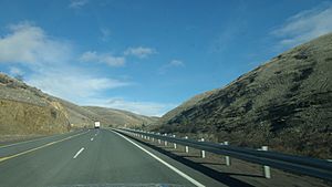
- U.S. Route 197: This road generally runs north and south.
- Oregon Route 216: This road generally runs east and west.
See also
 In Spanish: Tygh Valley para niños
 | Ernest Everett Just |
 | Mary Jackson |
 | Emmett Chappelle |
 | Marie Maynard Daly |


