
Umtanum Ridge Water Gap facts for kids
Quick facts for kids Umtanum Ridge Water Gap |
|
|---|---|

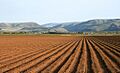
A view north from Umtanum Ridge into the Yakima River Canyon from the west of the Yakima River.
|
|
| Lua error in Module:Location_map at line 420: attempt to index field 'wikibase' (a nil value). | |
| Location | central Washington state |
| Designated | 1980 |


The Umtanum Ridge Water Gap is a special natural area in central Washington state, United States. It's like a giant cut in the mountains made by a river. In 1980, it was named a National Natural Landmark. This means it's a very important natural place.
This amazing place is a water gap. This means the Yakima River has carved its way through two big, folded mountains called Manastash and Umtanum Ridge. These ridges are part of the Yakima Fold Belt. This area is near the edge of the Columbia Plateau, a large flat area in central Washington.
The Umtanum Ridge Water Gap is known for its steep, rocky sides. These sides are made of a type of rock called Columbia River basalt. The Yakima River flows right through the middle of these rocky ridges. Many people call this area the Yakima River Canyon. It is located between the cities of Ellensburg and Yakima. Washington State Route 821 follows the river through the canyon. This road used to be the main way to travel between Ellensburg and Yakima.
How the Canyon Formed
The land here was once covered by huge flows of basalt rock. These flows were incredibly thick, sometimes more than 5,000 meters (17,000 feet) deep! Over a very long time, these flat layers of rock started to bend and fold. This happened because the land was being squeezed from the north and south.
When the land folded, it created high ridges, which are called anticlines. It also created low valleys, called synclines. As the Yakima River flows south to join the Columbia River, it cuts through four of these big ridges. These ridges are the Manastash Ridge, the Umtanum Ridge, the Yakima Ridge, and the Ahtanum Ridge.

The Umtanum Ridge is the tallest ridge the Yakima River cuts through. It rises to 983 meters (3,225 feet) very close to the river. The river itself is much lower, at about 470 meters (1,542 feet) in that spot. It seems strange that the river cuts through a high ridge instead of finding an easier path. This is an example of something called geologic precedence.
Scientists believe the ancient Yakima River was already flowing south when the basalt layers were flat. As the land slowly began to fold and the ridges started to rise, the river kept flowing in its original path. It was powerful enough to cut down through the rising rock, keeping its level. This idea is supported by the river's many curves, called meanders, that you can see in the canyon today. When a river has curves, they tend to stay even as the river cuts deeper into rising land.
Images for kids
-
A view from the north near Ellensburg, Washington, looking toward the Yakima Canyon.

