Yakima Ridge facts for kids
Quick facts for kids Yakima Ridge |
|
|---|---|
| Highest point | |
| Elevation | 4,195 ft (1,279 m) NAVD 88 |
| Prominence | 1,224 ft (373 m) |
| Geography | |
| Location | Yakima and Benton, counties, Washington |
| Topo map | USGS Black Rock Spring |
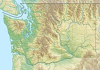
Yakima Ridge is a long mountain ridge located in Yakima County and Benton County in the state of Washington, USA. It's like a giant, long hill that stretches across the land.
This ridge starts near the city of Yakima in the west. From there, it runs towards the east and southeast. It goes through an area called the Yakima Training Center. The ridge finally ends near the Hanford Reach National Monument and the Hanford Site.
Yakima Ridge has other similar landforms nearby. To its north, you'll find Umtanum Ridge. To its south are the Rattlesnake Hills. Also, two valleys called Moxee Valley and Black Rock Valley are located south of Yakima Ridge.
Contents
How Yakima Ridge Was Formed
Yakima Ridge is part of something called the Yakima Fold Belt. Imagine a giant rug that gets pushed from both sides. It would wrinkle up and form folds. That's similar to how these ridges were made!
Ancient Rock Layers
Millions of years ago, during a time called the Miocene epoch, huge amounts of lava flowed across this area. This lava cooled and hardened, forming thick layers of rock known as Columbia River basalt flows.
The Folding Process
Over a very long time, these flat layers of basalt rock were slowly pushed and squeezed. This pressure caused the rock layers to bend and fold upwards, like a giant arch. This upward fold is what geologists call an anticline. Yakima Ridge is one of these large, arched folds in the Earth's crust.
The Yakima River's Path
The Yakima River is a powerful river that flows through this region. As the Yakima Ridge slowly rose, the river kept cutting its way through the rock.
Selah Gap
The river carved a special path right through Yakima Ridge. This path is known as a water gap, and the one through Yakima Ridge is called Selah Gap. It's a narrow opening where the river continues to flow, even as the land around it rises.
Other River Gaps
The Yakima River also cut through other ridges in a similar way. For example, it created the Umtanum Ridge Water Gap through Umtanum Ridge. It also formed Union Gap through Ahtanum Ridge. These gaps show how strong and persistent rivers can be over millions of years!
 | Kyle Baker |
 | Joseph Yoakum |
 | Laura Wheeler Waring |
 | Henry Ossawa Tanner |


