Uravan, Colorado facts for kids
Quick facts for kids
Uravan, Colorado
|
|
|---|---|

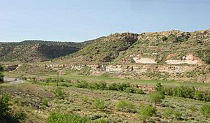
The reclaimed Uravan townsite (at the base of sandstone outcrop) as it appeared in 2008
|
|
| Country | United States |
| State | Colorado |
| County | Montrose |
| Elevation | 4,990 ft (1,520 m) |
| Population
(2010)
|
|
| • Total | 0 |
| Time zone | UTC-7 (Mountain (MST)) |
| • Summer (DST) | UTC-6 (MDT) |
| GNIS feature ID | 203153 |
Uravan was once a busy mining town in western Montrose County, Colorado, United States. Its name is a mix of "uranium" and "vanadium." The town was built in 1936 by the U.S. Vanadium Corporation. They wanted to dig up rich vanadium ore from the ground. As a bonus, they also found small amounts of uranium. Back then, uranium was mostly used to make yellow colors for things like ceramics.
Uravan was located about 90 miles (145 km) south-southwest of Grand Junction. It was right next to the San Miguel River. At its peak, over 800 people lived in Uravan. The town had a school, a store, a hospital, tennis courts, and a recreation center with a pool. The school and other places stayed open until at least 1983. However, Uravan was completely shut down by mid-1985. Today, none of its old buildings are left. Uravan is now an empty area that is part of a special cleanup program called Superfund.
Contents
Ancient History of the Area
There are several very old sites near Uravan. These places are listed on the Colorado State Register of Historic Properties. They show that people lived here long ago.
- Dolores Cave: This cave was home to people from about 600 BC to AD 1400. Scientists found a corn cob from around AD 1500 there. This means corn was still grown in the area. This was even after the Ancient Pueblo People (also known as Anasazi) left their homes in Colorado in the 1200s.
- Tabeguache Cave II: This is a big rock shelter where people lived from about AD 600 to 1500. There are other similar rock shelters nearby, including Tabeguache Cave.
Uravan's Mining Story
Early Gold Mining
In 1885, people found gold in Mesa Creek. This creek flows into the San Miguel River, about nine miles from Nucla, Colorado. A company called Montrose Placer Mining built a huge structure called the Hanging Flume. It was on the east wall of the Dolores River Canyon. This flume helped them move water for mining.
Uranium Mining in the 1900s
During World War II, Uravan played a secret role. It provided some of the uranium needed for the first atomic bomb. Because of the war, the government only said they were buying vanadium. They didn't pay the miners for the uranium ore. Much later, many miners were able to get money from the U.S. government for this.
After World War II, the Cold War began. The United States needed a lot of uranium for national defense. So, in 1946, the U.S. Congress created the U.S. Atomic Energy Commission (AEC). This group could control land for uranium mining. They also set high prices for uranium ore. This caused a "uranium boom" in the early 1950s. Many people came to the Four Corners region to look for uranium. Uravan grew a lot and became a major "yellowcake boomtown."
In the 1960s, the U.S. military needed less uranium. By the end of 1970, the government stopped buying it. But a new market appeared: commercial nuclear power plants. However, the uranium mining industry in the U.S. faced problems. There weren't many new nuclear power plants being built. Also, cheaper uranium was coming from Canada. This caused the U.S. uranium mining industry to collapse in the late 1970s and early 1980s.
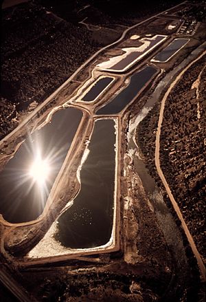
The town of Uravan had been shrinking for several years. In 1985, the decision was made to close it down. A huge cleanup of the entire area began in 1986. Most of the cleanup was finished by 2001. All the buildings were removed. The land was reshaped and new plants were put in. Today, all that remains is a turnoff and a sign along State Highway 141.
What's Next for Uravan?
On May 6, 2012, the Montrose County leaders made an agreement with Dow Chemical. They received three pieces of land. These included two "Ballpark Parcels" and the old townsite property.
Montrose County agreed to take this land for the Rimrocker Historical Society. This group has been working since 1990 to save and share the history of Uravan. In 2013, the Historical Society and Montrose County made a long-term agreement. They plan to build a museum and a campground on a 17-acre (6.9 ha) section of the land.
The Rimrocker Historical Society holds an event every August. It's called the Uranium History Celebration and Reunion Picnic. It takes place at Historic Uravan. In 2012, over 1,000 people came to celebrate the 100th anniversary of the original Joe Jr. Mill.
 | Janet Taylor Pickett |
 | Synthia Saint James |
 | Howardena Pindell |
 | Faith Ringgold |


