Vestal, New York facts for kids
Quick facts for kids
Vestal, New York
|
||
|---|---|---|
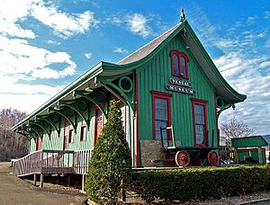
Vestal DLW station, today refashioned as the Vestal Museum (2006)
|
||
|
||
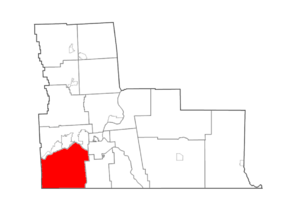
Map highlighting Vestal's location within Broome County.
|
||
| Country | ||
| State | ||
| County | Broome | |
| Established | 1823 | |
| Government | ||
| • Type | Town Council | |
| Area | ||
| • Total | 52.56 sq mi (136.13 km2) | |
| • Land | 51.73 sq mi (133.97 km2) | |
| • Water | 0.84 sq mi (2.17 km2) 1.62% | |
| Elevation | 1,010 ft (308 m) | |
| Population
(2020)
|
||
| • Total | 29,110 | |
| • Estimate
(2023)
|
31,517 | |
| • Density | 542.91/sq mi (209.62/km2) | |
| Time zone | UTC−5 (EST) | |
| • Summer (DST) | UTC−4 (EDT) | |
| ZIP Codes |
13850–13851
|
|
| Area code(s) | 607 | |
| FIPS code | 36-007-77255 | |
| GNIS feature ID | 0979582 | |
Vestal is a town located in Broome County, New York. It is in the southern part of New York, near the Susquehanna River and the Pennsylvania border. In 2020, about 29,110 people lived here. Vestal is a western suburb of Binghamton. It is also home to the main campus of Binghamton University.
Contents
History of Vestal
Early Settlers and Native Americans
The first European settlers arrived in Vestal around 1785. Before that, the central area of Vestal was home to an indigenous village. This village was near Route 26 at Choconut Creek. It belonged to the Ochugnut tribe of the Tuscarora people.
During the American Revolution, soldiers were sent to this area. They aimed to engage tribes and destroy their homes and crops. In 1779, some villages were burned, including one near present-day Vestal High School. This was part of a larger campaign in New York.
Town Formation and Growth
After the war, several European families settled near the town of Union. The town of Vestal was officially formed in 1823. It was created from the southern half of Union.
In 1901, a large dynamite explosion happened in Vestal. It was on a train of the Delaware, Lackawanna and Western Railroad. Another train crashed into it, destroying both. Twelve trainmen were killed or injured. Many people came to see the scene.
Vestal's history is linked to its neighbors: Binghamton, Endicott, and Johnson City. In the 20th century, Vestal became a place where people lived while working in nearby industries. These included companies like Endicott Johnson Corporation, IBM, and Lockheed Martin.
Binghamton University and Observatories
In 1954, New York State started building a new campus in Vestal. This was for Harpur College, which is part of the SUNY system. The college moved to Vestal by 1961. It has grown a lot since then and is now called Binghamton University.
The Kopernik Observatory & Science Center is also in Vestal. It is a public observatory that opened in 1974. It was built to celebrate the 500th birthday of astronomer Nicolaus Copernicus. It is one of the best public observatories in the Northeast United States.
Modern Development and Historic Sites
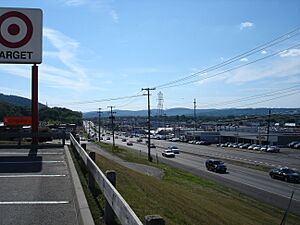
In the 1990s, Vestal became a major shopping area. Many large shopping centers were built along the Vestal Parkway (NY Route 434). This road became one of the busiest in the region. Vestal's old downtown area is on Front Street. It still has many small shops.
Two important places in Vestal are listed on the National Register of Historic Places. These are the Drovers Inn and Round Family Residence and the Vestal Central School. They were added to the list in 2010.
Geography of Vestal
Location and Size
Vestal covers about 136.2 square kilometers (52.56 square miles). Most of this area is land, about 134.0 square kilometers (51.73 square miles). The rest is water, about 2.2 square kilometers (0.84 square miles). The town is located on the south side of the Susquehanna River.
Major Roads and Highways
Several important roads pass through Vestal. New York State Route 17 goes through the northern part of town. It connects with New York State Route 26 near the Susquehanna River. New York State Route 434, also known as Vestal Parkway, crosses NY-26. New York State Route 201 also crosses the Susquehanna River. It connects eastern Vestal with Johnson City.
Hamlets in Vestal
The Town of Vestal includes five smaller communities called hamlets:
- Ross Corners: This hamlet is in the western part of town. It is named after David Ross, a lumberman who owned a store there.
- Tracy Creek: Also in the western section, this hamlet is named after Benjamin Tracy. It is located by a creek of the same name. It was once a community for lumbering and farming.
- Twin Orchards: This hamlet is on the south bank of the Susquehanna River. It got its name from the large orchards that used to be on both sides of its main road.
- Vestal Center: This hamlet is on NY-26, about 4 miles (6.4 km) south of the main district. It is also about 3 miles (4.8 km) north of the Pennsylvania state line. President Theodore Roosevelt once visited and gave a speech here.
- Willow Point: Located east of Twin Orchards, this hamlet is also on the south bank of the Susquehanna River.
Population and People
In 2000, there were 26,535 people living in Vestal. By 2010, the population grew to 28,043. The town had 8,525 households in 2000. About 29.6% of these households had children under 18. Most households (59.9%) were married couples.
The population is spread out in terms of age. In 2000, 18.9% were under 18 years old. About 24.0% were between 18 and 24, many of whom are likely students at Binghamton University. The median age in Vestal was 34 years old.
The average income for a household in Vestal in 2000 was $51,098. For families, the average income was $60,676. About 7.1% of the population lived below the poverty line.
Parks and Fun Activities
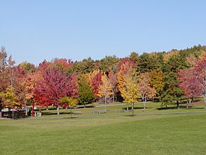
Vestal has 21 parks that are managed by the town. These parks offer many places for outdoor activities.
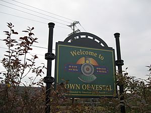
The Vestal Rail Trail is a popular spot. It is 2.1 miles (3.4 km) long and has a paved path. It's great for walking, running, or biking.
Education in Vestal
Vestal is home to several educational institutions:
- Binghamton University: This is a large university with over 17,000 students. It is part of the SUNY system.
- Vestal Central School District: This district provides education from kindergarten through 12th grade. It serves over 4,000 students and includes Vestal High School.
- Ross Corners Christian Academy: This is another school option in Vestal.
- Hillel Academy: This is a Jewish day school.
Town Services
Transportation
New York State Route 17 is a main road that goes through Vestal. Broome County Transit provides bus service for public transportation. In the past, Vestal was also a stop for passenger trains.
Emergency Services
- Vestal Fire Department (VFD): This is a volunteer fire department. Its members are volunteers who help put out fires in Vestal and nearby areas. It is supported by local taxes.
- Vestal Volunteer Emergency Squad (VVES): This group provides emergency medical services (EMS). They respond to over 38,000 calls each year. The VVES relies on volunteers and does not receive taxpayer money.
- Vestal Police Department (VPD): The VPD has 39 police officers and other staff. They work to keep the town safe. They have special units like a K-9 (dog) unit and a bicycle patrol. They also share a special response team with other agencies in Broome County.
See also
 In Spanish: Vestal (Nueva York) para niños
 | William L. Dawson |
 | W. E. B. Du Bois |
 | Harry Belafonte |


