Vineland, Minnesota facts for kids
Quick facts for kids
Vineland, Minnesota
Neyaashiing
|
|
|---|---|
| Country | United States |
| State | Minnesota |
| County | Mille Lacs |
| Township | Kathio |
| Area | |
| • Total | 9.87 sq mi (25.57 km2) |
| • Land | 9.32 sq mi (24.15 km2) |
| • Water | 0.55 sq mi (1.42 km2) |
| Elevation | 1,253 ft (382 m) |
| Population
(2020)
|
|
| • Total | 869 |
| • Density | 93.21/sq mi (35.99/km2) |
| Time zone | UTC-6 (Central (CST)) |
| • Summer (DST) | UTC-5 (CDT) |
| ZIP codes | |
| Area code(s) | 320 |
| GNIS feature ID | 653663 |
| FIPS code | 27-67180 |
Vineland is a small community in Mille Lacs County, Minnesota, United States. It is part of the Mille Lacs Indian Reservation. A "census-designated place" (CDP) is a special area that the government counts for population, but it's not a city or town with its own local government.
In 2020, about 869 people lived in Vineland. This was a bit less than the 1,001 people who lived there in 2010.
The name of the community in the Ojibwe language is Neyaashiing. This means "on the point of land." This name makes sense because Vineland is located on a piece of land called Indian Point, which sticks out into Mille Lacs Lake. Vineland is also an important place for the Mille Lacs Band of Ojibwe. It serves as their main administrative center.
Vineland uses the ZIP code 56359, which is linked to the nearby town of Onamia.
Contents
History of Vineland
A post office opened in Vineland in 1891. It helped people send and receive mail for about 30 years, closing in 1921. The community got its name from Vinland, a place where Vikings once tried to settle.
Geography and Location
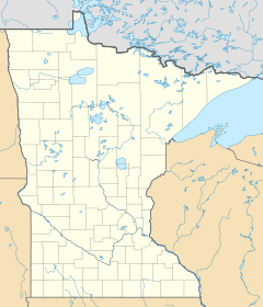
Vineland is located in the northwestern part of Mille Lacs County. It is in the northern area of Kathio Township. The western edge of Vineland borders Crow Wing County. Its eastern side is right on the shore of Mille Lacs Lake.
U.S. Highway 169 goes through Vineland, running close to the lake. This highway can take you about 11 miles south to Onamia. If you go north on the highway, it's about 9 miles to Garrison.
The total area of Vineland is about 9.87 square miles. Most of this area, about 9.32 square miles, is land. The rest, about 0.55 square miles, is water. This means about 5.57% of Vineland is covered by water.
People of Vineland
| Historical population | |||
|---|---|---|---|
| Census | Pop. | %± | |
| 2000 | 607 | — | |
| 2010 | 1,001 | 64.9% | |
| 2020 | 869 | −13.2% | |
| U.S. Decennial Census | |||
In 2000, there were 607 people living in Vineland. Most of the people living here were Native American, making up about 94.40% of the population. About 5.11% of the people were White. A small number, 0.49%, were from two or more racial backgrounds.
The community has a younger population. In 2000, about 44.3% of the people were under 18 years old. The average age of people in Vineland was 22 years old.
Education in Vineland
Students in Vineland attend schools that are part of the Onamia Public Schools district.
See also
 In Spanish: Vineland (Minnesota) para niños
 | Madam C. J. Walker |
 | Janet Emerson Bashen |
 | Annie Turnbo Malone |
 | Maggie L. Walker |


