
Viroqua, Wisconsin facts for kids
Quick facts for kids
Viroqua
|
|
|---|---|
 |
|

Location of Viroqua in Vernon County, Wisconsin.
|
|
| Country | United States |
| State | Wisconsin |
| County | Vernon |
| Area | |
| • Total | 4.36 sq mi (11.29 km2) |
| • Land | 4.36 sq mi (11.29 km2) |
| • Water | 0.00 sq mi (0.00 km2) |
| Population
(2020)
|
|
| • Total | 4,504 |
| • Density | 1,033.7/sq mi (399.1/km2) |
| Time zone | UTC-6 (Central (CST)) |
| • Summer (DST) | UTC-5 (CDT) |
| ZIP codes |
54665
|
| Area code(s) | 608 |
| FIPS code | 55-82925 |
| Website | viroqua-wisconsin.com |
Viroqua is a city in Wisconsin, United States. It is the main city, or county seat, of Vernon County, Wisconsin. In 2020, about 4,504 people lived there. Viroqua is part of the larger town of Viroqua.
Contents
- What's in a Name? The Story of Viroqua
- A Look Back: Viroqua's History
- Where is Viroqua? Geography and Climate
- Who Lives in Viroqua? Population and People
- Getting Around: Transportation in Viroqua
- How Viroqua Makes Money: Economy
- Learning in Viroqua: Education
- Arts and Fun: Culture in Viroqua
- Famous People from Viroqua
- Images for kids
- See also
What's in a Name? The Story of Viroqua
The city of Viroqua was not always called Viroqua. It was first named "Farwell." This name honored Leonard J. Farwell, who was the second Governor of Wisconsin.
In 1854, the name was changed to Viroqua. No one is completely sure why the name changed or where "Viroqua" came from. One popular story says it was the name of a daughter of Black Hawk, a famous Native American leader. However, there is no proof for this story. Another idea is that the name came from a Mohawk actress.
The most likely reason for the name is a book. In 1848, a novel called Viroqua, or, the Flower of the Ottawas was published by Emma Carra. The city probably took its name from the main character in this book.
A Look Back: Viroqua's History
Long ago, the Ho-Chunk people lived in the area where Viroqua is today. The Ho-Chunk are a Siouan-speaking group. They lived in the Great Lakes region for thousands of years. Starting in the 1820s, the Ho-Chunk people were moved to lands further west.
Becoming the County Seat
Viroqua and another nearby town, Springville, both wanted to be the main city, or county seat, of Vernon County. A pioneer named Moses Decker promised 40 acres of land if Viroqua was chosen. This land later became known as the County Addition to Viroqua.
Moses Decker was one of the first settlers in the area. He arrived in 1847 and helped plan the village of Viroqua. Other early settlers came in 1844. They built mills on the Kickapoo River to cut lumber. Farmers began to arrive in 1846.
In 1851, the plan to create Bad Axe County (now Vernon County) was approved. Viroqua was chosen as the county seat. This decision was made permanent by a vote in May 1852. The Vernon County Courthouse was built in Viroqua in 1880.
A Major Tornado
On June 28, 1865, a very strong tornado hit Viroqua. This storm was deadly, and 22 people lost their lives.
Where is Viroqua? Geography and Climate
Viroqua is located at 43.556534 degrees North and -90.887663 degrees West. The city covers about 3.80 square miles of land. It is in the Driftless Region, which is an area that was not flattened by glaciers. It is also near the western part of the Ocooch Mountains.

Viroqua's Weather
Viroqua has a changing climate with warm summers and cold winters. The hottest month is usually July, and the coldest is January. The city gets a good amount of rain throughout the year, with more in the summer months. Snowfall is common in winter.
| Climate data for Viroqua, Wisconsin, 1991–2020 normals, extremes 1893–present | |||||||||||||
|---|---|---|---|---|---|---|---|---|---|---|---|---|---|
| Month | Jan | Feb | Mar | Apr | May | Jun | Jul | Aug | Sep | Oct | Nov | Dec | Year |
| Record high °F (°C) | 55 (13) |
63 (17) |
83 (28) |
90 (32) |
106 (41) |
101 (38) |
108 (42) |
103 (39) |
99 (37) |
90 (32) |
78 (26) |
64 (18) |
108 (42) |
| Mean maximum °F (°C) | 42.4 (5.8) |
47.9 (8.8) |
64.0 (17.8) |
76.2 (24.6) |
83.2 (28.4) |
87.5 (30.8) |
89.4 (31.9) |
88.2 (31.2) |
84.2 (29.0) |
77.5 (25.3) |
61.2 (16.2) |
47.6 (8.7) |
91.2 (32.9) |
| Mean daily maximum °F (°C) | 22.9 (−5.1) |
27.6 (−2.4) |
40.4 (4.7) |
54.3 (12.4) |
66.0 (18.9) |
75.3 (24.1) |
79.1 (26.2) |
77.4 (25.2) |
70.2 (21.2) |
56.9 (13.8) |
41.2 (5.1) |
28.4 (−2.0) |
53.3 (11.8) |
| Daily mean °F (°C) | 14.5 (−9.7) |
18.6 (−7.4) |
30.9 (−0.6) |
43.7 (6.5) |
55.4 (13.0) |
65.3 (18.5) |
69.0 (20.6) |
67.2 (19.6) |
59.3 (15.2) |
46.7 (8.2) |
32.8 (0.4) |
20.8 (−6.2) |
43.7 (6.5) |
| Mean daily minimum °F (°C) | 6.1 (−14.4) |
9.5 (−12.5) |
21.3 (−5.9) |
33.1 (0.6) |
44.8 (7.1) |
55.3 (12.9) |
59.0 (15.0) |
57.1 (13.9) |
48.3 (9.1) |
36.4 (2.4) |
24.4 (−4.2) |
13.1 (−10.5) |
34.0 (1.1) |
| Mean minimum °F (°C) | −16.8 (−27.1) |
−12.0 (−24.4) |
0.1 (−17.7) |
18.8 (−7.3) |
30.6 (−0.8) |
42.0 (5.6) |
48.3 (9.1) |
46.6 (8.1) |
33.9 (1.1) |
22.6 (−5.2) |
7.1 (−13.8) |
−8.0 (−22.2) |
−20.3 (−29.1) |
| Record low °F (°C) | −42 (−41) |
−37 (−38) |
−35 (−37) |
−8 (−22) |
22 (−6) |
30 (−1) |
36 (2) |
32 (0) |
20 (−7) |
1 (−17) |
−17 (−27) |
−36 (−38) |
−42 (−41) |
| Average precipitation inches (mm) | 1.16 (29) |
1.14 (29) |
1.99 (51) |
3.98 (101) |
4.72 (120) |
5.70 (145) |
4.58 (116) |
4.58 (116) |
3.94 (100) |
2.65 (67) |
1.98 (50) |
1.58 (40) |
38.00 (965) |
| Average snowfall inches (cm) | 11.3 (29) |
10.4 (26) |
7.1 (18) |
3.8 (9.7) |
0.0 (0.0) |
0.0 (0.0) |
0.0 (0.0) |
0.0 (0.0) |
0.0 (0.0) |
0.4 (1.0) |
4.0 (10) |
10.2 (26) |
30.0 (76) |
| Average precipitation days (≥ 0.01 in) | 8.0 | 7.0 | 7.7 | 10.8 | 12.5 | 11.2 | 9.8 | 9.1 | 9.9 | 8.9 | 7.7 | 8.4 | 111.0 |
| Average snowy days (≥ 0.1 in) | 7.4 | 6.6 | 3.9 | 1.6 | 0.0 | 0.0 | 0.0 | 0.0 | 0.0 | 0.4 | 2.7 | 7.4 | 30 |
| Source 1: NOAA | |||||||||||||
| Source 2: National Weather Service | |||||||||||||
Who Lives in Viroqua? Population and People
Viroqua has grown steadily over the years. In 1880, only 762 people lived there. By 2020, the population had grown to 4,504.
| Historical population | |||
|---|---|---|---|
| Census | Pop. | %± | |
| 1880 | 762 | — | |
| 1890 | 1,270 | 66.7% | |
| 1900 | 1,950 | 53.5% | |
| 1910 | 2,059 | 5.6% | |
| 1920 | 2,574 | 25.0% | |
| 1930 | 2,792 | 8.5% | |
| 1940 | 3,549 | 27.1% | |
| 1950 | 3,795 | 6.9% | |
| 1960 | 3,926 | 3.5% | |
| 1970 | 3,739 | −4.8% | |
| 1980 | 3,716 | −0.6% | |
| 1990 | 3,922 | 5.5% | |
| 2000 | 4,335 | 10.5% | |
| 2010 | 4,362 | 0.6% | |
| 2020 | 4,504 | 3.3% | |
| U.S. Decennial Census 2014 Estimate |
|||
Population in 2020
In 2020, Viroqua had 4,504 residents. Most people living in Viroqua were White (93.1%). There were also smaller groups of Black or African American, Asian, and Native American people. About 2.2% of the population was Hispanic or Latino.
The average income for a family in Viroqua was about $55,075 per year.
Population in 2010
In 2010, Viroqua had 4,362 people. About 25.5% of households had children under 18. The average age of residents was 45 years old.
Getting Around: Transportation in Viroqua
Viroqua is an important meeting point for several major roads. These include U.S. Highway 14, U.S. Highway 61, Wisconsin Highway 27, Wisconsin Highway 56, and Wisconsin Highway 82.
Recently, some of the main highways and streets in Viroqua were updated. Highways 14, 61, and 27 were expanded to have four lanes. However, the four blocks in the downtown area kept two lanes. This allows for parking along the side of the road.
Viroqua was also part of a new air route in 1932. This route connected La Crosse, Wisconsin, to Rockford, Illinois. A very bright beacon light was installed near Viroqua to help guide planes.
Bus and Air Travel
Commuter bus service is available from Viroqua to La Crosse. Buses run seven times a day in each direction.
Viroqua also has its own airport, the Viroqua Municipal Airport (Y51).

How Viroqua Makes Money: Economy
Viroqua is known as an "accredited Main Street America city." This means it works to keep its downtown area lively and successful. The downtown area is even listed on the National Register of Historic Places.

Viroqua gained fame in 1992 when Smithsonian Magazine called it "The Town That Beat Walmart". This was because Viroqua found ways for its local businesses to succeed even with a large retail store nearby. The city helps small businesses grow through special programs. One program, the Pop-Up Shop Initiative, lets new businesses use a downtown space for free during the holiday season.
Viroqua is also a place for "food tourism." Vernon County, where Viroqua is located, has many organic farms. There are over 200 organic farms in the area. This helps local restaurants and brings visitors who want to enjoy fresh, local food.

Learning in Viroqua: Education
Viroqua has several schools and colleges for students of all ages.


- Viroqua High School
- Viroqua Middle School
- Viroqua Elementary School
- Driftless Folk School
- Pleasant Ridge Waldorf School
- English Lutheran School
- Youth Initiative High School
- Laurel High School
- Better Futures High School
- Thoreau College
- Western Technical College (offers classes in Viroqua)
Arts and Fun: Culture in Viroqua
The Temple Theatre is a special place for arts and culture in Viroqua. It was built in 1922 in a classical revival style. Volunteers helped restore the theater, which cost $1.6 million. It now hosts many shows and events.
The Driftless Region around Viroqua has many organic farms. This helps new businesses, restaurants, and tourism grow. People come to Viroqua to enjoy the natural beauty and the local food scene.
Famous People from Viroqua
Many notable people have connections to Viroqua.
- Joseph D. Beck, a U.S. Representative
- James Gillett, a former Governor of California
- Mark C. Lee, a United States astronaut
- Chris Mulkey, an actor and musician
- Jeremiah McLain Rusk, a governor of Wisconsin
- Freddie Slack, a famous pianist and bandleader
- Butch Vig, a record producer and musician
Images for kids
-
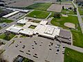
Viroqua High School / Middle School with elementary school in background
-
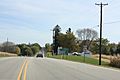
Sign on WIS 56
-
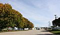
Vernon County fairgrounds
-
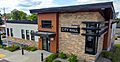
Viroqua City Hall


See also
 In Spanish: Viroqua (Wisconsin) para niños
