Waddell Creek (California) facts for kids
Quick facts for kids Waddell Creek |
|
|---|---|

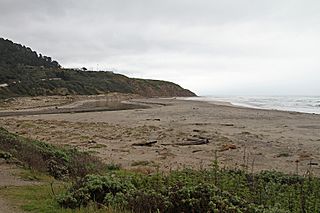
The mouth of Waddell Creek at Waddell Beach, in the Rancho Del Oso section of the Big Basin Redwoods State Park
|
|
| Other name(s) | Cañada de la La Salud |
| Country | United States |
| State | California |
| Region | Santa Clara County |
| Physical characteristics | |
| Main source | Confluence of East and West Waddell Creeks in the Big Basin Redwoods State Park 82 ft (25 m) 37°08′02″N 122°16′03″W / 37.13389°N 122.26750°W |
| River mouth | Pacific Ocean 0 ft (0 m) 37°05′33″N 122°16′36″W / 37.09250°N 122.27667°W |
| Basin features | |
| Tributaries |
|
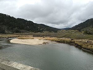
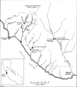
Waddell Creek is a stream and its surrounding land area, called a watershed. It flows through Big Basin Redwoods State Park in Santa Cruz County, California. The creek starts where East and West Waddell Creeks join together. It then flows into the Pacific Ocean at Waddell Beach, near Año Nuevo Point.
Contents
History of Waddell Creek
Early Explorers and a Healing Creek
The first European explorers to visit this area were part of the Spanish Portolá expedition in 1769. They camped at Waddell Creek for three days, from October 20-22. Heavy rains made them stay longer. Many people in the group were sick.
However, something amazing happened. A missionary named Juan Crespi wrote in his diary that the sick people started to get better. It was as if the rain had brought them health! Because of this, they renamed the valley "Cañada de la La Salud," which means "Canyon of Health."
William Waddell and the Lumber Industry
Later, in 1851, a man named William Waddell came to California from Kentucky. He was the first American settler in this area. The creek and valley are named after him.
In 1862, William Waddell built a sawmill on the creek. He used it to cut down many trees in the area. He even built a special tramway to move the lumber from his mill to the beach. From there, it was loaded onto ships at a wharf. Sadly, William Waddell was killed by a grizzly bear in 1875.
Hiking Along Waddell Creek
Explore the Skyline-to-the-Sea Trail
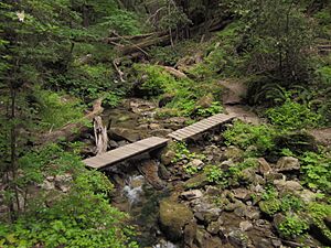
Waddell Creek is a great place for hiking! A long trail called the Skyline-to-the-Sea Trail follows parts of West Waddell Creek and then Waddell Creek. This trail is about 34.5 miles (55.5 km) long. It starts high up in the Santa Cruz Mountains at Sanborn County Park.
Many people who love hiking enjoy walking along this creek. It's a popular trail that offers beautiful views of nature.
Waddell Creek's Path and Water Sources
Where the Creek Begins
The main part of Waddell Creek is about 2.75 miles (4.4 km) long. However, if you measure from the very start of its smallest streams, it's about 14 miles (22.5 km) long. The Waddell Creek watershed covers about 26 square miles (67 square km). This area includes many smaller streams that flow into East and West Waddell Creeks.
West Waddell Creek starts high up at about 1,800 feet (549 meters). Its source is near the border of Santa Cruz and San Mateo Counties. East Waddell Creek begins where Opal Creek and Blooms Creek meet. This is at about 915 feet (279 meters), just below the Big Basin Redwoods State Park headquarters. Some of the highest streams that feed the creek start even higher, above 2,000 feet (610 meters).
Wildlife and Nature in Waddell Creek
Fish Life: Salmon and Trout
Waddell Creek used to be a very important home for fish. Two types of fish, steelhead trout and coho salmon, would swim up the creek to lay their eggs. This is called a "spawning run."
By 1995, there were very few coho salmon left south of San Francisco Bay. Waddell Creek had one of the last small groups of these salmon. Another nearby creek, Scott Creek, also had a small group. Sadly, coho salmon disappeared from Waddell Creek for a while.
But there is good news! Efforts to help the salmon are working. Salmon from a hatchery on a stream called Big Creek (which flows into Scott Creek) returned in 2015. Scientists hope these efforts will help coho salmon return to Waddell Creek too.
Where Fish Can Lay Eggs
The best places for salmon and trout to lay their eggs are limited. On West Waddell Creek, fish can travel about 2.65 miles (4.26 km) from where the East and West creeks join. They can go up to a spot called Slippery Falls. On East Waddell Creek, they can go about 1 mile (1.6 km) up to the Main Falls. These waterfalls stop the fish from going any further upstream.
Trees and Plants Along the Creek
The upper parts of Waddell Creek are surrounded by giant coast redwood trees. These are some of the tallest trees in the world! As you go lower down the creek, you'll see different kinds of trees.
Some common trees along the lower creek banks include:
- Red alder
- Bigleaf maple
- California buckeye
- Pacific madrone
- California laurel
- Various types of willow trees
You might also spot other trees like tanoak, box elder, white alder, black cottonwood, California nutmeg, and coast Douglas fir. The variety of trees makes the area beautiful and provides homes for many animals.
 | Tommie Smith |
 | Simone Manuel |
 | Shani Davis |
 | Simone Biles |
 | Alice Coachman |


