Wallpack Valley facts for kids

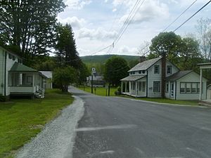
The Wallpack Valley (sometimes spelled Walpack Valley) is a beautiful valley found in Sussex County, in the northwestern part of New Jersey. It's shaped by two natural features: Wallpack Ridge on its west side, which is about 600 to 900 feet high, and Kittatinny Mountain on its east side, which is much taller at 1400 to 1800 feet.
Wallpack Ridge acts like a natural wall, separating the Wallpack Valley from the Delaware River valley, also known as the Minisink Valley. The Wallpack Valley is home to the Flat Brook and its main smaller streams, the Big Flat Brook and Little Flat Brook. This valley is quite narrow, stretching for about 25 miles (40 kilometers). It runs from Montague Township in the north, south of Port Jervis, New York, all the way to the Walpack Bend in the Delaware River. Near Flatbrookville in Walpack Township, the Flat Brook flows into the Delaware River.
A Look at Haneys Mill
Haneys Mill is a special part of Walpack. Around 1860, a grist mill was built here. A grist mill is a place where grain is ground into flour. Old maps from that time show the mill, along with a sawmill (for cutting wood), a lime kiln (used to make lime), and homes belonging to the Haney, Fuller, and B.D. Fuller families.
Over the years, the mill at Haneys Mill was used for different things. It was a grist mill, a sawmill, and even a cidermill, where apples were pressed to make cider. The last person to operate it was Jake Haney. The old farmhouse where the Haney family lived in the mid-1800s was also nearby. Some scenes from a 1933 movie called "These Thirty Years," made by the Ford Motor Company, were filmed right here. In the movie, this place was called the Haines farm. The barns across the road from the house were used for a scene where an auction took place.
Protecting the Valley: The Delaware Water Gap
In the 1950s, big floods caused the Delaware River to rise very high. This led to a plan to build a large dam and a reservoir (a big artificial lake) on the Delaware River. This project was planned in the 1950s and 1960s. The idea was to create electricity using the water.
To build this dam, the U.S. Army Corps of Engineers took control of a lot of land in northwestern New Jersey and northeastern Pennsylvania. The plan was that the new lake created by the dam would flood the entire Walpack Valley.
However, because of different reasons, including political discussions and concerns about the ground (geological reasons), the dam project was stopped. The land that had been taken was then given to the National Park Service. This agency helps protect special natural and historical places. In 1978, the land became part of the Delaware Water Gap National Recreation Area. Today, Wallpack Ridge is a key part of this beautiful recreation area, which is open for everyone to enjoy.
 | Sharif Bey |
 | Hale Woodruff |
 | Richmond Barthé |
 | Purvis Young |

