Warra, Queensland facts for kids
Quick facts for kids WarraQueensland |
|||||||||||||||
|---|---|---|---|---|---|---|---|---|---|---|---|---|---|---|---|
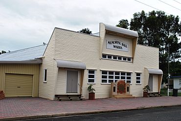
Warra Memorial Hall
|
|||||||||||||||
| Population | 180 (2021 census) | ||||||||||||||
| • Density | 0.914/km2 (2.37/sq mi) | ||||||||||||||
| Postcode(s) | 4411 | ||||||||||||||
| Area | 196.9 km2 (76.0 sq mi) | ||||||||||||||
| Time zone | AEST (UTC+10:00) | ||||||||||||||
| Location |
|
||||||||||||||
| LGA(s) | Western Downs Region | ||||||||||||||
| State electorate(s) | Callide | ||||||||||||||
| Federal Division(s) | Maranoa | ||||||||||||||
|
|||||||||||||||
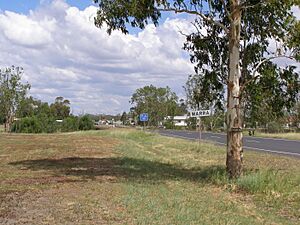
Warra is a small country town in the Western Downs Region of Queensland, Australia. It is also a larger area, called a locality. In 2021, about 180 people lived in Warra.
Contents
Exploring Warra's Location
Warra is located in the Darling Downs, a famous farming region in Queensland. It is about 256 kilometers (159 miles) north-west of Brisbane, the state capital.
Natural Boundaries and Transport
The area of Warra is bordered by Haystack Road and Seigmeiers Road to the north. The Condamine River forms its south-western edge. The town itself is in the western part of the locality.
The main road, the Warrego Highway, and the Western railway line both pass through Warra. They enter from the south-east and leave to the west. Warra has its own railway station. Inside the town, the highway is known as Thorne Street.
Farming and Land Use
The land around Warra is used for different types of farming. Farmers grow crops both with and without irrigation (added water). Some areas are also used for grazing animals on natural grasslands.
A Look Back at Warra's History
The name Warra comes from a large farm called Warra Warra. This farm was once known as Cobble Cobble. The name Warra Warra is thought to come from the Mandandanji language. It might mean a woman carrying a load or plenty of water.
Early Schools in Warra
- Warra State School: This school first opened on April 12, 1881, as a provisional school. It became Warra State School in 1889. A pre-school section was added in 1977.
- Daiwan State School: This school opened in 1910. It was renamed Haystack State School in 1924 and closed in 1968.
- Braeside State School: This school was open from 1915 to 1923, then reopened in 1928 and closed permanently in 1950.
- Llanberris Provisional School: This school was open for a short time, from 1919 to 1923.
Warra's Churches Over Time
- All Saints' Anglican Church: The foundation stone for this church was laid in 1906. It was officially opened in 1907.
- Presbyterian/Uniting Church: A Presbyterian church was built in Warra around 1907-1908. Later, it became the Warra Uniting Church when different churches joined together. In 2005, this church building was sold and became a house.
- St Francis Xavier Catholic Church: This church was opened in 1913. Sadly, a big storm destroyed it in 1980.
The Warra Coal Mine
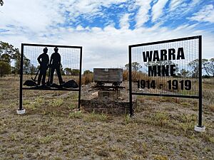
Between 1915 and 1919, the Queensland government ran a coal mine in Warra. This mine provided coal for the southern railway lines. Even though it produced a lot of coal, the mine had problems with water getting in. Because of these issues, the mine ended up losing money.
Remembering Warra's Heroes
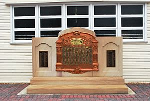
The Warra Honour Board was revealed in 1917. It remembers people from Warra who served in wars.
Education for Warra Kids
Warra State School is a government primary school for students from Prep to Year 6. It is located on Robinson Street. In 2023, there were 6 students enrolled at the school.
For high school, students from Warra travel to nearby towns. The closest high schools are in Jandowae, Chinchilla, and Dalby.
Places to Visit in Warra
Community Hubs
- Warra Memorial Hall: This hall is at 8-10 Thorne Street. It is a place for community events and gatherings.
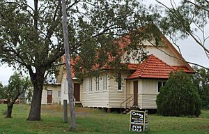
- All Saints Anglican Church: Located on Lytton Street, this church is the only one still operating in Warra. It is used for Anglican, Catholic, and Uniting church services.
Historic Sites
- St Francis Xavier Catholic Church Site: Even though the church building was destroyed, a bell tower with the original bell and cross still stands on the site. You can find it just west of town on the Warrego Highway. A special plaque is there to remember the church.
Famous People from Warra
The famous Aboriginal boxer Jerry Jerome started his boxing career in Warra.
Warra Beyond Earth
Did you know that the name Warra has been used for a crater on the planet Mars? This crater is named Warra, but it does not specifically remember the town.
 | Georgia Louise Harris Brown |
 | Julian Abele |
 | Norma Merrick Sklarek |
 | William Sidney Pittman |


