Waterville, Iowa facts for kids
Quick facts for kids
Waterville, Iowa
|
|
|---|---|

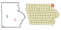
Location of Waterville, Iowa
|
|
| Country | |
| State | |
| County | Allamakee |
| Township | Paint Creek |
| Area | |
| • Total | 0.35 sq mi (0.91 km2) |
| • Land | 0.35 sq mi (0.91 km2) |
| • Water | 0.00 sq mi (0.00 km2) |
| Elevation | 883 ft (269 m) |
| Population
(2020)
|
|
| • Total | 109 |
| • Density | 310.54/sq mi (120.02/km2) |
| Time zone | UTC-6 (Central (CST)) |
| • Summer (DST) | UTC-5 (CDT) |
| ZIP code |
52170
|
| Area code(s) | 563 |
| FIPS code | 19-82470 |
| GNIS feature ID | 0462734 |
Waterville is a small city in Allamakee County, Iowa, United States. It is located within Paint Creek Township. In 2020, the city had a population of 109 people.
Contents
History of Waterville
The first people settled in the area around Waterville in 1850. A few years later, in 1854, Nathaniel Beebe built the Waterville Mill. This was an important step for the growing community.
In 1855, Col. J. Spooner opened a store, which helped the town get the things it needed. The Waterville Post Office also started in 1855, making it easier for people to send and receive mail. In 1856, James Beebe built a hotel, offering a place for travelers to stay.
A big change came in 1877 when the Waukon and Mississippi Railroad was finished. This railroad went right through Waterville. It made Waterville the only train station between Waukon and Waukon Junction. This was important for trade and travel.
Waterville officially became a city in 1912.
Geography of Waterville
Waterville is located about 14 miles from Waukon. It is also about 9 miles away from the Mississippi River. The city sits on the north side of Paint Creek.
Near Waterville, the Paint Creek canyon is about 150 feet deep. It has tall, steep cliffs made of a type of rock called Oneota Dolomite.
The United States Census Bureau says that Waterville covers a total area of about 0.35 square miles (0.91 square kilometers). All of this area is land, with no water.
Population and People
| Historical populations | ||
|---|---|---|
| Year | Pop. | ±% |
| 1880 | 73 | — |
| 1920 | 183 | +150.7% |
| 1930 | 222 | +21.3% |
| 1940 | 253 | +14.0% |
| 1950 | 199 | −21.3% |
| 1960 | 184 | −7.5% |
| 1970 | 158 | −14.1% |
| 1980 | 157 | −0.6% |
| 1990 | 140 | −10.8% |
| 2000 | 145 | +3.6% |
| 2010 | 144 | −0.7% |
| 2020 | 109 | −24.3% |
| Source: and Iowa Data Center Source: |
||
Waterville's Population in 2020
In 2020, the census counted 109 people living in Waterville. There were 49 households and 36 families in the city. Most of the people living in Waterville were White (95.4%).
About 34.7% of the households had children under 18 living with them. Many households (55.1%) were married couples living together. The average age of people in Waterville was 48.9 years old. About 20.2% of the residents were under 20 years old. Also, 22.9% were 65 years old or older. Slightly more than half of the residents (52.3%) were male.
Waterville's Population in 2010
The census in 2010 showed that 144 people lived in Waterville. There were 59 households and 37 families. Most people were White (98.6%).
About 37.3% of the households had children under 18. The average age in the city was 38 years. About 29.2% of residents were under 18 years old. Also, 12.5% were 65 years or older. The city had more males (55.6%) than females (44.4%).
Education in Waterville
Waterville is part of the Allamakee Community School District. This school district used to have an elementary school right in Waterville. That school building is now used as a community center for everyone in the town.
See also
 In Spanish: Waterville (Iowa) para niños
 | Tommie Smith |
 | Simone Manuel |
 | Shani Davis |
 | Simone Biles |
 | Alice Coachman |

