Wellsford facts for kids
Quick facts for kids
Wellsford
Whakapirau (Māori)
|
|
|---|---|

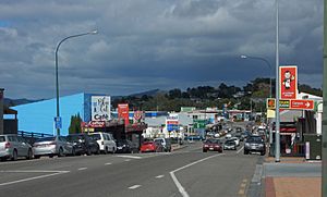
Main Street in Wellsford
|
|
| Country | New Zealand |
| Region | Auckland |
| Ward | Rodney ward |
| Community board | Rodney Local Board |
| Subdivision | Wellsford subdivision |
| Electorates |
|
| Area | |
| • Total | 4.72 km2 (1.82 sq mi) |
| Population
(June 2023)
|
|
| • Total | 2,280 |
| • Density | 483.1/km2 (1,251/sq mi) |
| Postcode(s) |
0900, 0977, 0975, 0972, 0974, 0973
|
Wellsford is a town in the northern part of New Zealand's North Island. Its Māori name is Whakapirau. It is the most northern big town in the Auckland Region. Wellsford is about 77 kilometres northwest of Auckland city centre.
The town is an important local hub. It sits where two main roads, State Highway 1 and State Highway 16, meet. This makes it almost halfway between Auckland and the city of Whangārei in the Northland Region.
Māori people have lived near the eastern Kaipara Harbour since the 1200s or 1300s. They used the forests and sea resources. By the mid-1600s, the Ngāti Whātua group called Te Uri-o-Hau lived here.
Wellsford was started in 1862 by a group called the Albertlanders. They were farmers and tradespeople from England. They first settled near the southern Oruawharo River. The area became known for its timber and kauri gum. Later, in the early 1900s, it became a centre for dairy farming. This was helped by the opening of the Wellsford railway station in 1909.
Contents
What's in a Name? Wellsford's Story
The town was first known by its Māori name, Whakapirau. This is the name of a local stream that flows into the Kaipara Harbour. The early settlers did not like this name. They thought it meant "stinking canoe."
So, they looked for a new name. At a public meeting in the late 1860s or early 1870s, the name Wellsford was chosen. It is believed that the name was made from the last names of settler families in the area. The name Wellsford first appeared in print around 1874. The area where Wellsford is now was often called "The Gum Ridge" in the 1870s.
Where is Wellsford?
Wellsford is located on the Northland Peninsula. This peninsula gets very narrow near Wellsford. An arm of the Kaipara Harbour on the west coast stretches inland for 20 kilometres. It reaches within 15 kilometres of the Pacific Ocean on the east coast.
The town is built on hilltops. It is at the meeting point of State Highway 1 and State Highway 16. The upper part of the Whakapirau Creek is north of the town. Southern Wellsford is in the area of the Hōteo River. The Whakapirau Creek flows into the Oruawharo River, which is part of the Kaipara Harbour.
The highest point in Wellsford is a 135-metre hill. It is located east of the junction of Matheson Road and Worthington Road.
Wellsford's Past: A Look Back
Māori History in Wellsford
In the mid-1700s, Ngāti Whātua people from Northland moved south to the Kaipara Harbour. The northern and eastern parts of Kaipara, including Wellsford, were controlled by Te Uri-o-Hau. This was a Ngāti Whātua group led by Haumoewhārangi.
Ngāti Rongo became a hapū (sub-tribe) in the area. This happened through the marriage of Haumoewhārangi's granddaughter, Moerangaranga, and Ngāwhetu. Ngāti Manuhiri also formed ties with Te Uri-o-Hau. Te Uri-o-Hau, including the hapū Ngāti Mauku and Ngāti Tahuhu, lived seasonally along the Oruawharo River.
In the 1820s, during the Musket Wars, many people left the eastern Kaipara. They sought safety in other parts of the country. Te Uri-o-Hau and Ngāti Rango slowly returned to the area by the late 1830s.
Early European Settlement
The land along the Oruawharo River was bought by the Crown (government) in 1860. The Hoteo Block to the south was bought in 1868.
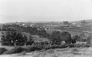
The Oruawharo Block became a planned settlement. It was mainly settled by Baptist tradespeople and farmers from England. They arrived between 1862 and 1865. These settlers were called the Albertlanders, named after Prince Albert. They were a group who wanted a new life away from the Anglican Church. Wellsford was first known as Whakapirau. Settlers built their homes between the Whakapirau Stream and the eastern Oruawharo Block.
The first main industry in Whakapirau was timber. In 1864, Nicholson's timber mill opened. Kauri gum diggers also set up camps in the area in the 1870s. A 500-acre area was even set aside for kauri gum digging. The modern Wellsford town site was also dug for kauri gum. It was often called "The Gum Ridge." Te Uri-o-Hau members traded and mixed with the Albertland settlers. The town's modern name, Wellsford, was likely adopted in the early 1870s. Over time, Wellsford moved east to its current spot.
In 1885, the Crown bought the Pakiri Block from Ngāti Manuhiri. This area was right next to Wellsford. This allowed Wellsford to grow south, away from the Whakapirau Stream.
The Railway and Modern Wellsford

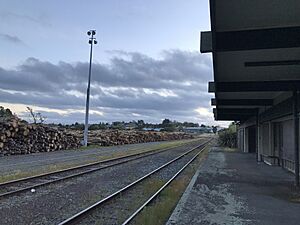
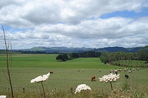
By 1900, the timber and kauri gum trades were slowing down. Settlers then focused on dairy farming. The Wayby Co-operative Dairy Company was started in 1902. In 1909, the North Auckland Line railway reached Wellsford. This brought more economic growth to Wellsford. Dairy and sheep farming became very important. During this time, the town slowly moved away from the Whakapirau Stream. The new town centre grew near the train station.
Dairy farming grew even more when better roads were built in the 1930s. As roads improved, Wellsford became a popular stop for travellers. People driving between Auckland and Whangārei on State Highway 1 would often stop here. Passenger train services to Wellsford stopped in 1975. In 1979, Irwin Industrial Tools opened in Wellsford. They made circular saw-blades and were a big employer. However, they closed in 2009.
The local Ōruawharo Marae is a traditional meeting place. It is for Te Uri-o-Hau and the Ngāti Whātua hapū of Ngāti Mauku and Ngāti Tahuhu. It includes the Rangimārie meeting house. In 1990, the Albertland Heritage Museum opened in Wellsford.
In the 2000s, more people have moved to Wellsford for tourism and lifestyle blocks. The Auckland Northern Motorway is planned to extend from Warkworth to Wellsford in the future. New housing developments are expected to greatly increase the town's size.
Who Lives in Wellsford?
Wellsford is a small urban area. It covers about 4.72 square kilometres. As of 2018, its estimated population was 2,037 people.
In the 2023 New Zealand census, Wellsford had 2,037 people. This was an increase of 63 people since the 2018 census. There were 1,035 males and 1,002 females. The average age was 36.0 years. About 22.2% of people were under 15 years old.
People could choose more than one ethnicity. About 78.5% identified as European (Pākehā). About 25.2% identified as Māori. Other groups included Pasifika (6.6%) and Asian (8.7%). English was spoken by 95.4% of people. Māori language was spoken by 4.4%.
About 32.8% of people were Christian. About 53.5% said they had no religion.
Learning in Wellsford
Wellsford has a secondary school and a primary school.
- Rodney College is for students in years 9–13.
- Wellsford School is for students in years 1–8.
Other primary schools in the area also send students to Rodney College. These include Tauhoa, Pākiri, Tāpora, Tomarata, and Mangawhai Primary Schools. All the schools are for both boys and girls.
Sports and Fun in Wellsford
Sports are a big part of life in Wellsford.
- Popular sports include rugby, soccer, netball, cricket, tennis, and athletics.
- The Wellsford Golf Club is popular and also has squash courts.
- You can also enjoy Rollerskating, archery, and bowling.
- Horse riding is also popular in the area.
See also
 In Spanish: Wellsford para niños


