Wenonah, New Jersey facts for kids
Quick facts for kids
Wenonah, New Jersey
|
||
|---|---|---|
|
Borough
|
||
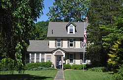
Stone House Inn, built c. 1773
|
||
|
||
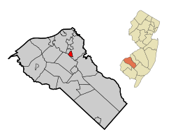
Map of Wenonah highlighted within Gloucester County. Inset: Location of Gloucester County in New Jersey.
|
||
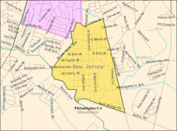
Census Bureau map of Wenonah, New Jersey
|
||
| Country | ||
| State | ||
| County | ||
| Incorporated | March 10, 1883 | |
| Government | ||
| • Type | Borough | |
| • Body | Borough Council | |
| Area | ||
| • Total | 1.01 sq mi (2.62 km2) | |
| • Land | 1.00 sq mi (2.58 km2) | |
| • Water | 0.02 sq mi (0.04 km2) 1.58% | |
| Area rank | 498th of 565 in state 23rd of 24 in county |
|
| Elevation | 69 ft (21 m) | |
| Population
(2020)
|
||
| • Total | 2,283 | |
| • Estimate
(2023)
|
2,309 | |
| • Rank | 476th of 565 in state 23rd of 24 in county |
|
| • Density | 2,293.0/sq mi (885.3/km2) | |
| • Density rank | 272nd of 565 in state 9th of 24 in county |
|
| Time zone | UTC−05:00 (Eastern (EST)) | |
| • Summer (DST) | UTC−04:00 (Eastern (EDT)) | |
| ZIP Code |
08090
|
|
| Area code(s) | 856 Exchanges: 415, 464, 468 | |
| FIPS code | 3401578110 | |
| GNIS feature ID | 0885434 | |
| Website | ||
Wenonah is a small borough located in Gloucester County, in the state of New Jersey, United States. It is a quiet community with a population of 2,283 people, based on the 2020 United States census. This number was just a little higher than the 2,278 people counted in 2010.
Wenonah was officially created as a borough by the New Jersey Legislature on March 10, 1883. This happened after local residents voted for it. The borough got its name from Wenonah, who was the mother of Hiawatha in Henry Wadsworth Longfellow's famous poem The Song of Hiawatha.
One interesting fact about Wenonah is that it is a "dry town." This means that it is against the law to buy or sell alcohol there.
Contents
History of Wenonah
Wenonah was started in 1871 by business people from Philadelphia. They wanted to create a country resort where people could relax. They chose this spot because it was near the Mantua Creek and along the West Jersey Railroad.
Over the next 40 years, many dams were built to create lakes for fun activities. From 1902 until the Great Depression, a private school called Wenonah Military Academy trained students there.
Wenonah has always been mostly a place where people live. More than 21% of the borough's land is protected. This means it cannot be built on. There are also over 6 miles of hiking trails around the lakes and waterways.
On September 1, 2021, a strong tornado hit the area. It was an EF3 tornado with winds up to 150 miles per hour. This tornado was caused by the leftover storms from Hurricane Ida. More than 200 homes and buildings in Wenonah were damaged. This was the highest number of damaged properties in any town hit by that tornado.
Geography and Location
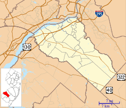
Wenonah covers a total area of about 1.01 square miles (2.62 square kilometers). Most of this area is land, with a small part being water.
The borough shares its borders with two other townships. These are Deptford Township and Mantua Township.
Population and People
| Historical population | |||
|---|---|---|---|
| Census | Pop. | %± | |
| 1880 | 166 | — | |
| 1890 | 383 | 130.7% | |
| 1900 | 498 | 30.0% | |
| 1910 | 645 | 29.5% | |
| 1920 | 918 | 42.3% | |
| 1930 | 1,245 | 35.6% | |
| 1940 | 1,311 | 5.3% | |
| 1950 | 1,511 | 15.3% | |
| 1960 | 2,100 | 39.0% | |
| 1970 | 2,364 | 12.6% | |
| 1980 | 2,303 | −2.6% | |
| 1990 | 2,331 | 1.2% | |
| 2000 | 2,317 | −0.6% | |
| 2010 | 2,278 | −1.7% | |
| 2020 | 2,283 | 0.2% | |
| 2023 (est.) | 2,309 | 1.4% | |
| Population sources: 1890–2000 1880–1890 1890–1920 1890–1910 1910–1930 1940–2000 2000 2010 2020 |
|||
Population in 2010
In 2010, there were 2,278 people living in Wenonah. These people lived in 829 households, and 649 of these were families. The population density was about 2,343 people per square mile.
Most of the people in Wenonah were White (96.27%). There were also smaller numbers of Black or African American, Native American, Asian, and Pacific Islander residents. About 1.36% of the population identified as Hispanic or Latino.
About 33.9% of households had children under 18 living there. Most households (66.3%) were married couples. The average household had 2.74 people.
The median age in Wenonah was 42.6 years old. About 25.1% of the population was under 18.
Population in 2000
In 2000, Wenonah had 2,317 people. There were 844 households, and 652 of these were families. The population density was about 2,380 people per square mile.
The racial makeup was similar to 2010, with most residents being White (97.546%). About 0.731% of the population was Hispanic or Latino.
About 35.3% of households had children under 18. The average household size was 2.70 people.
The median age was 41 years. About 25.9% of the population was under 18.
How Wenonah is Governed
Local Government Structure
Wenonah is run by a borough form of government. This is a common way for towns in New Jersey to be governed. The government is made up of a mayor and a borough council.
The mayor is chosen directly by the voters and serves for four years. The borough council has six members. They serve three-year terms, and two seats are up for election each year. In Wenonah, the council members make the laws, and the mayor leads meetings. The mayor can only vote if there is a tie. The mayor also helps assign council members to different committees.
As of 2025, the mayor of Wenonah is Jessica S. Doheny. Her term ends on December 31, 2026. The members of the Wenonah Borough Council include Jaclyn Graves, Jonathan Barbato, Daniel Cox, Anthony J. Fini, Jeanne Grigri, and Alex Pozza.
Political Participation
In the 2012 presidential election, Barack Obama received 53.0% of the votes in Wenonah. In the 2008 election, he received 53.3% of the votes. In the 2004 election, John Kerry received 49.8% of the votes.
In the 2013 election for governor, Chris Christie received 61.1% of the votes in Wenonah. In the 2009 election for governor, he received 44.3% of the votes.
Education in Wenonah
Local Schools
Students in Wenonah attend public schools through the Wenonah School District. Children in kindergarten through sixth grade go to Wenonah Elementary School. In the 2023–24 school year, this school had 163 students.
For seventh through twelfth grades, students attend Gateway Regional High School. This high school also serves students from nearby towns like National Park, Westville, and Woodbury Heights. In the 2023–24 school year, Gateway Regional High School had 875 students.
Vocational Education Options
Students from all over Gloucester County can apply to attend Gloucester County Institute of Technology. This is a four-year high school in Deptford Township. It offers special training in technical and vocational subjects. Students do not have to pay tuition to attend this school.
Getting Around Wenonah
Roads and Highways
As of 2015, Wenonah had about 15.42 miles of roads. Most of these roads are maintained by the borough itself. The main roads that serve Wenonah are County Route 553 and County Route 632.
Public Transportation Options
NJ Transit offers bus service between Sewell and Philadelphia on the 412 route.
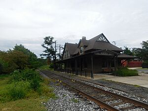
Wenonah is also planned to have a stop on the Glassboro–Camden Line. This is a new light rail system that will be about 18 miles long. It was expected to be finished in 2019, but as of 2019, it was not expected until 2025.
Notable People from Wenonah
Many interesting people have lived in or are connected to Wenonah. Here are a few:
- B.C. Camplight (born 1979), a singer-songwriter.
- Michael Capuzzo (born 1957), an author and four-time Pulitzer Prize nominee.
- Ethel A. Grosscup (1891–1949), a physical educator and child health consultant.
- Edward Everett Grosscup (1860–1933), who was the chairman of the New Jersey Democratic State Committee.
- Carl Hausman (born 1953), a journalist, educator, and author.
- Michael Pellegrino (born 2001), a soccer player.
- Isaac Pursell (1853–1910), an architect.
- Grover C. Richman Jr. (1911–1983), a lawyer who served as the United States Attorney for New Jersey.
- Joe Solecki (born 1993), a professional mixed martial artist.
- Steve Squyres (born 1957), an astronomer known for his work on the Mars Exploration Rover Mission.
- Tim Squyres (born 1959), a film editor who worked on movies like Crouching Tiger, Hidden Dragon and Life of Pi.
- Bob Steuber (1921–1996), an NFL football player who is in the College Football Hall of Fame.
See also
 In Spanish: Wenonah (Nueva Jersey) para niños
 | Shirley Ann Jackson |
 | Garett Morgan |
 | J. Ernest Wilkins Jr. |
 | Elijah McCoy |


