West Bradford Township, Pennsylvania facts for kids
Quick facts for kids
West Bradford Township
|
|||||
|---|---|---|---|---|---|
|
Township
|
|||||
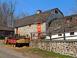
Derbydown Homestead in West Bradford Township
|
|||||
|
|||||
| Motto(s):
"Between the Brandywines"
|
|||||
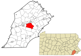
Location of West Bradford Township in Chester County and in Pennsylvania
|
|||||
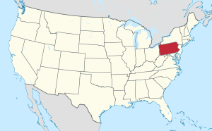
Location of Pennsylvania in the United States
|
|||||
| Country | United States | ||||
| State | Pennsylvania | ||||
| County | Chester | ||||
| Established | 1705 (as Bradford Twp.) | ||||
| Area | |||||
| • Total | 18.60 sq mi (48.16 km2) | ||||
| • Land | 18.50 sq mi (47.91 km2) | ||||
| • Water | 0.10 sq mi (0.25 km2) | ||||
| Elevation | 548 ft (167 m) | ||||
| Population
(2010)
|
|||||
| • Total | 14,316 | ||||
| • Estimate
(2016)
|
12,858 | ||||
| • Density | 695.10/sq mi (268.39/km2) | ||||
| Time zone | UTC-5 (EST) | ||||
| • Summer (DST) | UTC-4 (EDT) | ||||
| ZIP Codes |
19335, 19320, 19382, 19380
|
||||
| Area code(s) | 610 | ||||
| FIPS code | 42-029-82544 | ||||
| Website | http://www.westbradford.org | ||||
West Bradford Township is a special area in Chester County, Pennsylvania, in the United States. It's known as a township, which is a type of local government area. In 2020, about 14,706 people called West Bradford Township home.
Contents
History of West Bradford Township
West Bradford Township has a rich history with many important places. Several areas here are listed on the National Register of Historic Places. This means they are officially recognized for their historical importance.
Historic Districts and Buildings
There are three special areas called federal historic districts in West Bradford Township:
- Marshallton
- Trimbleville
- Northbrook
These districts are like outdoor museums, preserving many old buildings and the way they were laid out.
Other important historical buildings and places in the township include:
- The Baily Farm
- The Bradford Friends Meetinghouse
- The Como Farm
- The Derbydown Homestead
- The Humphry Marshall House
- The Marshallton Inn
- The Temple-Webster-Stoner House
Geography of West Bradford Township
West Bradford Township covers an area of about 18.6 square miles (48.2 square kilometers). Most of this area is land, with a small part, about 0.1 square miles (0.2 square kilometers), being water.
Neighboring Communities
West Bradford Township shares its borders with several other towns and townships:
- Caln Township (to the north)
- Downingtown (to the north)
- East Caln Township (to the north)
- East Bradford Township (to the east)
- Newlin Township (to the south)
- Pocopson Township (to the south)
- East Fallowfield Township (to the west)
Local Neighborhoods
Within West Bradford Township, you'll find several distinct neighborhoods and communities:
- Brandywine Greene
- Embreeville
- Marshallton
- Northbrook
- Romansville
- Trimbleville
- Victoria Crossing at Bradford Glen
Population and People
| Historical population | |||
|---|---|---|---|
| Census | Pop. | %± | |
| 1930 | 1,558 | — | |
| 1940 | 1,367 | −12.3% | |
| 1950 | 1,530 | 11.9% | |
| 1960 | 1,894 | 23.8% | |
| 1970 | 2,996 | 58.2% | |
| 1980 | 7,343 | 145.1% | |
| 1990 | 10,406 | 41.7% | |
| 2000 | 10,775 | 3.5% | |
| 2010 | 12,376 | 14.9% | |
| 2020 | 14,316 | 15.7% | |
In 2020, the census counted 14,706 people living in West Bradford Township. These people lived in 4,974 different homes.
The population density was about 773.9 people per square mile (298.8 people per square kilometer). This tells us how many people live in each area.
The people living in the township come from many different backgrounds. Most residents are White (85.6%), with others identifying as African American (2.8%), Asian (4.0%), or from two or more races (7.1%). About 4.1% of the population is of Hispanic or Latino origin.
The average household in West Bradford Township has about 2.89 people.
When looking at age groups, about 30.4% of residents are under 19 years old. About 9.2% are 65 years or older. The average age of people in the township is 39.6 years.
Education in West Bradford Township
Public Schools
Students in West Bradford Township attend schools in the Downingtown Area School District. There are two elementary schools right within the township:
- Bradford Heights Elementary School
- West Bradford Elementary School
After elementary school, all students from the township go to Downingtown Middle School and then to Downingtown West High School.
Transportation
As of 2021, West Bradford Township has about 103.39 miles (166.39 kilometers) of public roads. Some of these roads are kept up by the Pennsylvania Department of Transportation (PennDOT), and others are maintained by the township itself.
Two main roads pass through West Bradford Township:
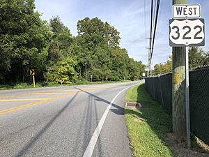
- U.S. Route 322 (also called Downingtown Pike) runs across the northeastern part of the township.
- Pennsylvania Route 162 (Telegraph Road and Strasburg Road) goes through the southeastern part.
Fun and Notable Places
West Bradford Township is home to several interesting spots:
- The west branch of the Brandywine River flows through the township. This river is famous because General Cornwallis and the British Army crossed it here during the Battle of Brandywine long ago.
- Broad Run Golfer's Club is a golf course designed by a famous golf course architect, Rees Jones.
- The Humphry Marshall House is the home of botanist Humphry Marshall, who studied plants. It's located in the village of Marshallton.
- Strasburg Road is a very old road that was paved way back in 1772-1773 and still runs through West Bradford.
- United Sports is a large complex where people can play many different sports.
Famous People from West Bradford Township
Some notable people have connections to West Bradford Township:
- John Beale Bordley
- John Hickman
- Humphry Marshall, a famous botanist (plant scientist)
- Claude Rains, an actor known for many movies, including playing Captain Renault in Casablanca
See also
 In Spanish: Municipio de West Bradford para niños
 | Jewel Prestage |
 | Ella Baker |
 | Fannie Lou Hamer |


