
Brentwood, New York facts for kids
Quick facts for kids
Brentwood, New York
|
|
|---|---|

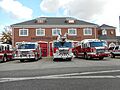
The Brentwood Fire Department in 2014.
|
|
| Nickname(s):
"The Jewel of Long Island"
|
|

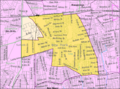
U.S. Census map of Brentwood.
|
|

Brentwood, New York
Location in Long Island

Brentwood, New York
Location in New York
|
|
| Country | |
| State | |
| County | Suffolk |
| Town | Islip |
| Named for | Brentwood, Essex |
| Area | |
| • Total | 10.95 sq mi (28.36 km2) |
| • Land | 10.95 sq mi (28.36 km2) |
| • Water | 0.00 sq mi (0.00 km2) |
| Elevation | 79 ft (24 m) |
| Population
(2020)
|
|
| • Total | 62,387 |
| • Density | 5,697.44/sq mi (2,199.77/km2) |
| Time zone | UTC-5 (Eastern (EST)) |
| • Summer (DST) | UTC-4 (EDT) |
| ZIP code |
11717
|
| Area code(s) | 631, 934 |
| FIPS code | 36-08026 |
| GNIS feature ID | 0944688 |
Brentwood is a large community called a hamlet in Suffolk County, New York. It's located on Long Island and is part of the Town of Islip. With a population of 62,387 people in 2020, Brentwood is the most populated community of its kind in Suffolk County and on Long Island, outside of New York City.
Contents
History of Brentwood
How Brentwood Began
In 1844, the area where Brentwood now stands was known by two names: Thompson Station and Suffolk Station. These were new stops on the Long Island Rail Road's main train line.
On March 21, 1851, the area became a special community called Modern Times. It was founded by Josiah Warren and Stephen Pearl Andrews. They bought about 750 acres (3 km²) of land for this new settlement. In 1864, the community was renamed Brentwood, taking its name from a town in England.
The Modern Times community was built on the idea of "individual freedom" and "personal responsibility." People were encouraged to follow their own interests. All things made by work were considered private property. The community even had its own local money system, based on trading labor for goods and services. There were no courts, jails, or police at first. This was meant to show that violence might be caused by rules that didn't allow people enough freedom. However, the community eventually ended, partly due to the American Civil War and new residents who didn't share the original ideas. Today, only a few original buildings from Modern Times still exist, like two unique octagon-shaped houses and the first schoolhouse.
Brentwood Today
In the early 1900s, Brentwood was home to the Ross Health Resort Onehtah. People visited this resort to escape city pollution, believing that the smell of pine needles was good for their health.
Brentwood is also where Pilgrim State Hospital is located. This was once one of the largest hospitals for mental health in the world. A part of this hospital's land, about 52 acres (0.21 km²), was turned into the Brentwood State Park athletic fields, which opened in 2009.
Brentwood celebrated its 100th anniversary on June 16–17, 1950. The community's 150th anniversary was celebrated more recently, from May 9–11, 2007.
Brentwood High School is famous for its boys' soccer team. They even won a national championship in 2019!
Where is Brentwood?
Brentwood covers a total area of about 11.0 square miles (28.36 km²). All of this area is land.
People in Brentwood
As of the census in 2020, there were 62,387 people living in Brentwood. The community had 12,580 households and 10,894 families. The population density was about 6,028 people per square mile (2,327 per km²).
Brentwood is a very diverse community. In 2020, about 18.6% of the people were White, 16.3% were African American, and 1.9% were Asian. A large part of the population, 64.3%, identified as Hispanic or Latino. Many people in Brentwood have roots in countries like El Salvador (27.7%), Puerto Rico (11.1%), and the Dominican Republic (7.3%).
About 29.9% of the population was under 18 years old. The average age of people in Brentwood was 31 years. The median income for a household in Brentwood was $68,314.
Schools and Libraries
School District
Brentwood is entirely within the Brentwood Union Free School District. This means all public school students living in Brentwood attend schools within this district. The district has eleven elementary schools, four middle schools, one freshman center, and two high schools.
Library District

The Brentwood Public Library serves the entire Brentwood community.
Emergency Services
Brentwood has dedicated emergency services that help keep the community safe.
Brentwood Fire Department
The Brentwood Fire Department is made up of volunteers. They provide fire rescue services to Brentwood, North Bay Shore, and Baywood, covering about 24 square miles (62 km²).
The department started in 1898 when local people came together to fight brush and forest fires. In 1899, the Brentwood Fire District was officially created. The first firehouse was built in 1900. In 1926, the department was reorganized, and Theodore Freund became the first Fire Chief. The original firehouse burned down in 1928, but a new brick building was built in its place. In 1932, the name "Brentwood Fire Department" was formally adopted.
Today, the Brentwood Fire Department is one of the busiest fire departments in Suffolk County, answering about 1,500 calls each year. It is part of the Suffolk County Fire Rescue and Emergency Services (FRES) system. The department has several firehouses, each with different companies that help protect the community.
Brentwood Legion Ambulance
Brentwood Legion Ambulance is also a volunteer service. It was founded in 1959 by William J.A. Seymour. He realized Brentwood needed its own ambulance service after he was seriously injured in a car crash and had to wait a long time for an ambulance from another town.
Mr. Seymour gathered volunteers from the American Legion’s Joseph Loeffler Post 1006. The word "Legion" in the department's name honors these founding members. They started with about 25 volunteers and bought a used 1948 Cadillac hearse, which they turned into their first ambulance. Over 50 years later, Brentwood Legion Ambulance has grown to over 250 members and uses modern equipment and vehicles to serve the community.
Getting Around Brentwood
Roads
Several important roads pass through or near Brentwood. The Long Island Expressway (Interstate 495) runs through the northern part of the hamlet. The Long Island Motor Parkway forms part of its northern border. The Sagtikos State Parkway also goes through Brentwood, and New York State Route 111 forms part of its eastern border.
Trains

Brentwood has its own train station, the Brentwood LIRR station, which is on the Ronkonkoma Branch of the Long Island Rail Road.
Buses

The Brentwood LIRR station is also a hub for several Suffolk Transit bus routes that serve the area:
- 4: Travels between Amityville LIRR station and Smith Haven Mall.
- 5: Travels between Babylon LIRR station and Smith Haven Mall.
- 7: Connects Bay Shore and Northport.
- 11: Travels between Bay Shore and Hauppauge.
- 58: Travels between Brentwood LIRR station and Riverhead LIRR station.
Famous People from Brentwood
Many notable people have connections to Brentwood, including:
- EPMD – Hip-hop artists, both members grew up in Brentwood.
- Robert Gallucci (born 1946) – A former U.S. Ambassador, who graduated from Brentwood High School in 1962.
- Andrew Jean-Baptiste (born 1992) – A professional soccer player.
- Mitch Kupchak (born 1954) – A former basketball player and general manager for the NBA's Los Angeles Lakers.
- Hector LaSalle – A lawyer and judge, currently a presiding judge in the New York State Supreme Court.
- Frank Lopardo – An opera singer.
- Craig Mack (1971–2018) – A hip-hop musician.
- Dave Martinez (born 1964) – Manager of the Washington Nationals baseball team and a former outfielder.
- Buddy McGirt (born 1964) – A boxing champion and trainer.
- Lester Quiñones (born 2000) – An NBA player for the Golden State Warriors.
- Jef Raskin (1943–2005) – Known as the "Father of the Macintosh" computer, he was a computer scientist and inventor who graduated from Brentwood High School in 1960.
- Ray Reid (born 1960) – A successful college men's soccer coach, who led UConn to a national title.
- Jai Rodriguez (born 1979) – An actor and musician, born in Brentwood.
Images for kids
-
The Brentwood Fire Department in 2014.
-
U.S. Census map of Brentwood.
See also
 In Spanish: Brentwood (Nueva York) para niños
