West Mount Barren facts for kids
Quick facts for kids West Mount Barren |
|
|---|---|
 |
|
| Highest point | |
| Elevation | 372 m (1,220 ft) |
| Geography | |
| Location | Goldfields-Esperance of Western Australia |
| Parent range | Barrens Range |
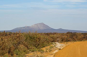
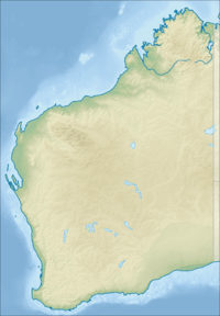
West Mount Barren is a mountain located in the Fitzgerald River National Park in Western Australia. You can find it on the south coast, between the towns of Bremer Bay and Hopetoun. The very top of the mountain, called the summit, is at these coordinates: 34°12′59″S 119°25′58″E / 34.21639°S 119.43278°E.
In 1802, a famous explorer named Matthew Flinders gave West Mount Barren its name. He also named East Mount Barren and Mid-Mount Barren. He called them "Barren" because the land looked empty and dry to him.
Contents
What is West Mount Barren Like?
West Mount Barren stands 372 metres (about 1,220 feet) above the sea. It is part of a group of mountains called the Barren Range, all found within the national park. The closest mountain is Mount Bland, which is 320 metres tall and about 5 kilometres (3 miles) northeast.
The Barren Range isn't one long, continuous line of mountains. Instead, West, Mid, and East Mount Barren are separate peaks. They are connected by flat coastal land. Mid Mount Barren is about 20 kilometres (12 miles) northeast of West Mount Barren. East Mount Barren is even further, about 50 kilometres (31 miles) northeast. Other peaks nearby include Woolbernup Hill and Thumb Peak.
You can reach West Mount Barren by driving on an unsealed (dirt) road. This road is fine for regular cars. At the bottom of the mountain, there's a car park with a special plaque. From there, an easy walking path leads to the summit. The walk takes about two hours to go up and back down.
It's important to stay on the path when you visit. This helps protect the native plants from a disease called dieback. From the top of West Mount Barren, you get an amazing view of the national park and the coastline.
How Did West Mount Barren Form?
The area around Ravensthorpe, where West Mount Barren is, has very old rocks. These rocks were formed by huge movements of the Earth's crust. The Barren Ranges are made of special rocks like quartzite, phyllite, dolomite, and conglomerate.
These rock layers were once sand on the bottom of the sea. Over millions of years, they were squeezed, heated, and pushed upwards by the Earth's forces. This process caused the rocks to bend and break, forming the mountains we see today.
Plants of West Mount Barren
The plants around West Mount Barren are mostly scrub-heath. This means there are many types of shrubs that grow well in sandy or rocky soil. Many of these shrubs belong to the Proteaceae and Myrtaceae plant families.
Several plant species are found only in this area, including on and around West Mount Barren. Some of these unique plants are:
- Royal Hakea (Hakea victoria)
- Qualup Bells (Pimelea physodes)
- Oval-leaf Adenanthos (Adenanthos ellipticus)
- Blue Dampiera (Dampiera linearis)
- Silver-leafed Barrens regalia (Regelia velutina)
- Barrens clawflower (Calothamnus validus)
- Broad-leaved Brown Pea (Bossiaea ornata)
Wildfires and the Park
The area around West Mount Barren often experiences bush fires. These fires are usually started by Lightning strikes. They can burn large parts of the national park. For example, in December 2006, four lightning-started fires joined together. This created a much larger blaze that burned many hectares of bushland.
 | Frances Mary Albrier |
 | Whitney Young |
 | Muhammad Ali |


