
West Point, Virginia facts for kids
Quick facts for kids
West Point, Virginia
|
|
|---|---|

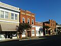
Storefronts in 2016
|
|

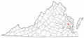
Location of West Point, Virginia
|
|
| Country | United States |
| State | Virginia |
| County | King William |
| Area | |
| • Total | 6.66 sq mi (17.25 km2) |
| • Land | 5.05 sq mi (13.08 km2) |
| • Water | 1.61 sq mi (4.17 km2) |
| Elevation | 62 ft (19 m) |
| Population
(2010)
|
|
| • Total | 2,900 |
| • Estimate
(2019)
|
3,257 |
| • Density | 644.82/sq mi (248.99/km2) |
| Time zone | UTC-5 (Eastern (EST)) |
| • Summer (DST) | UTC-4 (EDT) |
| ZIP code |
23181
|
| Area code(s) | 804 |
| FIPS code | 51-84960 |
| GNIS feature ID | 1500297 |

West Point is a town in King William County, Virginia, USA. It used to be called Delaware. In 2020, about 3,414 people lived there.
Contents
Where is West Point?
West Point is located where two rivers, the Mattaponi and Pamunkey, meet. These rivers join to form the York River. The York River then flows about 40 miles (64 km) to the Chesapeake Bay. It separates two parts of eastern Virginia: the Virginia Peninsula and the Middle Peninsula.
The town covers about 6.7 square miles (17.4 km2). Most of this area is land, but about 1.5 square miles (3.9 km2) is water.
Many of the buildings in downtown West Point are part of the West Point Historic District. This area is listed on the National Register of Historic Places because of its important history.
A Look at West Point's History
West Point was once the site of a Native American village called Cinquoteck. This village belonged to the Mattaponi people, who were part of the Powhatan Confederacy.
In the 1600s, there were often fights between the Native Americans and the English colonists from Jamestown. By the middle of that century, the colonists had taken over much of the land, including the area of Cinquoteck.
Today, the Mattaponi and Pamunkey tribes still live on reservations near West Point. These reservations were set up by treaty a long time ago. Both tribes are recognized by the state of Virginia.
From Plantation to Port Town
In 1655, a large farm called Port Richmond West Plantation was built on the land where Cinquoteck used to be. This was the home of John West, who was a Governor of Virginia.
Later, parts of the plantation were sold, and a settlement grew up at what became known as West Point. It was a good spot because it had access to the York River. In 1691, the government decided that West Point should be a port of entry. This meant ships could officially come and go from there.
In 1705, the town was named "Delaware" to honor Thomas West, 3rd Baron De La Warr. He was an early settler of Jamestown and also a governor.

Railroads and Changes
The town changed its name back to "West Point" in 1861. This was when the Richmond and York River Railroad was finished, connecting West Point to other areas. This railroad was very important during the American Civil War. Union General George B. McClellan wanted to capture it during his plan to take Richmond.
After the war, the railroad was rebuilt. West Point became a major place for shipping people and goods. It was especially useful for traveling to Baltimore and other northern cities by boat on the York River and Chesapeake Bay.
By the early 1900s, West Point was a busy port and a place where people went for vacations. But then, more railroads were built to bigger ports closer to the ocean, like Newport News and Portsmouth. Also, tourists started going to newer vacation spots. So, West Point's importance as a port and resort declined.
New Industries for West Point
To bring new jobs, a shipyard was built in 1917. A pulp paper mill also opened in 1914. These industries helped the town grow again. The railroad still serves the paper mill today.
Schools in West Point
West Point is special because it has its own school division. This means its schools are separate from the schools in the rest of King William County. Only one other town in Virginia has this setup.
The schools in West Point are known for being highly rated in Virginia. Some students from West Point also attend the Maggie L. Walker Governor's School for Government and International Studies.
Weather in West Point
West Point has a climate with warm summers and mild winters. The average high temperature in July is around 90°F (32°C). In January, the average low temperature is about 28°F (-2°C). The town gets a good amount of rain throughout the year. Snowfall is usually light, with an average of about 9.6 inches (24 cm) per year.
Who Lives in West Point?
In 2000, there were 2,866 people living in West Point. The town had 1,068 households. About 35.8% of these households had children under 18 living with them. The average age of people in West Point was 39 years old.
Most people in the town were White (80.32%). About 16.92% were African American. Other groups included Native American, Asian, and people of two or more races. About 1.74% of the population was Hispanic or Latino.
The average income for a household in West Point was about $49,655.
Fun Events
Since 1983, West Point has held its annual Crab Carnival. This fun event happens during the first weekend of October. It's a time for everyone in the community to celebrate the town's history and keep a special tradition going!
Famous People from West Point
- Lewis "Chesty" Puller (1898–1971) – He was a very famous officer in the U.S. Marine Corps. He received many awards for his bravery.
Images for kids
-
Storefronts in 2016
-
Location of West Point, Virginia
See also
 In Spanish: West Point (Virginia) para niños
