Wheeling Creek (Ohio) facts for kids
Quick facts for kids Wheeling Creek |
|
|---|---|

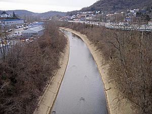
Wheeling Creek near its mouth in Bridgeport in 2006
|
|
|
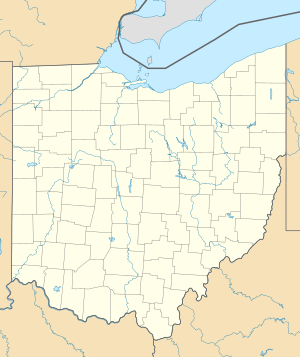
Location of the mouth of Wheeling Creek in Bridgeport, Ohio
|
|
| Country | United States |
| State | Ohio |
| Physical characteristics | |
| Main source | East of Flushing 1,242 ft (379 m) 40°08′57″N 81°03′00″W / 40.14917°N 81.05000°W |
| River mouth | Ohio River Bridgeport 623 ft (190 m) 40°04′17″N 80°44′17″W / 40.07139°N 80.73806°W |
| Length | 30.2 mi (48.6 km) |
| Basin features | |
| Basin size | 108 sq mi (280 km2) |
Wheeling Creek is a river in eastern Ohio, United States. It is about 30 miles (48.5 km) long. This creek is a tributary, which means it's a smaller stream that flows into a larger one. Wheeling Creek flows into the Ohio River.
The water from Wheeling Creek eventually joins the Mississippi River. This whole area, where water drains into a river system, is called a watershed. Wheeling Creek's watershed covers about 108 square miles (280 km²). It is located on the Allegheny Plateau, a high, flat area of land. This part of the plateau was not covered by glaciers long ago.
Wheeling Creek flows entirely within Belmont County, Ohio. Some smaller streams that feed into it also come from parts of Harrison County, Ohio and Jefferson County, Ohio.
Where Wheeling Creek Flows
Wheeling Creek starts in Flushing Township, Ohio, near the town of Flushing, Ohio. From there, it generally flows east. It passes through several townships like Union, Wheeling, Richland, Colerain, and Pease.
The creek also flows past many communities. These include Lafferty, Ohio, Bannock, Ohio, Fairpoint, Ohio, Maynard, Ohio, Barton, Ohio, Blaine, Ohio, Lansing, Ohio, and Brookside, Ohio.
Finally, Wheeling Creek reaches Bridgeport, Ohio. Here, it flows into the Ohio River from the west side. Just across the Ohio River, another creek with the same name, Wheeling Creek in West Virginia, also joins the Ohio River. The National Road (U.S. Route 40) runs alongside Wheeling Creek between Bridgeport and Blaine.
How Fast Does the Water Flow?
The United States Geological Survey (USGS) has a special device called a stream gauge on Wheeling Creek. This gauge measures how much water is flowing in the creek. It is located downstream of Blaine, about 4.8 miles (7.7 km) before the creek joins the Ohio River.
From 1984 to 2005, the average flow of the creek at this spot was 115 cubic feet per second (3 m³/s). Imagine a box that is one foot long, one foot wide, and one foot high; that's one cubic foot. So, 115 of those boxes of water flowed by every second on average!
The highest flow recorded during this time was 8,500 cubic feet per second (241 m³/s). This happened on September 17, 2004. The lowest flow recorded was 7 cubic feet per second (0.2 m³/s) on September 21, 1985.
Other Names for the Creek
The Geographic Names Information System (GNIS) keeps track of names for places. According to them, Wheeling Creek has been known by a few other names in the past. These include:
- Indian Wheeling Creek
- Scalp Creek
- Spit Head Creek
- Spithead Creek
 | Selma Burke |
 | Pauline Powell Burns |
 | Frederick J. Brown |
 | Robert Blackburn |


