White Inch facts for kids
| OS grid reference | NS545669 |
|---|---|
| Coordinates | 55°52′26″N 4°19′36″W / 55.8739°N 4.3268°W |
| Physical geography | |
| Island group | Islands of the River Clyde |
| Administration | |
| Sovereign state | United Kingdom |
| Country | Scotland |
| Council area | Lanarkshire |
| Demographics | |
| Population | 0 |
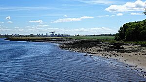
White Inch was once an island in the River Clyde near Glasgow, Scotland. It was located in the area of Govan in Lanarkshire. Over time, the river was deepened, and the material dug out was used to fill in the water around White Inch. This connected the island to the northern river bank by the 1830s. Today, the area is completely built up with buildings. The name "White Inch" still exists in the Whiteinch district of Glasgow and in street names. It probably got its name from white sand found there.
Contents
Islands of the River Clyde
The River Clyde once had several islands, not just sandbanks that appeared at low tide. Moving upstream towards Glasgow, these islands included Milton, Bodinbo, Newshot, Ron, Sand Inch, Kings Inch, Buck Inch, White Inch, and Water Inch. There was also a Colin's Isle near where the River Cart joins the Clyde.
The word "Inch" comes from the Scots language, which got it from the Gaelic word "Innis," meaning "island." The name "Ron" in Scots refers to a thicket, like a dense group of hawthorn or rose bushes. "Buck Inch" might mean a place where you could hear water pouring or gushing.
White Inch's History
Old maps show White Inch as an island. For example, a map from around 1636-52 by Gordon shows it, though it doesn't name it. Before 1732, Herman Moll's map clearly shows White Inch in the Clyde, with Water Inch upstream and Buck Inch downstream.
In 1758, James Barry's map of the Clyde also named White Inch and showed it as an island. It was located across from the old Linthouse Estate, between the River Kelvin and the Whiteinch Burn. It was easy to get to the island because the water was sometimes as shallow as 18 inches (46 cm). This allowed it to be used as part of a farm owned by the Smith family of Jordanhill.
Deepening the Clyde
As Glasgow grew into an important port, the River Clyde needed to be made deeper. This meant removing obstacles like hard gravel. The process of digging out the riverbed, called dredging, created huge amounts of rocks and mud. This material needed to be disposed of cheaply.
James Smith of Jordanhill owned land nearby, including Jordanvale and White Inch. He made a smart deal with the Clyde Trust, the group in charge of the river. The Trust could dump the dredged material into the river channel on the northern side of White Inch and onto the low land between Jordanvale and White Inch. This was very cheap for the Trust.
Special boats called punts, pulled by steamboats, brought the fill material to the area. This raised the ground level by about 10 to 15 feet (3 to 4.5 meters). Because of this, by the 1830s, White Inch was no longer an island, even during floods. The land where the island once stood was later used for shipyards and is now covered by industrial buildings.
The Ancient Ford
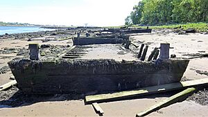
In 1913, when the Linthouse Shipyard was building new berths, workers found stones in the Clyde. The Old Govan Club looked at them and believed they were the remains of stepping stones from an old ford. A ford is a shallow place where a river can be crossed. This ford once crossed from the south bank of the river to White Inch and then continued to the north bank.
Changes in the River Clyde
In the 1600s, the Clyde flooded and changed its path. An old record states that the river "left its usual course... took a semi-circular direction, leaving the King’s Inch on the north side." This suggests that the main flow of the River Clyde might have become weaker in the channel north of White Inch.
Paisley Abbey and King's Inch
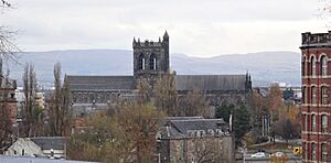
Around 1168, thirteen monks from Much Wenlock arrived in Renfrew. They stayed at the Steward's castle on King's Inch, where there was a church dedicated to Saints Mary and James. Their main home, Paisley Abbey, was not ready yet. Osbert was chosen as their leader, called a prior.
These monks had special rights to trade and fish in the area, including fishing rights on the River Clyde. By 1172, the monks had moved to Paisley Abbey. Walter Fitz Alan gave King's Inch and all the fishing rights on the Clyde between the island and Partick to the abbey.
 | Aurelia Browder |
 | Nannie Helen Burroughs |
 | Michelle Alexander |


