Bodinbo Island facts for kids
| Meaning of name | Bow shaped island with underwater rocks |
|---|---|
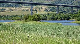
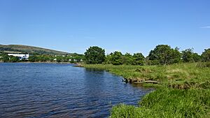
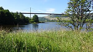
 Bodinbo Island from the Clyde Coastal Path |
|
| OS grid reference | NS463719 |
| Coordinates | 55°54′58″N 4°27′36″W / 55.915999°N 4.4598746°W |
| Physical geography | |
| Island group | Islands of the River Clyde |
| Area | c.3ha |
| Highest elevation | <3 metres (9.8 ft) |
| Administration | |
| Sovereign state | United Kingdom |
| Country | Scotland |
| Council area | Renfrewshire |
| Demographics | |
| Population | 0 |
Bodinbo Island is a small island in the River Clyde. It is near the old ferry crossing at Erskine. Long ago, this rocky island was a danger to ships. It was especially tricky for sailing boats in bad weather. This was before a special wall, called a training wall, was built. On some maps, it is called Bottombow Island. The nearby forest is known as Boden Boo.
Islands of the River Clyde
The River Clyde once had many islands. These were not just sandbanks that appeared at low tide. Moving upstream towards Glasgow, some of these islands included:
- Inchgreen (near Greenock)
- Bodinbo
- Newshot
- Ron
- Sand Inch
- King's Inch
- Buck Inch
- White Inch
- Water Inch
Green Inch, also called Milton Island, is near the old Dumbuck Ford. This is close to Dumbarton. Colin's Isle was once in the River Cart. The Cart joins the River Clyde.
The word 'Inch' comes from Scots. It means 'island' in Gaelic. 'Ron' in Scots means a thicket of thorny bushes. It can also mean a small, crowded woodland. 'Shot' was an old way to divide land. It could also mean a piece of land that sticks out. Another meaning of 'Shot' is a place where fishing nets were cast. Bodinbo Island might even have parts of an old fishing weir. This is a structure used to trap fish.
About Bodinbo Island
The name 'Bodinbo' appeared on maps in the early 1600s. These maps were made by Timothy Pont and Joan Blaeu. The island was likely shown because it was a hazard for ships.
A map from 1800 by John Ainslie shows the island's bow shape. This was before the training wall was built around 1857. The wall was made to narrow the river. This helped the water flow faster. A faster flow would clean the riverbed. It would make the river deeper and stop it from silting up. The Erskine Ferry was already running then. It operated from Donald's Quay, which was a bit further downstream.
The old river bank is close to the Clyde Coastal Path. It is lined with many trees.
The name 'Bodinbo' might be from Scots. 'Bod' and 'Bo' in place names can mean a hidden rock underwater. They can also mean small, low rocks on the shoreline. The island used to be bow-shaped. This was before silt built up behind the training wall.
The island is about 0.31 hectares in size. This is about three-quarters of an acre. Its highest point is about 3 meters (9 feet) above high water.
Some maps show an 'Erskine Harbour'. This has caused some confusion. People sometimes thought the training wall, island, and old river course were a harbour.
Wildlife on Bodinbo Island
The area around Bodinbo Island is very important for nature. It has large areas of reed beds. These are home to many different plants. The top of the island is above the high water mark. Here, you can find plants that grow on land. These include hawthorn shrubs. In the salty water and mud around the island, you find plants that like brackish water. Brackish water is a mix of fresh and salt water.
The Newshot Nature Reserve is also nearby. It is on the banks of the River Clyde. It faces the old island of Newshot.
 | Selma Burke |
 | Pauline Powell Burns |
 | Frederick J. Brown |
 | Robert Blackburn |


