Whitecliff Bay facts for kids
Quick facts for kids Sandown Bay |
|
|---|---|
 Whitecliff Bay |
|
| Civil parish | |
| Ceremonial county | |
| Region | |
| Country | England |
| Sovereign state | United Kingdom |
| EU Parliament | South East England |
| UK Parliament |
|
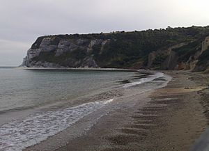
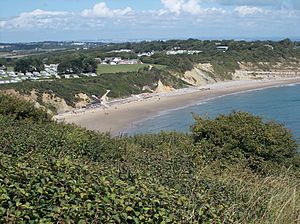
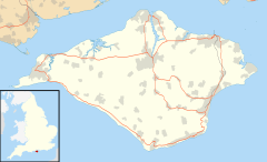
Whitecliff Bay is a beautiful sandy bay located near Foreland, which is the easternmost point of the Isle of Wight, England. It's about two miles southwest of Bembridge and just north of Culver Down. The bay has a shoreline that stretches for about three-quarters of a mile.
Its popular sandy shingle beach is over half a mile long. Whitecliff Bay is a fun place for tourists, with three holiday parks nearby. You'll find two cafes there, but not many other facilities. Getting to the bay can be a bit tricky, as you have to go down two steeply sloping concrete paths. This area is also very important for studying geology. It is part of the Whitecliff Bay And Bembridge Ledges SSSI, which means it's a special scientific site.
Discovering Whitecliff Bay's Geology

Whitecliff Bay has rocks that are almost exactly like those found at Alum Bay. Both bays show the same rock layers that run from east to west across the island. Here, you can see ancient layers of soft sand and clay from the Eocene period. These layers are full of fossils. Below them, you'll find older Cretaceous chalk rocks, which form the big cliff called Culver Down to the south.
Because of huge geological movements, the rock layers in the main part of the bay stand almost straight up. The younger rocks are found towards the north. In the bay, there are about 500 meters (1,640 feet) of clearly visible sands and clays. These rocks are from the late Paleocene to the late Eocene periods. This makes Whitecliff Bay a great place for fossil hunting, where you can find lots of prehistoric shells, sponges, and molluscs. The water in the bay is shallow for about 350 meters (1,150 feet) from the shore. It gets deeper about half a nautical mile (about 1 kilometer) out.
Whitecliff Bay's History
Whitecliff Bay was one of the places where the French invasion of the Isle of Wight (1545) landed. The French planned to attack Sandown from here. The bay gets its name from the chalky cliff on the headland, Culver Down. This cliff rises over 340 feet (104 meters) high at the southeastern end of the bay.
 | John T. Biggers |
 | Thomas Blackshear |
 | Mark Bradford |
 | Beverly Buchanan |


