
Winchester, Idaho facts for kids
Quick facts for kids
Winchester, Idaho
|
|
|---|---|

Business Highway 95 into downtown Winchester
|
|

Location of Winchester in Lewis County, Idaho.
|
|
| Country | United States |
| State | Idaho |
| County | Lewis |
| Area | |
| • Total | 0.18 sq mi (0.46 km2) |
| • Land | 0.18 sq mi (0.46 km2) |
| • Water | 0.00 sq mi (0.00 km2) |
| Elevation | 3,977 ft (1,212 m) |
| Population
(2020)
|
|
| • Total | 356 |
| • Density | 2,517.05/sq mi (970.19/km2) |
| Time zone | UTC-8 (Pacific (PST)) |
| • Summer (DST) | UTC-7 (PDT) |
| ZIP code |
83555
|
| Area code(s) | 208 |
| FIPS code | 16-87850 |
| GNIS feature ID | 2412279 |
Winchester is a small city in Lewis County, Idaho, in the United States. It is located on the Camas Prairie in the north central part of the state. In 2020, about 356 people lived there. Just south of the city, you can find Winchester Lake State Park.
Contents
History of Winchester
Early Days and Naming

Winchester is located inside the Nez Perce Indian Reservation. In November 1895, the U.S. government opened this land for people to settle. This happened after President Cleveland signed a special order.
The city got its name in 1900. People were meeting to create a school district. Someone saw a pile of Winchester rifles by the door and suggested the name. Everyone liked it, and so the city became Winchester.
Sawmill and Fire
For many years, a sawmill was a very important part of Winchester. It helped the town grow. However, the sawmill closed in May 1965. This was because most of the big trees in the area had already been cut down.
Before the mill closed, a big fire happened in November 1964. This fire destroyed a lot of the downtown area of Winchester.
Winchester Lake State Park
Winchester Lake State Park is a popular spot located about half a mile outside of town. It was planned in 1966 and officially opened in 1969. The lake was originally a mill pond. It was created in 1910 by building a dam on Lapwai Creek. In 2002, special equipment was added to the lake to help keep its water clean and healthy.
Geography and Location
Winchester covers a total area of about 0.18 square miles (0.46 square kilometers). All of this area is land. The city sits on the northern shore of Lapwai Lake. This is where Lapwai Creek flows out of the lake.
U.S. Route 95 is a main highway that passes about a mile northeast of Winchester. A smaller road connects the town directly to this highway. Winchester is part of the larger Camas Prairie region.
Climate in Winchester
Winchester has a climate with warm summers and cold, snowy winters. The average high temperature in July and August is in the upper 70s Fahrenheit (around 25-26 Celsius). In January, the average low temperature is in the low 20s Fahrenheit (around -5 Celsius). The city gets a good amount of rain and snow throughout the year.
Population Changes
Winchester's population has changed over the years. In 1920, there were 745 people living there. The population decreased over time, reaching 262 people in 1990. By 2020, the population had grown slightly to 356 people.
Who Lives in Winchester?
Based on the 2010 census, there were 340 people living in Winchester. Most of the people were White (92.1%). There were also some Native American (3.2%) and African American (1.2%) residents. About 2.1% of the population was Hispanic or Latino.
The average age of people in Winchester in 2010 was about 50 years old. About 17.4% of the residents were under 18 years old. Many people were between 45 and 64 years old (39.4%).
Getting Around Winchester
Highways and Roads
 - US 95 - This highway goes north to Lewiston and south to Grangeville.
Winchester is about 2 miles (3.2 kilometers) west of U.S. Route 95. This highway connects Winchester to nearby towns like Craigmont and Lewiston.
Before 1960, the main highway used to go right through Winchester. This old road had many sharp turns and steep hills. A new, straighter road was built in three years. This new road made the trip shorter by over 4 miles (6.4 kilometers) and saved about 25 minutes of driving time.
Old Railroad Tracks
You can still see the wooden bridges, called trestles, from the old Camas Prairie Railroad in the area. This railroad used to be an important way to transport goods.
Education in Winchester
Students in Winchester go to public schools in Craigmont. These schools are part of the Highland Joint School District #305. The main high school is Highland High School. Before 1962, Winchester had its own schools. The high school mascot was a logger, which is someone who cuts down trees.
Images for kids
-
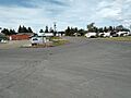
Business Highway 95 into downtown Winchester
-
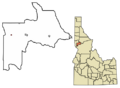
Location of Winchester in Lewis County, Idaho.
See also
 In Spanish: Winchester (Idaho) para niños
