Winding Gulf facts for kids
Quick facts for kids Winding Gulf |
|
|---|---|
|
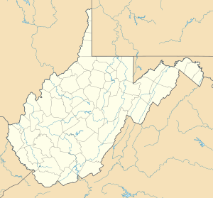
Location of the mouth of Winding Gulf in West Virginia
|
|
| Country | United States |
| State | West Virginia |
| County | Raleigh |
| Physical characteristics | |
| Main source | eastern Wyoming County 2,536 ft (773 m) 37°38′59″N 81°15′28″W / 37.649837°N 81.257879°W |
| River mouth | Guyandotte River Amigo 1,558 ft (475 m) 37°35′51″N 81°19′17″W / 37.5976146°N 81.3214908°W |
| Length | 15.5 mi (24.9 km) |
| Basin features | |
| Basin size | 21.63 sq mi (56.0 km2) |
Winding Gulf is a small river, about 15.5-mile (24.9 km) long, located in Raleigh County, West Virginia. It's like a smaller stream that flows into a bigger river. Winding Gulf joins the Guyandotte River, which then flows into the Ohio River, and finally into the mighty Mississippi River. This means Winding Gulf is part of a huge water system called a watershed, covering an area of 21.63 square miles (56.0 km2) in a countryside area on the Allegheny Plateau. A plateau is a large, flat area of land that is higher than the land around it.
Contents
Where Winding Gulf Flows
Winding Gulf starts in southern Raleigh County. It begins its journey about 2.3 miles (3.7 km) west-southwest of a place called Princewick. At first, it flows north, passing through the community that shares its name, Winding Gulf.
Journey Through Communities
After flowing north, the river turns west. It then follows the path of the Norfolk and Western Railroad. Along this part of its journey, Winding Gulf flows through several small towns. These include Big Stick and McAlpin.
At McAlpin, the river changes direction again, turning south. Here, it runs alongside County Route 30 and West Virginia Route 16. This section of the river passes through more communities like Stotesbury, Tams, Ury, and Helen.
Joining Other Rivers
A stream called Stonecoal Creek flows into Winding Gulf from the east. This happens in a place known as Stonecoal Junction. Soon after these two streams meet, Winding Gulf flows into the Guyandotte River. This meeting point is in the community of Amigo.
Land Around Winding Gulf
In 1992, experts from the United States Geological Survey studied the land around Winding Gulf. They found that most of the land, about 92.54%, was covered by forests. This means there were lots of trees and natural areas.
A smaller part of the land, about 3.99%, was used for farming. This is where people grew crops or raised animals. About 1.67% of the land was used for mining, likely for coal, which is common in West Virginia. The remaining 1.82% was used for other things.
 | Tommie Smith |
 | Simone Manuel |
 | Shani Davis |
 | Simone Biles |
 | Alice Coachman |


