Wonsevu, Kansas facts for kids
Quick facts for kids
Wonsevu, Kansas
|
|
|---|---|

|
|
| Country | United States |
| State | Kansas |
| County | Chase |
| Township | Cedar |
| Elevation | 1,352 ft (412 m) |
| Time zone | UTC-6 (CST) |
| • Summer (DST) | UTC-5 (CDT) |
| Area code | 620 |
| FIPS code | 20-80325 |
| GNIS ID | 477793 |
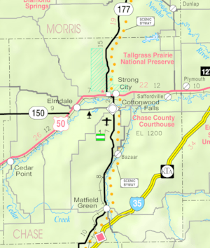
Wonsevu is a small, unincorporated community in southwest Chase County, Kansas, United States. An unincorporated community is a place that isn't officially a town or city. It is located where Cedar Creek Road and E Road meet. This spot is about 4.5 miles (7.2 km) north of the border between Chase and Butler counties. It's also about 3.75 miles (6.04 km) east of the border between Chase and Marion counties. Wonsevu is nestled in the beautiful Flint Hills area.
Contents
History of Wonsevu
Early Times in Kansas
For thousands of years, the Great Plains of North America were home to nomadic Native American tribes. They moved around to hunt and gather food.
From the 1500s to the 1700s, the Kingdom of France claimed a huge part of North America. This included the land where Kansas is today. In 1762, after a war, France secretly gave this land to Spain. This was part of a deal called the Treaty of Fontainebleau.
The 1800s and Wonsevu's Beginnings
In 1802, Spain gave most of this land back to France. Then, in 1803, the United States bought a massive amount of land from France. This was called the Louisiana Purchase. It included most of what is now Kansas. The U.S. paid about 2.83 cents per acre for this huge area.
In 1854, the Kansas Territory was officially set up. Then, in 1861, Kansas became the 34th U.S. state. Chase County, where Wonsevu is located, was established in 1859.
Wonsevu had its own post office for many years. It opened on August 23, 1875, and closed on October 15, 1907.
Wonsevu Today
Today, Wonsevu is almost a ghost town. A ghost town is a place where most people have left. You can still see a vacant church, an old school building, and two empty houses. There are also several ruins of old buildings left.
Geography and Climate
Wonsevu is located at 38°9′3″N 96°46′20″W / 38.15083°N 96.77222°W. This area is part of the scenic Flint Hills in the Great Plains. The Flint Hills are known for their rolling hills and tallgrass prairies.
Local Climate
The weather in Wonsevu has hot and humid summers. The winters are usually mild to cool. This type of weather is called a humid subtropical climate. On climate maps, you might see it labeled as "Cfa."
Education
Students from Wonsevu attend schools in the Peabody–Burns USD 398 public school district. All students go to schools in Peabody.
The two schools are:
- Peabody-Burns Junior/Senior High School, for older students.
- Peabody-Burns Elementary School, for younger students.
Media and Utilities
Local News
People in Wonsevu can read several newspapers to stay informed:
- Peabody Gazette-Bulletin: This is a local newspaper for nearby towns like Burns, Florence, and Peabody.
- The El Dorado Times: A regional newspaper from El Dorado.
- The Newton Kansan: Another regional newspaper from Newton.
Internet and TV
For internet access, residents can use satellite internet services. These include HughesNet, StarBand, and WildBlue.
For television, satellite TV is available from providers like DirecTV and Dish Network. People can also watch free over-the-air ATSC digital TV channels.
 | Ernest Everett Just |
 | Mary Jackson |
 | Emmett Chappelle |
 | Marie Maynard Daly |


