Yellow Creek (Illinois) facts for kids
Quick facts for kids Yellow Creek |
|
|---|---|
| Physical characteristics | |
| Main source | Stephenson County northwest of Lena, Illinois 977 ft (298 m) 42°25′10″N 89°53′52″W / 42.4194444°N 89.8977778°W |
| River mouth | Confluence with the Pecatonica east of Freeport, Illinois 748 ft (228 m) 42°17′23″N 89°34′10″W / 42.2897222°N 89.5694444°W |
| Length | 50 mi (80 km) |
| Basin features | |
| Progression | Yellow Creek → Pecatonica → Rock → Mississippi → Gulf of Mexico |
| GNIS ID | 421568 |
Yellow Creek is a stream in Illinois, USA. It flows into the Pecatonica River. This creek is about 50 miles (80.5 km) long. Most of Yellow Creek is in Stephenson County. A small part of it also goes through Jo Daviess County.
In 1996, experts checked the water quality of Yellow Creek. They found that 22 miles (35.4 km) of the creek had "good" water. The other 28 miles (45.1 km) were rated as "fair." An important event, the Battle of Waddams Grove, happened along Yellow Creek during the 1832 Black Hawk War.
Where Does Yellow Creek Flow?
Yellow Creek is a 50-mile (80.5 km) long stream. It is a major part of the Pecatonica River watershed. A watershed is an area of land where all the water drains into a single river or lake.
Most of Yellow Creek flows through Stephenson County. However, a small section of the stream also enters Jo Daviess County. This county is in the far northwest part of Illinois. The creek starts at a point in Stephenson County and ends where it joins the Pecatonica River.
What Is the History of Yellow Creek?

Yellow Creek played a role in the 1832 Black Hawk War. This war was a conflict between the Sauk leader Black Hawk and settlers in Illinois and the Michigan Territory.
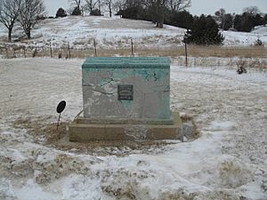
After some attacks by Native Americans in the area, a man named James W. Stephenson gathered a group of volunteers. They went looking for the attackers. On June 18, 1832, Stephenson's group found them. This meeting happened in an open area near Yellow Creek. It was about 12 miles (19.3 km) east of Kellogg's Grove. This event became known as the Battle of Waddams Grove.
The exact place where the battle happened is believed to be along Yellow Creek. It is northwest of the land that William Waddams first claimed. This area is north of the small town of Waddams Grove today.
How Clean Is Yellow Creek's Water?
In 1996, the Illinois Environmental Protection Agency checked the water quality of Yellow Creek. They found that 22 miles (35.4 km) of the stream had "good" water quality. Another 28 miles (45.1 km) were rated as "fair."
The main problems affecting Yellow Creek's water quality come from nutrient runoff. This runoff happens when extra nutrients from farms, like fertilizers, wash into the water.
In Freeport, Illinois, a group called the Yellow Creek Watershed Partnership was formed. Their goal is to make Yellow Creek and its watershed healthier and more diverse. They work to improve the environment around the creek.
 | Mary Eliza Mahoney |
 | Susie King Taylor |
 | Ida Gray |
 | Eliza Ann Grier |

