York, Ontario facts for kids
Quick facts for kids
York
|
|
|---|---|
|
Dissolved city (lower-tier)
|
|
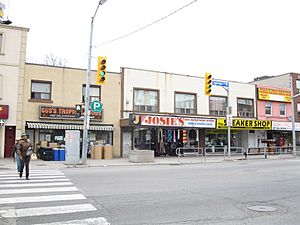
View of north side of Eglinton Avenue West at Oakwood Avenue in 2013; some of the storefronts were replaced with the main entrance to Oakwood station of Line 5 Eglinton
|
|
| Motto(s):
E singulis communitas (Latin for "From individuals, a community")
|
|
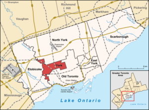
Location of York (red), as compared with the rest of Toronto.
|
|
| Country | Canada |
| Province | Ontario |
| Municipality | Toronto |
| Incorporated | 1850 (township) |
| Changed Region | 1954 Metropolitan Toronto from York County |
| Changed status | 1 January 1967 (borough) |
| Changed status | June 1983 (city) |
| Amalgamated | 1 January 1998 into Toronto |
| Area | |
| • Total | 23.49 km2 (9.07 sq mi) |
| Population
(2021)
|
|
| • Total | 146,828 |
| • Density | 6,250.7/km2 (16,189/sq mi) |
| Time zone | UTC−5 (EST) |
| • Summer (DST) | UTC−4 (EDT) |
| Area code(s) | 416, 647, 437, 942 |
York is a district and former city located in Toronto, Ontario, Canada. It is found northwest of Old Toronto, southwest of North York, and east of the Humber River.
York started as York Township in 1793. Over time, parts of it became separate areas like East York and North York. In 1953, it joined the Metropolitan Toronto group of cities. York grew by adding nearby towns like Lambton Mills and Weston. It eventually became known as the City of York. In 1998, York and other cities in Metro Toronto joined together to form the larger City of Toronto we know today.
Today, York is a vibrant part of Toronto's diverse culture. It is home to many different communities, including Portuguese, Jamaican, and Latin American neighborhoods.
Contents
History of York
Early Settlements and Beginnings
The oldest known settlement in the area was Teiaiagon. This village was built by the Iroquois people on the east bank of the Humber River. Today, this spot is known as Baby Point.
York Township was officially created in 1793. Its first borders were the Humber River to the west and what is now Victoria Park Avenue to the east. To the north was Steeles Avenue. In 1850, it became an official township in York County. This was when the area was part of Canada West, which later became Ontario in 1867.
Black Communities in York
York Township was home to one of the first Black communities in the Toronto area. Many African American fugitive slaves settled here. By 1861, York had the second-largest Black population in the Toronto area. Most lived in York Township West. This history continues today; in 2016, 17 percent of York's population was Black. This is the largest percentage among Toronto's six former municipalities.
Growth and Changes in Boundaries
From 1850 onwards, small villages like Parkdale (1879) and Brockton (1881) grew within York. These villages were later added to Toronto. Other parts of York, such as "The Annex" and Riverdale, were also directly joined with Toronto.
This trend of Toronto absorbing parts of York eventually stopped. Toronto no longer wanted to pay for the services needed in new suburbs. Neighborhoods like Humewood–Cedarvale and Oakwood Village were developed in the 1910s.
In the 1920s, the southern part of York became more like a city, while the northern part remained rural. The people in the northern, rural area voted to separate. This led to the creation of the new Township of North York in 1922. In 1924, the eastern part of York also became a separate township called East York.
Joining Metropolitan Toronto
York Township had its own public transportation services, but they were run by the Toronto Transportation Commission (now Toronto Transit Commission). In 1954, York and other nearby municipalities joined to form Metropolitan Toronto. This was a new level of government.
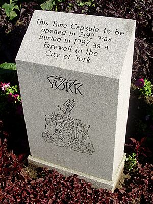
In 1967, York absorbed the town of Weston and became the Borough of York. Later, in June 1983, it became the City of York. On January 1, 1998, the City of York was dissolved. Its responsibilities were combined with the new, larger City of Toronto. The building where York's council used to meet, the York Civic Centre, is now used for courts and other city services.
Neighbourhoods in York
York has many unique neighborhoods. One example is Weston, which still has its own main street, Weston Road.
Fairbank and Silverthorn
North and west of Oakwood Village is the Fairbank community. Silverthorn is just west of Fairbank. These areas are known for their "steep streets, staircases, and unusual views of houses." This is because the land here is very hilly, similar to parts of San Francisco.
Mount Dennis and Baby Point
The Mount Dennis area was once home to Kodak's Canadian operations from 1912 to 2006. Most of the old buildings are gone, but the main office building is now part of the Line 5 Eglinton's Eglinton Maintenance and Storage Facility.
Baby Point, located between Jane Street and the Humber River, was the site of the ancient Iroquoian village of Teiaiagon. It was once part of the Lambton Mills village within York Township.
Education in York
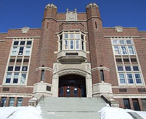
Before York became part of Toronto, the York Board of Education (YBE) managed public English schools. Since 1998, four different school boards now serve the area:
- Conseil scolaire catholique MonAvenir (CSCM)
- Conseil scolaire Viamonde (CSV)
- Toronto Catholic District School Board (TCDSB)
- Toronto District School Board (TDSB)
The TDSB runs several schools for both elementary and secondary education. Some of the secondary schools in York operated by the TDSB include:
- Forest Hill Collegiate Institute
- Frank Oke Secondary School
- George Harvey Collegiate Institute (now merged with York Memorial Collegiate Institute)
- Oakwood Collegiate Institute
- Runnymede Collegiate Institute
- Weston Collegiate Institute
- York Memorial Collegiate Institute
Vaughan Road Academy was York's first secondary school, opened in 1927. It closed in 2017 because fewer students were attending. The building is now used as a temporary elementary school.
The TCDSB operates one secondary school in York, St. Oscar Romero Catholic Secondary School.
St. Michael's College School, a private Roman Catholic school for young men, is also located in the area.
Public Library System
Before 1998, York had its own library system called the York Public Library. When York joined Toronto, its library system merged with others to form the new Toronto Public Library (TPL). The TPL now runs several library branches in the district.
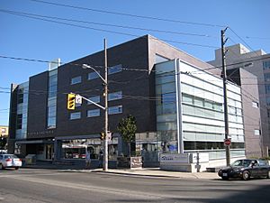
York's first public library was the Mount Dennis branch, which opened in 1923. In 1945, the York Public Library Board was created. They built three new library buildings that opened in 1951. One of these, the Main Library, was later renamed the Maria Shchuka branch and was rebuilt in 2003. The Oakwood Village branch was York's newest library, opening in 1996.
Public Transit
York used to have its own bus and streetcar services. These were later taken over by the Toronto Transit Commission (TTC). Today, the area is served by TTC buses, streetcars, and the subway system. Only the Heath Street exit of St. Clair West station on Line 1 Yonge–University is within the former city of York.
Line 5 Eglinton
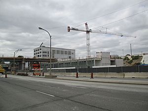
The TTC once planned to build the Eglinton West subway line. Construction began in 1994 but was stopped in 1995. There was no serious talk about it again until 2007. That's when Line 5 Eglinton (also known as the Eglinton Crosstown LRT) was proposed.
Construction for the new LRT began in 2013. The first part of the line is opening in the second half of 2025.
GO Transit
The Weston GO Station is the only GO Transit and Union Pearson Express (UP Express) train station in the district. There are also plans for new stations. The Caledonia GO Station will connect with Line 5's Caledonia station. The Mount Dennis GO Station will connect with Line 5's Mount Dennis station.
Politics and Government
York was first organized as a township in 1793 and became officially incorporated in 1850. It was part of York County until 1954. In 1954, York joined other municipalities south of Steeles Avenue to form Metropolitan Toronto. In 1967, York became a borough of Metropolitan Toronto, and then a city in 1983.
In 1997, York and the other cities in Metropolitan Toronto joined together to form the new City of Toronto. Today, people living in York vote for the Mayor of Toronto and for councillors on the Toronto City Council. They also vote for school trustees. At the national and provincial levels, residents vote for members of the Parliament of Canada and the Legislative Assembly of Ontario.
Leaders of York
Before York joined Toronto, it had its own municipal council. The head of the council was called a reeve, and later a mayor.
- First Reeve: Franklin Jackes (1850–1851)
- Last Reeve: John Lister (Jack) Mould (1963–1966) – He also became York's first mayor.
The following individuals served as York's mayor:
- John Lister (Jack) Mould (1966–1969)
- Philip White (1970–1978)
- Gayle Christie (1978–1982)
- Alan Tonks (1982–1988) – He later became the Chairman of Metropolitan Toronto.
- Fergus Brown (1988–1994)
- Frances Nunziata (1994–1997) – She was York's last mayor.
See also
 In Spanish: York (Ontario) para niños
- List of neighbourhoods in York
- History of neighbourhoods in Toronto
 | William M. Jackson |
 | Juan E. Gilbert |
 | Neil deGrasse Tyson |


