
Yowie Bay, New South Wales facts for kids
Quick facts for kids Yowie BaySydney, New South Wales |
|||||||||||||||
|---|---|---|---|---|---|---|---|---|---|---|---|---|---|---|---|

Yowie Bay marina
|
|||||||||||||||

Yowie Bay
Location in Sydney
|
|||||||||||||||
| Established | 1889 | ||||||||||||||
| Postcode(s) | 2228 | ||||||||||||||
| Elevation | 28 m (92 ft) | ||||||||||||||
| Location | 24 km (15 mi) south of Sydney CBD | ||||||||||||||
| LGA(s) | Sutherland Shire | ||||||||||||||
| State electorate(s) |
|
||||||||||||||
| Federal Division(s) | Cook | ||||||||||||||
|
|||||||||||||||
Yowie Bay is a lovely suburb located in southern Sydney, in the state of New South Wales, Australia. It is about 24 kilometres south of the main city area, known as the Sydney central business district. Yowie Bay is part of the Sutherland Shire, which is a local government area.
The suburb gets its name from a small bay. This bay is on the northern side of the Port Hacking estuary. An estuary is where a river meets the sea, mixing fresh and salt water. Yowie Bay shares its postcode (2228) with the suburb of Miranda to its north. To the east, across the water, is Caringbah South. To the west, across another bay, is Gymea Bay.
A Look Back: Yowie Bay's History
The name Ewey Bay first appeared on a map in 1827. This map was made by a surveyor named Robert Dixon. Dixon often used Aboriginal names for places around Port Hacking. So, it's thought that Ewey was an Aboriginal name too.
Land in the area was opened up in 1889. It was called the Village of Weerona. Around the same time, the spelling Yowie started to appear.
In 1890, a man named Richard Hill wrote a letter to a newspaper. He said that Yowie meant "Cooee." He explained that Aboriginal people would "cooee" (a loud call) from Yowie Point to their friends on the north side. Then, their friends would come over in canoes. The word "yowi" also meant "echo of a cooee" in a list of Aboriginal words from 1899. This list was collected in a police district that included the Sutherland Shire. It seems there is no link to the mythical Australian creature called a Yowie.
It's not fully clear why both Ewey and Yowie were used. One idea is that Ewey might have been linked to "ewes" (female sheep). Sheep were raised in the area in the 1860s. Some workers might have pronounced "ewe" as "yow," leading to the name Yowie.
Local newspapers reported that the Sutherland Shire Council tried to make Ewey Bay the official name. However, the Geographical Names Board officially named the suburb Yowie Bay in 1973.
What's in Yowie Bay?
Yowie Bay is mainly a place where people live. There are only a few shops and businesses. You can find a marina at the end of Wonga Road. A marina is a place where boats are kept. There's also a liquor shop nearby.
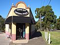
The Port Hacking Open Sailing Club is located right on Yowie Bay. If you like coffee, The Yawn Coffee Project is on the corner of Forest Road and Attunga Road. It used to be a corner shop. The Yowie Bay Friendly Grocer, which was once the Yowie Bay General Store, is on Forest Road. There's also one small school here, Yowie Bay Public School.
Images for kids
-
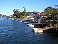
Yowie Bay homes and jetties
-
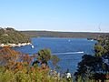
Yowie Bay view towards Port Hacking
-
Yowie Bay marina
-
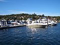
Yowie Bay marina
-
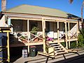
Yowie Bay general store


