
Port Hacking facts for kids
Quick facts for kids Port Hacking Estuary |
|
|---|---|

Looking inland over Port Hacking estuary towards the west from the Tasman Sea.
|
|

Port Hacking Estuary
Location in New South Wales
|
|

Port Hacking, the southernmost inlet shown on a 2005 NASA image of the urban sprawl of Greater Sydney
|
|
| Location | Southern Sydney, New South Wales |
| Coordinates | 34°03′55″S 151°08′05″E / 34.06528°S 151.13472°E |
| Type | An open youthful tide dominated, drowned valley estuary |
| Native name | Deeban Error {{native name checker}}: parameter value is malformed (help) |
| Etymology | in honour of Henry Hacking, a pilot at Port Jackson |
| Primary inflows | Hacking River |
| Primary outflows | Tasman Sea |
| Catchment area | 165.3 km2 (63.8 sq mi) |
| Basin countries | Australia |
| Managing agency | Sutherland Shire Council, |
| Surface area | 11.7 km2 (4.5 sq mi) |
| Average depth | 9.1 m (30 ft) |
| Water volume | 105,261.5 km3 (8.53369×10¹⁰ acre⋅ft) |
| Frozen | never |
| Settlements | Bundeena, Cronulla, Woolooware, Burraneer, Caringbah South, Dolans Bay, Port Hacking, Lilli Pilli, Yowie Bay, Miranda, Gymea Bay, Grays Point |
Port Hacking Estuary, known as Deeban in the Tharawal language of the Aboriginal people, is a special waterway. It is a type of estuary where the sea fills a river valley. This beautiful area is found in southern Sydney, New South Wales, Australia. It is about 30 kilometres south of the main city centre.
Port Hacking starts from the Hacking River near Helensburgh. It also gets water from smaller creeks like South West Arm. The water flows east until it reaches the Tasman Sea. This happens between Cronulla and Bundeena. The tide's effect stops at a weir in the Royal National Park. The estuary has large sandbanks formed by the sea. There is also a river delta from the Hacking River at Grays Point. A deep area separates these two deltas.
The total land area that drains into Port Hacking is about 165 square kilometres. The Sutherland Shire Council helps manage the land around the estuary. The northern side of Port Hacking has many towns and suburbs. However, the southern side is mostly natural land. This area forms the northern edge of the Royal National Park.
For thousands of years, Aboriginal people lived near Port Hacking. These were the Tharawal and Eora peoples. They used the bay to find food and for trading.
Contents
Port Hacking Estuary: A Special Waterway
A Look at Its History
Aboriginal History
For over 8,000 years, the Tharawal people lived in the Port Hacking area. We know this from many Aboriginal items found there. These include tools, middens (piles of shells from old meals), rock carvings, and cave paintings. In the mid-1800s, people needed a lot of shell grit. This grit was used to make lime for building in Sydney. So, many shells and oyster rocks were taken from Port Hacking. Sadly, this destroyed many Aboriginal midden sites.
European History
In April 1796, Matthew Flinders and George Bass explored this area. They named it Port Hacking after Henry Hacking. He was a pilot at Port Jackson and a skilled hunter. Henry Hacking was the first to tell them about a large river he had seen inland.
Europeans have made big changes to the area. The river was blocked by a weir at Audley. A fish hatchery at The Basin changed the sandbanks near the sea. Taking shell grit removed large areas of seagrass. Also, the entire northern shore is now covered with towns. Port Hacking has been closed to commercial fishing for about 100 years. Some areas also have other fishing rules. The northern tip of Port Hacking, at Cronulla, is called Bass and Flinders Point.
Exploring Port Hacking Today
Port Hacking marks the southern edge of Sydney's urban area. As you move inland from the sea, the northern side of Port Hacking has many suburbs. These include Cronulla, Woolooware, Burraneer, Caringbah South, Dolans Bay, Port Hacking, Lilli Pilli, Yowie Bay, Miranda, Gymea Bay, and Grays Point.
The southern side of the estuary is mostly natural. It is part of the Royal National Park. However, there are small towns like Bundeena and Maianbar there. Other places on the southern bank are Warumbul and Gundamaian. These are also inside the Royal National Park.
The Cronulla and National Park Ferry Cruises runs a regular ferry service. It crosses Port Hacking, connecting Cronulla to Bundeena. They also offer boat tours along Port Hacking.
Port Hacking is a "drowned river valley." This means the sea filled an old river valley. Its water surface covers about 11 square kilometres. Very little industry or farming affects the Hacking River. Because of this, the water quality is "extremely good." The wide mudflats and sandbanks at low tide are perfect for wading birds.
Port Hacking is a popular spot for fun activities. Many people enjoy swimming, fishing, and boating here. The estuary and its bays are used for watersports. These include wakeboarding, water skiing, and Scuba diving. A unique rock formation called Shiprock is found here. It is above the only aquatic reserve in Port Hacking. This area is protected because it has special marine animals and plants.
Gallery
-
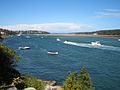
Port Hacking estuary near Burraneer
-
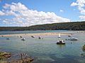
Port Hacking estuary at Lilli Pilli
-
Port Hacking estuary at Lilli Pilli
-
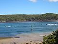
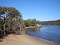
Port Hacking estuary near Warumbul
-
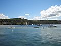
Port Hacking estuary at Grays Point


