
Abbeville, Alabama facts for kids
Quick facts for kids
Abbeville, Alabama
|
|||
|---|---|---|---|

Henry County Courthouse is located in Abbeville (2012)
|
|||
|
|||

Location of Abbeville in Henry County, Alabama.
|
|||
| Country | United States | ||
| State | Alabama | ||
| County | Henry | ||
| Area | |||
| • Total | 15.58 sq mi (40.36 km2) | ||
| • Land | 15.54 sq mi (40.26 km2) | ||
| • Water | 0.04 sq mi (0.11 km2) 0.32% | ||
| Elevation | 449 ft (137 m) | ||
| Population
(2020)
|
|||
| • Total | 2,358 | ||
| • Density | 151.71/sq mi (58.58/km2) | ||
| Time zone | UTC-6 (CST) | ||
| • Summer (DST) | UTC-5 (CDT) | ||
| ZIP code |
36310
|
||
| Area code(s) | 334 | ||
| FIPS code | 01-00124 | ||
| GNIS feature ID | 112880 | ||


Abbeville is a city in Henry County, located in the southeastern part of Alabama, United States. It is the main city, or county seat, of Henry County. Abbeville is also part of the larger Dothan Metropolitan Statistical Area. In 2020, about 2,358 people lived there.
Contents
History of Abbeville
Abbeville is the oldest settlement in eastern Alabama that was started by colonists. It is even older than Henry County and the state of Alabama itself. The city got its name from "Abbe," a local Muscogee man. The name means "a grove of dogwood trees."
In early 1819, there was an active trading post in Abbeville. This was when Alabama was still a territory. The first settlers coming into the wiregrass area passed through a place called Franklin, which was west of Abbeville.
Abbeville became the county seat of Henry County in 1833. Before that, Columbia held this title. Abbeville officially became a city in 1853. By 1950, the city's population had grown to 2,162 people.
Geography and Climate
Abbeville is located in southeastern Alabama. It is near U.S. Route 431, Alabama State Route 10, and Alabama State Route 27. The city is about 25 miles (40 km) northeast of Dothan. It is also about 23 miles (37 km) south-southwest of Eufaula.
The United States Census Bureau says that Abbeville covers an area of about 15.6 square miles (40.4 km²). Most of this area is land, with only a small part (0.32%) being water.
Climate in Abbeville
Abbeville has a climate with hot, humid summers. The winters are generally mild to cool. This type of weather is called a humid subtropical climate. On climate maps, it is often shown as "Cfa."
Population Information
| Historical population | |||
|---|---|---|---|
| Census | Pop. | %± | |
| 1850 | 300 | — | |
| 1890 | 465 | — | |
| 1900 | 889 | 91.2% | |
| 1910 | 1,141 | 28.3% | |
| 1920 | 1,267 | 11.0% | |
| 1930 | 2,047 | 61.6% | |
| 1940 | 2,080 | 1.6% | |
| 1950 | 2,162 | 3.9% | |
| 1960 | 2,524 | 16.7% | |
| 1970 | 2,996 | 18.7% | |
| 1980 | 3,155 | 5.3% | |
| 1990 | 3,173 | 0.6% | |
| 2000 | 2,987 | −5.9% | |
| 2010 | 2,688 | −10.0% | |
| 2020 | 2,358 | −12.3% | |
| U.S. Decennial Census | |||
Abbeville first appeared in the U.S. Census in 1850. It has been included in every census since 1890.
2020 Census Details
In 2020, Abbeville had 2,358 people. There were 1,029 households and 604 families living in the city.
Here's a look at the different groups of people living in Abbeville in 2020:
| Race | Number of People | Percentage |
|---|---|---|
| White (not Hispanic) | 1,157 | 49.07% |
| Black or African American (not Hispanic) | 1,034 | 43.85% |
| Native American | 5 | 0.21% |
| Asian | 15 | 0.64% |
| Other/Mixed | 80 | 3.39% |
| Hispanic or Latino | 67 | 2.84% |
2010 Census Details
In 2010, there were 2,688 people living in Abbeville. The city had 1,077 households and 699 families. The population density was about 192 people per square mile.
The racial makeup of the city in 2010 was:
- 54.4% White
- 41.4% Black or African American
- 1.0% Asian
- 2.0% from other races
- 1.2% from two or more races
- 3.1% of the population was Hispanic or Latino.
Education
Abbeville is part of the Henry County Public Schools system. The city has two main schools:
- Abbeville High School
- Abbeville Elementary School
There is also a private high school called Abbeville Christian Academy.
Transportation
You can get to Abbeville by bus. Greyhound Lines provides intercity bus service to the city.
Media
Abbeville has its own local media:
- Radio: The city is served by one radio station, WESZ-LP.
- Newspaper: The local newspaper is the Abbeville Herald. It is published weekly and has been around since 1915.
Notable People
Many interesting people have come from Abbeville, including:
- Leroy Cook, a former defensive end for the Dallas Cowboys football team.
- Sharlene Newman, a Cognitive Neuroscientist and AAAS Fellow.
- William Oates, a veteran of the Civil War and the Spanish–American War.
- Chris Porter, a former Auburn University basketball player who also played professionally.
- Jimmy Rane, who founded and leads Great Southern Wood Preserving.
- Al Richardson, a former American football linebacker for the Atlanta Falcons.
- Edward Vaughn, a Black Power activist, bookstore owner, and member of the Michigan House of Representatives.
Gallery
-
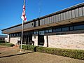
Abbeville City Hall and Police Department
-
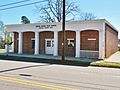
Abbeville Post Office (ZIP code: 36310)
-
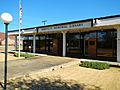
Abbeville Memorial Library
-
Atlantic Coast Line Railroad Depot in Abbeville
-
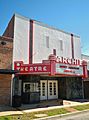
Archie Theatre was first opened in 1948
-
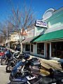
Historic Downtown Abbeville (2012)
-
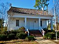
The Bethune-Kennedy House is a very old home, built around 1840. It is the oldest building still standing in Abbeville. It was added to the National Register of Historic Places in 1978.


See also
 In Spanish: Abbeville (Alabama) para niños
