
National Register of Historic Places listings in Alabama facts for kids
The National Register of Historic Places is a special list of places in the United States that are important to history. These places can be buildings, sites, districts (areas with many historic buildings), or even objects. They are recognized for their historical, architectural, archaeological, engineering, or cultural importance.
In Alabama, there are many amazing places on this list! This article will tell you about some of them, organized by county.

| Autauga - Baldwin - Barbour - Bibb - Blount - Bullock - Butler - Calhoun - Chambers - Cherokee - Chilton - Choctaw - Clarke - Clay - Cleburne - Coffee - Colbert - Conecuh - Coosa - Covington - Crenshaw - Cullman - Dale - Dallas - DeKalb - Elmore - Escambia - Etowah - Fayette - Franklin - Geneva - Greene - Hale - Henry - Houston - Jackson - Jefferson (Birmingham) - Lamar - Lauderdale - Lawrence - Lee - Limestone - Lowndes - Macon - Madison - Marengo - Marion - Marshall - Mobile (Mobile) - Monroe - Montgomery - Morgan - Perry - Pickens - Pike - Randolph - Russell - St. Clair - Shelby - Sumter - Talladega - Tallapoosa - Tuscaloosa - Walker - Washington - Wilcox - Winston |
Contents
- How Many Historic Places Are There?
- Autauga County
- Baldwin County
- Barbour County
- Bibb County
- Blount County
- Bullock County
- Butler County
- Calhoun County
- Chambers County
- Cherokee County
- Chilton County
- Choctaw County
- Clarke County
- Clay County
- Cleburne County
- Coffee County
- Colbert County
- Conecuh County
- Coosa County
- Covington County
- Crenshaw County
- Cullman County
- Dale County
- Dallas County
- DeKalb County
- Elmore County
- Escambia County
- Etowah County
- Fayette County
- Franklin County
- Geneva County
- Greene County
- Hale County
- Henry County
- Houston County
- Jackson County
- Jefferson County
- Lamar County
- Lauderdale County
- Lawrence County
- Lee County
- Limestone County
- Lowndes County
- Macon County
- Madison County
- Marengo County
- Marion County
- Marshall County
- Mobile County
- Monroe County
- Montgomery County
- Morgan County
- Perry County
- Pickens County
- Pike County
- Randolph County
- Russell County
- St. Clair County
- Shelby County
- Sumter County
- Talladega County
- Tallapoosa County
- Tuscaloosa County
- Walker County
- Washington County
- Wilcox County
- Winston County
How Many Historic Places Are There?
There are about 1,200 historic properties and districts listed in Alabama. The National Register doesn't directly report these numbers for each county. Below is a count of the current listings based on detailed lists of properties and districts.

Stewartfield in Mobile

William J. Samford Hall in the Auburn University Historic District

Ashland Place Historic District in Mobile

Jemison-Van de Graaff Mansion in Tuscaloosa


Fort Morgan, on the shore of Mobile Bay in Baldwin County. This fort was attacked by the Union Navy in 1864 during the Battle of Mobile Bay of the American Civil War.
|
|

Dexter Avenue Baptist Church, the first church of Rev. Dr. Martin Luther King Jr. when he started his work as a national civil rights activist in 1955.


|
|||||||||||||||||||||||||||||||||||||||||||||||||||||||||||||||||||||||||||||||||||||||||||||||||||||||||||||||||||||||||||||||||||||||||||||||||||||||||||||||||||||||||||||||||||||||||||||||||||||||||||||||||||||||||||||||||


Autauga County
| Name on the Register | Image | Date listed | Location | City or town | Description | |
|---|---|---|---|---|---|---|
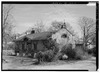
| 1 | Bell House |
 |
(#99000150) |
550 Upper Kingston Rd. 32°28′17″N 86°28′40″W / 32.471389°N 86.477778°W |
Prattville | A beautiful Queen Anne style house built in 1893. |
| 2 | Daniel Pratt Historic District |
 |
(#84000596) |
Roughly bounded by Northington Rd. and 1st, 6th, Bridge, and Court Sts. 32°27′41″N 86°28′20″W / 32.461389°N 86.472222°W |
Prattville | This historic area in Prattville is named after Daniel Pratt, who founded the city. |
| 3 | Lassiter House |
 |
(#97000651) |
County Road 15, 0.5 miles north of its junction with State Route 14 32°28′20″N 86°48′18″W / 32.472222°N 86.805°W |
Autaugaville | An I-house (a type of American folk house) built in 1825. |
| 4 | Montgomery-Janes-Whittaker House |
 |
(#74000396) |
South of Prattville off State Route 14 32°25′28″N 86°27′07″W / 32.424444°N 86.451944°W |
Prattville | A historic home located south of Prattville. |
| 5 | Mount Sinai School |
 |
(#01001296) |
1820 County Road 57 32°33′01″N 86°32′43″W / 32.550278°N 86.545278°W |
Prattville | A historic school building in Autauga County. |
Baldwin County
This county has many historic places listed on the National Register. You can find a full list here: National Register of Historic Places listings in Baldwin County, Alabama.
Barbour County
This county has many historic places listed on the National Register. You can find a full list here: National Register of Historic Places listings in Barbour County, Alabama.
Bibb County
| Name on the Register | Image | Date listed | Location | City or town | Description | |
|---|---|---|---|---|---|---|
| 1 | Blocton Italian Catholic Cemetery |
 |
(#99000464) |
Primitive Ridge Rd. 33°06′46″N 87°06′49″W / 33.112778°N 87.113611°W |
West Blocton | A historic cemetery in West Blocton. |
| 2 | Brierfield Furnace |
 |
(#74000401) |
West of Brierfield 33°02′41″N 86°55′45″W / 33.044722°N 86.929167°W |
Brierfield | The remains of an old iron furnace, important for its role in industry. |
| 3 | Centreville Historic District |
 |
(#78000482) |
Walnut St., East and West Court Sq. 32°56′41″N 87°08′13″W / 32.944722°N 87.136944°W |
Centreville | A historic area in Centreville, including the courthouse square. |
| 4 | Davidson-Smitherman House |
 |
(#87001552) |
167 3rd Ave. 32°56′34″N 87°08′01″W / 32.942778°N 87.133611°W |
Centreville | A historic house in Centreville. |
| 5 | Sarah Amanda Trott McKinney House |
(#92000626) |
State Route 25 between Montevallo and Centreville 33°00′25″N 87°00′18″W / 33.006944°N 87.005°W |
Sixmile | A historic house located near Sixmile. | |
| 6 | Montebrier |
 |
(#73000331) |
North of Brierfield on Mahan Creek 33°02′32″N 86°54′11″W / 33.042222°N 86.903056°W |
Brierfield | A historic property north of Brierfield. |
Blount County
| Name on the Register | Image | Date listed | Location | City or town | Description | |
|---|---|---|---|---|---|---|
| 1 | Easley Covered Bridge |
 |
(#81000125) |
Spans Dub Branch 33°58′15″N 86°31′06″W / 33.970833°N 86.518333°W |
Oneonta | A historic covered bridge over Dub Branch. |
| 2 | Robert G. Griffith Sr. House |
 |
(#00000143) |
1204 County Road 25 34°12′38″N 86°28′38″W / 34.210556°N 86.477222°W |
Summit | A historic house in Summit. |
| 3 | Horton Mill Covered Bridge |
 |
(#70000099) |
5 miles (8 km) north of Oneonta on Route 3 34°00′58″N 86°26′55″W / 34.016111°N 86.448611°W |
Oneonta | Another historic covered bridge near Oneonta. |
| 4 | Nectar Covered Bridge |
 |
(#81000124) |
8 miles southwest of Nectar 33°57′22″N 86°37′34″W / 33.956111°N 86.626111°W |
Nectar | This bridge sadly burned down on June 13, 1993. |
| 5 | Swann Covered Bridge |
 |
(#81000123) |
West of Cleveland 33°59′50″N 86°36′06″W / 33.997222°N 86.601667°W |
Cleveland | A covered bridge located west of Cleveland. |
Bullock County
| Name on the Register | Image | Date listed | Location | City or town | Description | |
|---|---|---|---|---|---|---|
| 1 | Bullock County Courthouse Historic District |
 |
(#76000312) |
N. Prairie St. 32°08′43″N 85°42′59″W / 32.145278°N 85.716389°W |
Union Springs | A historic area around the Bullock County Courthouse. |
| 2 | Foster House |
.jpg) |
(#98001021) |
201 Kennon St. 32°08′41″N 85°43′17″W / 32.144722°N 85.721389°W |
Union Springs | A historic house in Union Springs. |
| 3 | Merritt School |
 |
(#98000110) |
Old Troy Rd., 0.5 miles south of U.S. Route 82 32°04′29″N 85°32′03″W / 32.074722°N 85.534167°W |
Midway | The Old Merritt School is a Rosenwald School that was built in 1922. These schools were built for African American children in the South. |
| 4 | Sardis Baptist Church |
 |
(#01001299) |
State Route 223S at its junction with County Road 22 32°05′18″N 85°45′44″W / 32.088333°N 85.762222°W |
Union Springs | The Sardis Baptist Church was founded in 1837. The current building was built in 1850. |
Butler County
This county has many historic places listed on the National Register. You can find a full list here: National Register of Historic Places listings in Butler County, Alabama.
Calhoun County
This county has many historic places listed on the National Register. You can find a full list here: National Register of Historic Places listings in Calhoun County, Alabama.
Chambers County
| Name on the Register | Image | Date listed | Location | City or town | Description | |
|---|---|---|---|---|---|---|
| 1 | Chambers County Courthouse Square Historic District |
.JPG) |
(#80000682) |
Roughly bounded by Alabama and 2nd Aves. and 1st St. 32°53′58″N 85°24′03″W / 32.899444°N 85.400833°W |
La Fayette | A historic area around the Chambers County Courthouse. |
| 2 | County Line Baptist Church |
 |
(#82002001) |
East of Dudleyville 32°55′04″N 85°35′23″W / 32.917778°N 85.589722°W |
Dudleyville | This church was built around 1890. |
| 3 | Fairfax Historic District |
 |
(#99001177) |
Roughly bounded by River Rd., Spring St., Lanier St., Denson St., Combs St., and Cussetta Rd. 32°47′35″N 85°10′51″W / 32.793056°N 85.180833°W |
Valley | A historic district in Valley. |
| 4 | Langdale Historic District |
 |
(#99001299) |
Roughly bounded by 65th St., 20th Ave., 61st, 58th, and 55th Sts., 16th Ave., and the Chattahoochee River 32°48′43″N 85°10′13″W / 32.811944°N 85.170278°W |
Valley | A historic district in Valley, near the Chattahoochee River. |
| 5 | New Hope Rosenwald School |
 |
(#01001297) |
2.25 miles southeast of U.S. Route 431 on County Road 267 32°56′36″N 85°17′08″W / 32.943333°N 85.285556°W |
Fredonia | Another Rosenwald School, built to provide education for African American children. |
| 6 | Ernest McCarty Oliver House |
 |
(#74000402) |
LaFayette St., N./U.S. Route 431 32°56′10″N 85°23′52″W / 32.936111°N 85.397778°W |
La Fayette | A historic house in La Fayette. |
| 7 | Riverview Historic District |
 |
(#99001300) |
Roughly bounded by School and G.I. Sts., the Chattahoochee River, and along California St. 32°47′14″N 85°08′45″W / 32.787222°N 85.145833°W |
River View | A historic district in River View. |
| 8 | Shawmut Historic District |
 |
(#99001176) |
Roughly bounded by 25th Boulevard, 29th Boulevard, 20th Ave., 35th St., and 38th Boulevard 32°50′25″N 85°11′00″W / 32.840278°N 85.183333°W |
Valley | A historic district in Valley. |
| 9 | Vines Funeral Home and Ambulance Service |
 |
(#08000434) |
211 B St. SW. 32°53′30″N 85°24′14″W / 32.891667°N 85.403889°W |
La Fayette | A historic funeral home and ambulance service building. |
Cherokee County
| Name on the Register | Image | Date listed | Location | City or town | Description | |
|---|---|---|---|---|---|---|
| 1 | Cornwall Furnace |
.JPG) |
(#72000158) |
2 miles (3.2 km) north of Cedar Bluff 34°14′49″N 85°35′19″W / 34.24688°N 85.58848°W |
Cedar Bluff | The remains of an old iron furnace. |
Chilton County
| Name on the Register | Image | Date listed | Location | City or town | Description | |
|---|---|---|---|---|---|---|
| 1 | Gragg Field Historic District |
 |
(#04000557) |
700 Airport Rd. 32°50′57″N 86°36′35″W / 32.849167°N 86.609722°W |
Clanton | Built in 1937 as part of the New Deal's Works Progress Administration. In 1948, the airport got a hangar used by the famous "Tuskegee Airmen" during World War II. |
| 2 | Verbena |
 |
(#76002238) |
U.S. Route 31 32°45′13″N 86°30′38″W / 32.753611°N 86.510556°W |
Verbena | In the 1870s, people from Montgomery used Verbena as a summer escape from yellow fever. They built many fancy homes that are still there today. |
| 3 | Walker-Klinner Farm |
 |
(#87001849) |
3.5 miles east of Maplesville on State Route 22 32°48′09″N 86°48′25″W / 32.8025°N 86.806944°W |
Maplesville | This two-story Eastlake-style home was built in 1890. It is part of a large historic farm started in the 1850s. |
Choctaw County
| Name on the Register | Image | Date listed | Location | City or town | Description | |
|---|---|---|---|---|---|---|
| 1 | Mount Sterling Methodist Church |
 |
(#86000995) |
Near the junction of County Roads 27 and 43 32°05′28″N 88°09′49″W / 32.091111°N 88.163611°W |
Mount Sterling | A historic Methodist church. |
Clarke County
This county has many historic places listed on the National Register. You can find a full list here: National Register of Historic Places listings in Clarke County, Alabama.
Clay County
| Name on the Register | Image | Date listed | Location | City or town | Description | |
|---|---|---|---|---|---|---|
| 1 | Hugo Black House |
(#73000334) |
S. 2nd St., E. (State Route 77) 33°15′44″N 85°50′00″W / 33.262222°N 85.833333°W |
Ashland | This house was torn down many years ago. | |
| 2 | Clay County Courthouse |
 |
(#76000316) |
Courthouse Sq. 33°16′27″N 85°50′09″W / 33.274167°N 85.835833°W |
Ashland | The courthouse for Clay County. |
Cleburne County
| Name on the Register | Image | Date listed | Location | City or town | Description | |
|---|---|---|---|---|---|---|
| 1 | Cleburne County Courthouse |
 |
(#76000317) |
Vickory St. 33°38′58″N 85°35′17″W / 33.649444°N 85.588056°W |
Heflin | The courthouse for Cleburne County. |
| 2 | John Morgan House |
 |
(#93000762) |
321 Ross St. 33°38′51″N 85°35′13″W / 33.6475°N 85.586944°W |
Heflin | A historic house in Heflin. |
| 3 | Shoal Creek Church |
 |
(#74000404) |
On Forest Service Road 533 in the Talladega National Forest, 4 miles (6.4 km) northwest of Edwardsville 33°46′32″N 85°33′50″W / 33.775556°N 85.563889°W |
Edwardsville | A historic church located in the Talladega National Forest. |
Coffee County
| Name on the Register | Image | Date listed | Location | City or town | Description | |
|---|---|---|---|---|---|---|
| 1 | Boll Weevil Monument |
 |
(#73000336) |
Main and College Sts. 31°18′52″N 85°51′14″W / 31.314444°N 85.853889°W |
Enterprise | A unique monument in Enterprise, honoring the boll weevil for forcing farmers to diversify crops. |
| 2 | Coffee County Courthouse |
 |
(#73000335) |
Courthouse Sq. 31°24′45″N 86°03′44″W / 31.4125°N 86.062222°W |
Elba | The courthouse for Coffee County. |
| 3 | Pea River Power Company Hydroelectric Facility |
(#84000602) |
South of Elba 31°21′47″N 86°05′40″W / 31.363085°N 86.094498°W |
Elba | A historic hydroelectric power facility. | |
| 4 | Rawls Hotel |
 |
(#80000684) |
116 S. Main St. 31°18′16″N 85°51′15″W / 31.304444°N 85.854167°W |
Enterprise | A historic hotel in Enterprise. |
| 5 | Seaboard Coastline Depot |
 |
(#74000405) |
Corner of Railroad and W. College Sts. 31°18′47″N 85°51′15″W / 31.313056°N 85.854167°W |
Enterprise | This building was originally a train station. It now houses Enterprise's Depot Museum. |
Colbert County
This county has many historic places listed on the National Register. You can find a full list here: National Register of Historic Places listings in Colbert County, Alabama.
Conecuh County
| Name on the Register | Image | Date listed | Location | City or town | Description | |
|---|---|---|---|---|---|---|
| 1 | Evergreen School |
(#16000398) |
100 City School Dr. 31°25′57″N 86°56′22″W / 31.432530°N 86.939560°W |
Evergreen | A historic school building in Evergreen. | |
| 2 | Asa Johnston Farmhouse |
 |
(#08000455) |
County Road 29 0.6 miles northwest of its junction with County Road 6 31°17′07″N 86°52′01″W / 31.285311°N 86.866909°W |
Johnsonville | A historic farmhouse. |
| 3 | Louisville and Nashville Depot |
 |
(#75000308) |
Southwestern end of Front St. 31°26′02″N 86°57′31″W / 31.433889°N 86.958611°W |
Evergreen | A historic train station in Evergreen. |
| 4 | New Evergreen Commercial Historic District |
 |
(#93001542) |
Roughly bounded by Mill, Cooper, Rural, Court, Liberty, E. Front, Cary, and Despious Sts. 31°26′03″N 86°57′17″W / 31.434202°N 86.954738°W |
Evergreen | A historic commercial area in Evergreen. |
Coosa County
| Name on the Register | Image | Date listed | Location | City or town | Description | |
|---|---|---|---|---|---|---|
| 1 | Coosa County Jail |
 |
(#74000407) |
Off State Route 22 32°53′25″N 86°13′13″W / 32.890278°N 86.220278°W |
Rockford | The old jail building for Coosa County. |
Former Listing
| Name on the Register | Image | Date listed | Date removed | Location | City or town | Summary | |
|---|---|---|---|---|---|---|---|
| 1 | Oakachoy Covered Bridge |
(#90000928) |
|
Over Oakachoy Cr. W of SR 259 |
Nixburg vicinity | This bridge was removed from the list because it burned down in 2001. |
Covington County
| Name on the Register | Image | Date listed | Location | City or town | Description | |
|---|---|---|---|---|---|---|
| 1 | Andalusia Commercial Historic District |
 |
(#88003238) |
Roughly bounded by Coffee St., the former Seaboard Coast Line railroad tracks, and S. Three Notch St. 31°18′23″N 86°28′51″W / 31.306467°N 86.480872°W |
Andalusia | A historic commercial area in Andalusia. |
| 2 | Avant House |
 |
(#96000046) |
909 Sanford Rd. 31°19′05″N 86°26′45″W / 31.318056°N 86.445833°W |
Andalusia | A historic house in Andalusia. |
| 3 | Bank of Andalusia |
 |
(#88003239) |
28 S. Court Sq. 31°18′27″N 86°28′56″W / 31.3075°N 86.482222°W |
Andalusia | The historic Bank of Andalusia building. |
| 4 | Central of Georgia Depot |
 |
(#84000606) |
125 Central St. 31°18′24″N 86°28′50″W / 31.306667°N 86.480556°W |
Andalusia | This building was a train station and is now the Three Notch Museum. |
| 5 | Covington County Courthouse and Jail |
 |
(#88003240) |
101 N. Court Sq. 31°18′31″N 86°28′56″W / 31.308611°N 86.482222°W |
Andalusia | The historic courthouse and jail for Covington County. |
| 6 | First National Bank Building |
 |
(#82002006) |
101 S. Cotton St. 31°18′27″N 86°28′55″W / 31.3075°N 86.481944°W |
Andalusia | The historic First National Bank Building. |
| 7 | Florala Historic District |
(#10001050) |
23216-24310 Fifth Ave., N. Fifth St., 519-1189 S. Fifth St., 1113-1115 Fourth St., 22510-22664 Wall St. 31°00′21″N 86°19′42″W / 31.005833°N 86.328333°W |
Florala | A historic district in Florala. | |
| 8 | J.W. Shreve Addition Historic District |
 |
(#09000692) |
115-300 6th Ave., 302-425 College St., and 403-505 E. Three Notch St. 31°18′38″N 86°28′38″W / 31.310567°N 86.477236°W |
Andalusia | A historic district in Andalusia. |
| 9 | Opp Commercial Historic District |
(#01001164) |
Roughly bounded by Covington Ave. and Hart, Main, Whaley, and College Sts. 31°16′55″N 86°15′14″W / 31.282039°N 86.253939°W |
Opp | A historic commercial district in Opp. | |
| 10 | William T. Shepard House |
(#73000339) |
Poley Rd. 31°16′44″N 86°17′50″W / 31.278889°N 86.297222°W |
Opp | A historic house near Opp. |
Crenshaw County
| Name on the Register | Image | Date listed | Location | City or town | Description | |
|---|---|---|---|---|---|---|
| 1 | Brantley Historic District |
 |
(#04000558) |
Roughly bounded by Sasser St., Fulton Ave., Peachtree St., and Wyatt, and the former Central of Georgia railroad line 31°34′57″N 86°15′26″W / 31.582401°N 86.257193°W |
Brantley | A historic district in Brantley. |
| 2 | Kirkpatrick House |
 |
(#75000309) |
West of Highland Home on U.S. Route 331 31°57′10″N 86°18′52″W / 31.952778°N 86.314444°W |
Highland Home | This house was built around 1869. |
| 3 | Luverne Historic District |
 |
(#04000926) |
Bounded by 1st, 6th Sts., Legrande, Glenwood, Folmar, and Hawkins Aves. 31°42′55″N 86°15′50″W / 31.715312°N 86.263801°W |
Luverne | A historic district in Luverne. |
Cullman County
| Name on the Register | Image | Date listed | Location | City or town | Description | |
|---|---|---|---|---|---|---|
| 1 | Ave Maria Grotto |
.jpg) |
(#84000610) |
St. Bernard Abbey 34°10′28″N 86°48′58″W / 34.174444°N 86.816111°W |
Cullman | A unique outdoor park with miniature replicas of famous religious buildings. |
| 2 | Clarkson Bridge |
 |
(#74000408) |
West of Cullman 34°12′27″N 86°59′28″W / 34.2075°N 86.991111°W |
Cullman | A historic covered bridge. |
| 3 | Crane Hill Masonic Lodge |
 |
(#01001294) |
14538 County Road 222 34°05′49″N 87°03′16″W / 34.097083°N 87.0545°W |
Crane Hill | A historic Masonic Lodge building. |
| 4 | Cullman Downtown Commercial Historic District |
 |
(#85000738) |
Roughly bounded by 4th and 1st Aves. and 2nd and 5th Sts., SE. 34°10′33″N 86°50′24″W / 34.175826°N 86.840036°W |
Cullman | A historic commercial area in downtown Cullman. |
| 5 | Cullman Historic District |
 |
(#84000615) |
Roughly bounded by 1st and 8th Aves. and 3rd and 9th Sts. 34°10′26″N 86°49′58″W / 34.173855°N 86.832762°W |
Cullman | A larger historic district in Cullman. |
| 6 | Ernest Edward Greene House |
 |
(#92001828) |
105 6th Ave., SE. 34°10′45″N 86°50′16″W / 34.179167°N 86.837778°W |
Cullman | A historic house in Cullman. |
| 7 | Louisville and Nashville Railroad Depot |
 |
(#76000320) |
309 1st Ave., NE. 34°10′48″N 86°50′39″W / 34.18°N 86.844167°W |
Cullman | A historic train station. |
| 8 | Shady Grove Methodist Church and Cemetery |
 |
(#02001067) |
Ruby Community 3.7 miles west of Logan 34°08′29″N 87°02′08″W / 34.141389°N 87.035556°W |
Logan | A historic church and cemetery. |
| 9 | Stiefelmeyer's |
 |
(#83003444) |
202 1st Ave., SE. 34°10′35″N 86°50′32″W / 34.176389°N 86.842222°W |
Cullman | A historic building in Cullman. |
Dale County
| Name on the Register | Image | Date listed | Location | City or town | Description | |
|---|---|---|---|---|---|---|
| 1 | Claybank Log Church |
 |
(#76000321) |
E. Andrews Ave. 31°26′48″N 85°39′41″W / 31.446667°N 85.661389°W |
Ozark | A historic log church. |
| 2 | Samuel Lawson Dowling House |
(#96000594) |
311 Owens St. 31°27′25″N 85°38′30″W / 31.456944°N 85.641667°W |
Ozark | A historic house in Ozark. | |
| 3 | J. D. Holman House |
(#82002007) |
409 E. Broad St. 31°27′35″N 85°38′14″W / 31.459722°N 85.637222°W |
Ozark | A historic house in Ozark. | |
| 4 | Oates-Reynolds Memorial Building |
(#74000409) |
Oates St. 31°19′51″N 85°35′46″W / 31.330833°N 85.596111°W |
Newton | A historic memorial building. |
Dallas County
This county has many historic places listed on the National Register. You can find a full list here: National Register of Historic Places listings in Dallas County, Alabama.
DeKalb County
This county has many historic places listed on the National Register. You can find a full list here: National Register of Historic Places listings in DeKalb County, Alabama.
Elmore County
This county has many historic places listed on the National Register. You can find a full list here: National Register of Historic Places listings in Elmore County, Alabama.
Escambia County
| Name on the Register | Image | Date listed | Location | City or town | Description | |
|---|---|---|---|---|---|---|
| 1 | Brewton Historic Commercial District |
 |
(#82002013) |
U.S. Route 31 and State Route 3 31°06′15″N 87°04′19″W / 31.104152°N 87.07194°W |
Brewton | A historic commercial area in Brewton. |
| 2 | Commercial Hotel-Hart Hotel |
(#86001160) |
120 Palafox St. 30°59′59″N 87°15′33″W / 30.999722°N 87.259167°W |
Flomaton | This historic hotel was torn down in October 2014. |
Etowah County
This county has many historic places listed on the National Register. You can find a full list here: National Register of Historic Places listings in Etowah County, Alabama.
Fayette County
| Name on the Register | Image | Date listed | Location | City or town | Description | |
|---|---|---|---|---|---|---|
| 1 | Fayette County Courthouse Historic District |
 |
(#76000326) |
Roughly the area between Peyton and Caine Sts., and Luxapalilla St. and the railroad tracks 33°41′05″N 87°49′52″W / 33.68472°N 87.83111°W |
Fayette | A historic area around the Fayette County Courthouse. |
| 2 | Edward Rose House |
(#95001020) |
325 2nd Ave., NW. 33°41′17″N 87°50′02″W / 33.688056°N 87.833889°W |
Fayette | A historic house in Fayette. |
Franklin County
| Name on the Register | Image | Date listed | Location | City or town | Description | |
|---|---|---|---|---|---|---|
| 1 | Alabama Iron Works |
(#77000203) |
South of Russellville off U.S. Route 43 34°27′53″N 87°46′40″W / 34.464722°N 87.777778°W |
Russellville | The site of an old iron works. | |
| 2 | Overton Farm |
 |
(#73000344) |
4 miles (6.4 km) northwest of Hodges 34°23′05″N 87°57′30″W / 34.384722°N 87.958333°W |
Hodges | A historic farm. |
Geneva County
There are no sites listed on the National Register of Historic Places in Geneva County.
Greene County
This county has many historic places listed on the National Register. You can find a full list here: National Register of Historic Places listings in Greene County, Alabama.
Hale County
This county has many historic places listed on the National Register. You can find a full list here: National Register of Historic Places listings in Hale County, Alabama.
Henry County
| Name on the Register | Image | Date listed | Location | City or town | Description | |
|---|---|---|---|---|---|---|
| 1 | Kennedy House |
 |
(#78000489) |
300 Kirkland St. 31°34′02″N 85°15′03″W / 31.567222°N 85.250833°W |
Abbeville | This unique house, built around 1840, is the oldest building still standing in Abbeville. |
| 2 | Oates House |
(#89000164) |
302 Kirkland St. 31°34′01″N 85°15′02″W / 31.566944°N 85.250556°W |
Abbeville | A historic house in Abbeville. | |
| 3 | Seaboard Coast Line Railroad Depot |
(#80000687) |
Broad St. 31°21′13″N 85°20′33″W / 31.353611°N 85.3425°W |
Headland | This building has been taken apart and no longer exists. |
Houston County
| Name on the Register | Image | Date listed | Location | City or town | Description | |
|---|---|---|---|---|---|---|
| 1 | Alabama Midland Railway Depot |
(#85002163) |
Midland St. 31°10′58″N 85°14′15″W / 31.182778°N 85.2375°W |
Ashford | A historic train station. | |
| 2 | Atlantic Coastline Railroad Passenger Depot |
(#93001519) |
Junction of Powell St. and Headland Ave. 31°13′50″N 85°23′30″W / 31.230556°N 85.391667°W |
Dothan | A historic passenger train station. | |
| 3 | Dothan Municipal Light and Water Plant |
 |
(#90001315) |
126 N. College St. 31°13′28″N 85°23′20″W / 31.224444°N 85.388889°W |
Dothan | A historic light and water plant. |
| 4 | Dothan Opera House |
 |
(#77000204) |
103 N. St. Andrews St. 31°13′26″N 85°23′29″W / 31.223889°N 85.391389°W |
Dothan | A historic opera house in Dothan. |
| 5 | Federal Building and U.S. Courthouse |
 |
(#74000412) |
100 W. Troy St. 31°13′31″N 85°23′33″W / 31.225278°N 85.3925°W |
Dothan | A historic federal building and courthouse. |
| 6 | Howell School |
(#13000406) |
408 E. Newton St. 31°13′43″N 85°23′18″W / 31.22853°N 85.38846°W |
Dothan | A historic school building. | |
| 7 | Main Street Commercial District |
 |
(#83002984) |
E. Main, Foster, St. Andrews, Crawford, and Troy Sts. 31°13′24″N 85°23′31″W / 31.223333°N 85.391944°W |
Dothan | A historic commercial area on Main Street. |
| 8 | Purcell-Killingsworth House |
 |
(#82001616) |
Main St. 31°17′49″N 85°06′40″W / 31.296944°N 85.111111°W |
Columbia | This Victorian mansion, also called "Traveler's Rest", was finished in 1890. |
| 9 | Water Works Standpipe |
(#16000835) |
Intersection of East Powell and North Saint Andrews St., .5 mi. north of Main St. 31°13′49″N 85°23′31″W / 31.230293°N 85.391863°W |
Dothan | A historic water tower. |
Jackson County
This county has many historic places listed on the National Register. You can find a full list here: National Register of Historic Places listings in Jackson County, Alabama.
Jefferson County
This county has many historic places listed on the National Register. You can find a full list here: Birmingham and other parts of Jefferson County.
Lamar County
| Name on the Register | Image | Date listed | Location | City or town | Description | |
|---|---|---|---|---|---|---|
| 1 | James Greer Bankhead House |
.jpg) |
(#75000316) |
Wolf Rd. 33°54′17″N 88°07′18″W / 33.904722°N 88.121667°W |
Sulligent | A historic house. |
Lauderdale County
This county has many historic places listed on the National Register. You can find a full list here: National Register of Historic Places listings in Lauderdale County, Alabama.
Lawrence County
| Name on the Register | Image | Date listed | Location | City or town | Description | |
|---|---|---|---|---|---|---|
| 1 | Archeological Site No. 1LA102 |
(#85003117) |
Address Restricted |
Haleyville | This is an archaeological site, meaning it contains important historical artifacts underground. Its exact location is kept private to protect it. | |
| 2 | Boxwood Plantation Slave Quarter |
(#13000470) |
20416 AL 20 34°38′02″N 87°06′49″W / 34.633966°N 87.113708°W |
Courtland | A historic slave quarter building from the Boxwood Plantation. | |
| 3 | Bride's Hill |
 |
(#86001544) |
Lock Rd. 34°40′13″N 87°14′40″W / 34.670278°N 87.244444°W |
Wheeler | A historic house. |
| 4 | Courtland Historic District |
(#91000597) |
Roughly bounded by Clinton, Madison, Van Buren, Jefferson, Ussery, Tennessee, Monroe and Academy Sts. 34°40′03″N 87°18′34″W / 34.6675°N 87.309444°W |
Courtland | A historic district in Courtland. | |
| 5 | Goode-Hall House |
 |
(#74000418) |
North of Town Creek off State Route 101 34°43′31″N 87°23′24″W / 34.725278°N 87.39°W |
Town Creek | A historic house, also known as Saunders Hall. |
| 6 | Thomas Holland House |
 |
(#91001478) |
Off Alternate U.S. Route 72 south of Hillsboro 34°35′45″N 87°12′20″W / 34.59577°N 87.205589°W |
Hillsboro | A historic house built around 1835. |
| 7 | Ice House |
 |
(#00000712) |
844 Seminary St. 34°28′56″N 87°17′24″W / 34.48224°N 87.289885°W |
Moulton | A historic ice house. |
| 8 | John McMahon House |
 |
(#87001454) |
Junction of South Lane and Jefferson St. 34°40′07″N 87°18′21″W / 34.668611°N 87.305833°W |
Courtland | A historic house in Courtland. |
| 9 | Moulton Courthouse Square Historic District |
 |
(#98001026) |
Roughly bounded by Lawrence, Main, Court, and Market Sts. 34°28′52″N 87°17′30″W / 34.481111°N 87.291667°W |
Moulton | A historic district around the courthouse in Moulton. |
| 10 | Wheeler Hydroelectric Project |
 |
(#16000431) |
24455 AL 101 34°38′56″N 87°15′21″W / 34.648889°N 87.255833°W |
Rogersville | A historic hydroelectric project, including Wheeler Dam. |
| 11 | Joseph Wheeler Plantation |
 |
(#77000209) |
East of Courtland off State Route 20 34°38′56″N 87°15′21″W / 34.648889°N 87.255833°W |
Wheeler | The historic plantation of Joseph Wheeler, also known as Pond Spring. |
Lee County
This county has many historic places listed on the National Register. You can find a full list here: National Register of Historic Places listings in Lee County, Alabama.
Limestone County
This county has many historic places listed on the National Register. You can find a full list here: National Register of Historic Places listings in Limestone County, Alabama.
Lowndes County
| Name on the Register | Image | Date listed | Location | City or town | Description | |
|---|---|---|---|---|---|---|
| 1 | Calhoun School Principal's House |
 |
(#76000340) |
County Road 33 32°03′28″N 86°32′58″W / 32.057778°N 86.549444°W |
Letohatchee | The Calhoun Colored School was a private school founded in 1892 for African American students. The principal's house is the only original building left. |
| 2 | Lowndes County Courthouse |
 |
(#71000100) |
Washington St. 32°10′58″N 86°34′43″W / 32.182778°N 86.578611°W |
Hayneville | The courthouse for Lowndes County. |
| 3 | Lowndesboro Historic District |
 |
(#73000356) |
North of U.S. Route 80 32°17′14″N 86°36′11″W / 32.287222°N 86.603056°W |
Lowndesboro | This historic district covers 1,800 acres and includes many historic buildings, like Meadowlawn Plantation. |
| 4 | James Spullock Williamson House |
 |
(#88003123) |
U.S. Route 31 32°01′29″N 86°27′06″W / 32.024722°N 86.451667°W |
Sandy Ridge | A Greek Revival-style plantation home built in 1850, also known as "Merry Oaks Farm". |
Macon County
This county has many historic places listed on the National Register. You can find a full list here: National Register of Historic Places listings in Macon County, Alabama.
Madison County
This county has many historic places listed on the National Register. You can find a full list here: National Register of Historic Places listings in Madison County, Alabama.
Marengo County
This county has many historic places listed on the National Register. You can find a full list here: National Register of Historic Places listings in Marengo County, Alabama.
Marion County
| Name on the Register | Image | Date listed | Location | City or town | Description | |
|---|---|---|---|---|---|---|
| 1 | Ernest Baxter Fite House |
(#94001545) |
Junction of Jackson Military Rd. and Thomas St. 34°08′00″N 87°59′27″W / 34.133333°N 87.990833°W |
Hamilton | A historic house. | |
| 2 | Pearce's Mill |
(#76000343) |
East of Hamilton on State Route 253 34°07′19″N 87°50′14″W / 34.121944°N 87.837222°W |
Hamilton | A historic mill. |
Marshall County
This county has many historic places listed on the National Register. You can find a full list here: National Register of Historic Places listings in Marshall County, Alabama.
Mobile County
This county has many historic places listed on the National Register. You can find a full list here: Mobile and other parts of Mobile County.
Monroe County
| Name on the Register | Image | Date listed | Location | City or town | Description | |
|---|---|---|---|---|---|---|
| 1 | Dellet Plantation |
 |
(#93001517) |
Along U.S. Route 84 on the western bank of the Alabama River 31°33′50″N 87°32′19″W / 31.563889°N 87.538611°W |
Monroeville | A historic plantation. |
| 2 | Monroeville Downtown Historic District |
 |
(#09000606) |
Parts of N. and S. Alabama Aves., E. and W. Claiborne St., N. and S. Mount Pleasant Aves., and Pineville Rd. 31°31′36″N 87°19′26″W / 31.526589°N 87.323864°W |
Monroeville | A historic downtown area in Monroeville. |
| 3 | New Hope Baptist Church |
 |
(#05000646) |
About 4 miles off County Road 50 near old Natchez 31°43′42″N 87°15′39″W / 31.728333°N 87.260833°W |
Beatrice | A historic church. |
| 4 | Old Monroe County Courthouse |
 |
(#73000366) |
Courthouse Sq. 31°31′40″N 87°20′00″W / 31.527778°N 87.333333°W |
Monroeville | The old courthouse for Monroe County. |
| 5 | Robbins Hotel |
 |
(#87000858) |
State Route 265 31°44′09″N 87°12′34″W / 31.735833°N 87.209444°W |
Beatrice | A historic hotel. |
Montgomery County
This county has many historic places listed on the National Register. You can find a full list here: National Register of Historic Places listings in Montgomery County, Alabama.
Morgan County
This county has many historic places listed on the National Register. You can find a full list here: National Register of Historic Places listings in Morgan County, Alabama.
Perry County
This county has many historic places listed on the National Register. You can find a full list here: National Register of Historic Places listings in Perry County, Alabama.
Pickens County
| Name on the Register | Image | Date listed | Location | City or town | Description | |
|---|---|---|---|---|---|---|
| 1 | Aliceville Elementary and High School |
(#80000734) |
420 3rd Ave., NE. 33°07′45″N 88°08′52″W / 33.129278°N 88.147655°W |
Aliceville | A historic school building. | |
| 2 | Parks E. Ball House |
(#82002069) |
Northwest of Aliceville 33°09′25″N 88°11′40″W / 33.156944°N 88.194444°W |
Aliceville | A historic house. | |
| 3 | Hugh Wilson Hill House |
 |
(#89000292) |
201 Phoenix 33°15′45″N 88°05′45″W / 33.2625°N 88.095833°W |
Carrollton | A historic house in Carrollton. |
| 4 | MONTGOMERY (snagboat) |
 |
(#83003521) |
Tom Bevill Visitor Center 33°13′32″N 88°15′36″W / 33.225556°N 88.26°W |
Pickensville | A historic snagboat, a type of boat used to remove obstacles from rivers. |
| 5 | Old Jail |
(#74000434) |
Northeastern corner of the junction of Church St. and 1st Ave. 33°19′16″N 87°54′15″W / 33.321111°N 87.904167°W |
Gordo | The old jail building in Gordo. | |
| 6 | Pickens County Courthouse |
 |
(#94000441) |
Junction of State Route 17, Phoenix St. (County Road 35) and Tuscaloosa St. (State Route 86) 33°15′42″N 88°05′42″W / 33.261667°N 88.095°W |
Carrollton | The courthouse for Pickens County. |
| 7 | Stewart-Blanton House |
(#85001130) |
State Route 86 33°15′19″N 88°09′34″W / 33.255278°N 88.159444°W |
Carrollton | A historic house. |
Pike County
| Name on the Register | Image | Date listed | Location | City or town | Description | |
|---|---|---|---|---|---|---|
| 1 | College Street Historic District |
 |
(#76000352) |
W. College St. between Pine and Cherry Sts. 31°48′35″N 85°58′31″W / 31.809722°N 85.975278°W |
Troy | A historic district on College Street. |
| 2 | Troy High School |
(#84000721) |
436 Elm St. 31°48′30″N 85°57′55″W / 31.808333°N 85.965278°W |
Troy | This historic high school building was torn down in 2010. A public library is planned for the site. |
Randolph County
| Name on the Register | Image | Date listed | Location | City or town | Description | |
|---|---|---|---|---|---|---|
| 1 | McCosh Grist Mill |
 |
(#76000353) |
Southeast of Rock Mills on McCosh Mill Rd. 33°06′29″N 85°14′06″W / 33.108056°N 85.235°W |
Rock Mills | A historic grist mill, used for grinding grain. |
| 2 | Roanoke Downtown Historic District |
 |
(#85003683) |
Roughly bounded by White, Main, W. Point, La Monte, Chestnut, and Louina Sts. 33°08′54″N 85°22′29″W / 33.148333°N 85.374722°W |
Roanoke | A historic downtown area in Roanoke. |
| 3 | Wadley Railroad Depot |
 |
(#11000428) |
Broad St. at NE. corner of Tallapoosa St. 33°07′18″N 85°33′46″W / 33.121667°N 85.562778°W |
Wadley | A historic train station. |
Russell County
This county has many historic places listed on the National Register. You can find a full list here: National Register of Historic Places listings in Russell County, Alabama.
St. Clair County
This county has many historic places listed on the National Register. You can find a full list here: National Register of Historic Places listings in St. Clair County, Alabama.
Shelby County
| Name on the Register | Image | Date listed | Location | City or town | Description | |
|---|---|---|---|---|---|---|
| 1 | Alabama Girls' Industrial School |
.jpg) |
(#78000509) |
Bounded by Middle Campus Dr., Oak, Bloch and Middle Sts.; also roughly bounded by Bloch St., Farmer St., Flowerhill Dr., King St., Valley St., and Middle St. 33°06′10″N 86°51′57″W / 33.102778°N 86.865833°W |
Montevallo | This historic district is part of the University of Montevallo campus. |
| 2 | Calera Downtown Historic District |
 |
(#06000188) |
Junction of U.S. Route 31 and State Route 25 33°06′01″N 86°45′09″W / 33.100278°N 86.7525°W |
Calera | A historic downtown area in Calera. |
| 3 | Chancellor House |
 |
(#01001168) |
51 Chancellor Ferry Rd. 33°17′41″N 86°23′55″W / 33.294722°N 86.398611°W |
Harpersville | A historic house. |
| 4 | Columbiana City Hall |
 |
(#74000437) |
107 Mildred St. 33°10′37″N 86°36′26″W / 33.1769°N 86.6072°W |
Columbiana | This building is also known as the Old Shelby County Courthouse. |
| 5 | Downtown Montevallo Historic District |
 |
(#13000180) |
555-925 Main, 710-745 Middle & 608 Valley Sts. 33°06′03″N 86°51′46″W / 33.100780°N 86.862826°W |
Montevallo | A historic downtown area in Montevallo. |
| 6 | Farrington Hall |
 |
(#15000434) |
124 Cty. Rd. 203 33°06′29″N 86°53′37″W / 33.1080°N 86.8937°W |
Montevallo vicinity | A historic building near Montevallo. |
| 7 | Helena Historic District |
 |
(#06000278) |
Parts of State Route 261 and Helena Rd., parts of 1st-3rd Ave., and the 200 block of 3rd St. 33°17′45″N 86°50′41″W / 33.295833°N 86.844722°W |
Helena | The "Old Town" area of Helena, with buildings from the late 1800s. |
| 8 | King House |
 |
(#72000179) |
University of Montevallo campus 33°06′08″N 86°51′51″W / 33.102222°N 86.864167°W |
Montevallo | A historic house on the University of Montevallo campus. |
| 9 | McKibbon House |
 |
(#01001408) |
611 E. Boundary St. 33°05′51″N 86°51′43″W / 33.0975°N 86.861944°W |
Montevallo | A historic house in Montevallo. |
| 10 | Old Rock House |
,_Harpersville_vicinity_(Shelby_County,_Alabama).jpg) |
(#06000182) |
1 mile southeast of Harpersville at the end of a farm lane on the northern side of U.S. Route 280 33°19′49″N 86°24′27″W / 33.330278°N 86.4075°W |
Harpersville | A historic house made of rock. |
Sumter County
This county has many historic places listed on the National Register. You can find a full list here: National Register of Historic Places listings in Sumter County, Alabama.
Talladega County
This county has many historic places listed on the National Register. You can find a full list here: National Register of Historic Places listings in Talladega County, Alabama.
Tallapoosa County
| Name on the Register | Image | Date listed | Location | City or town | Description | |
|---|---|---|---|---|---|---|
| 1 | Alexander City Commercial Historic District |
 |
(#00000711) |
Portions of Broad, Main, Green, Alabama, and Jefferson Sts., and Courthouse Sq. 32°56′44″N 85°57′14″W / 32.945556°N 85.953889°W |
Alexander City | A historic commercial area in Alexander City. |
| 2 | Avondale Historic District |
.JPG) |
(#05000837) |
Between Rose Ave. and Scott St., and Hillabee St. and 7th St. 32°56′24″N 85°56′28″W / 32.94°N 85.941111°W |
Alexander City | A historic district that was once home to Avondale Mills. |
| 3 | A.J. and Emma E. Thomas Coley House |
.JPG) |
(#90002109) |
455 Hillabee St. 32°56′51″N 85°56′54″W / 32.9475°N 85.948333°W |
Alexander City | A historic house in Alexander City. |
| 4 | Dadeville Historic District |
 |
(#13000471) |
Lafayette, East, South, S. Tallassee & West Sts. 32°49′53″N 85°45′48″W / 32.831306°N 85.763356°W |
Dadeville | A historic district in Dadeville. |
| 5 | Reuben Herzfeld House |
 |
(#95001023) |
497 Hillabee St. 32°56′51″N 85°56′53″W / 32.9475°N 85.948056°W |
Alexander City | Built in 1890, this house is also known as the Mistletoe Bough Bed & Breakfast. |
| 6 | Horseshoe Bend National Military Park |
 |
(#66000060) |
Tallapoosa River, 12 miles north of Dadeville on State Route 49 32°58′09″N 85°43′30″W / 32.969167°N 85.725°W |
Dadeville | This park marks the site of the Battle of Horseshoe Bend, an important battle in American history. |
| 7 | North Central Historic District |
.JPG) |
(#05000833) |
Between Hall and Summer, Warren and Hillabee, Warren and Ridgeway, and MLK and Hillabee 32°57′31″N 85°57′32″W / 32.958611°N 85.958889°W |
Alexander City | A historic district in Alexander City. |
| 8 | Russell Family Historic District |
(#05000839) |
35, 65, and 85 N. Central, 228 and 334 Robin Hill, and 101 Russwood 32°56′36″N 85°57′43″W / 32.943333°N 85.961944°W |
Alexander City | A historic district related to the Russell family. | |
| 9 | South Central Historic District |
(#05000840) |
Bounded by Broad St., Tallpoosa St., Cherokee Rd., Bishop St., Franklin St., and Willow St. 32°56′07″N 85°57′03″W / 32.935278°N 85.950833°W |
Alexander City | A historic district in Alexander City. |
Tuscaloosa County
This county has many historic places listed on the National Register. You can find a full list here: National Register of Historic Places listings in Tuscaloosa County, Alabama.
Walker County
| Name on the Register | Image | Date listed | Location | City or town | Description | |
|---|---|---|---|---|---|---|
| 1 | Bankhead House |
 |
(#73000375) |
1400 7th Ave. 33°50′14″N 87°16′59″W / 33.837222°N 87.283056°W |
Jasper | A historic house. |
| 2 | Boshell's Mill |
.jpg) |
(#75000329) |
North of Townley on State Route 124 33°51′17″N 87°26′51″W / 33.854722°N 87.4475°W |
Townley | A historic grist mill. |
| 3 | First United Methodist Church |
 |
(#85000257) |
1800 3rd Ave. 33°50′00″N 87°16′40″W / 33.833333°N 87.277778°W |
Jasper | A historic church. |
| 4 | Gilchrist House |
 |
(#72000188) |
12 miles southwest of Cordova on Pleasantfield-Evansbridge Rd. 33°38′03″N 87°21′23″W / 33.634167°N 87.356389°W |
Cordova | This house was built in 1812 but was destroyed by fire in the 1990s. |
| 5 | Jasper Downtown Historic District |
 |
(#04000233) |
Roughly bounded by 17th St., Corona Ave., 20th St., and 8th Ave. 33°49′54″N 87°16′44″W / 33.831667°N 87.278889°W |
Jasper | A historic downtown area in Jasper. |
| 6 | Stephenson House |
 |
(#78000510) |
Cobb St. 33°42′54″N 87°23′16″W / 33.715°N 87.387778°W |
Oakman | A historic house. |
| 7 | Walker County Hospital |
(#85001160) |
1100 7th Ave. 33°50′25″N 87°16′59″W / 33.840278°N 87.283056°W |
Jasper | A historic hospital building. |
Washington County
| Name on the Register | Image | Date listed | Location | City or town | Description | |
|---|---|---|---|---|---|---|
| 1 | McIntosh Log Church |
 |
(#74000439) |
South of McIntosh off U.S. Route 43 31°15′51″N 88°01′46″W / 31.264167°N 88.029444°W |
McIntosh | A historic log church. |
| 2 | Old St. Stephens Site |
 |
(#70000111) |
Address Restricted |
St. Stephens | This is an archaeological site, meaning it contains important historical artifacts underground. Its exact location is kept private to protect it. |
| 3 | Washington County Courthouse |
 |
(#97000655) |
County Road 34, 0.5 miles southeast of its junction with Old Stephens Rd. 31°32′24″N 88°03′17″W / 31.54°N 88.054722°W |
St. Stephens | The old courthouse for Washington County. |
Wilcox County
This county has many historic places listed on the National Register. You can find a full list here: National Register of Historic Places listings in Wilcox County, Alabama.
Winston County
| Name on the Register | Image | Date listed | Location | City or town | Description | |
|---|---|---|---|---|---|---|
| 1 | Archeological Site No. 1WI50 |
(#85003119) |
Address Restricted |
Haleyville | This is an archaeological site, meaning it contains important historical artifacts underground. Its exact location is kept private to protect it. | |
| 2 | Feldman's Department Store |
(#09000607) |
800 20th St. 34°13′35″N 87°37′30″W / 34.226264°N 87.62495°W |
Haleyville | A historic department store building. | |
| 3 | Houston Jail |
(#75000331) |
Off U.S. Route 278 on State Route 63 34°08′29″N 87°15′28″W / 34.141389°N 87.257778°W |
Houston | The historic jail building in Houston. | |
| 4 | Winston County Courthouse |
 |
(#87001416) |
Addison Rd. 34°08′48″N 87°24′08″W / 34.146667°N 87.402222°W |
Double Springs | The courthouse for Winston County. |
