
Agout facts for kids
Quick facts for kids Agout |
|
|---|---|
 |
|
| Country | France |
| Physical characteristics | |
| Main source | Massif Central |
| River mouth | Tarn River 43°47′4″N 1°41′1″E / 43.78444°N 1.68361°E |
| Length | 195 km (121 mi) |
| Basin features | |
| Progression | Tarn→ Garonne→ Atlantic Ocean |
| Basin size | 3,500 km2 (1,400 sq mi) |
The Agout (pronounced "Ah-goo") is a river in southwestern France. It's like a smaller river that flows into a bigger one, which is called a tributary. The Agout is a left tributary of the Tarn River. It flows through the Occitanie region of France.
Did you know that three towns in France are named after this river? They are La Salvetat-sur-Agout, Fraisse-sur-Agout, and Vielmur-sur-Agout. The "sur-Agout" part means "on the Agout."
Contents
Where Does the Agout River Flow?
The Agout river is about 194 kilometers (or 120 miles) long. Imagine a river that stretches for almost 200 kilometers! The area of land that collects water for the Agout river, called its drainage basin, is about 3,497 square kilometers (or 1,350 square miles).
How Much Water Does the Agout Carry?
The amount of water flowing in a river changes throughout the year. This is called its discharge. On average, the Agout river carries about 41 cubic meters (or 1,448 cubic feet) of water per second near the town of Lavaur. That's a lot of water moving every second!
The river's flow is usually highest in winter and spring (January to March) and lowest in late summer (July and August). This is because of rainfall and snowmelt patterns.
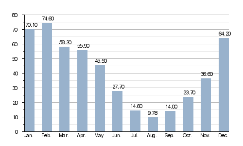
Average monthly discharge (m3/s) at Lavaur (56 years)
Journey of the Agout River
The Agout river begins its journey high up in the mountains, specifically in the Monts d'Espinouse. This area is part of the southern Massif Central mountain range in France. The exact source of the river is in a town called Cambon-et-Salvergues, in the Hérault department. It starts at an altitude of about 1,060 meters (or 3,478 feet) above sea level.
From its mountain source, the Agout generally flows towards the northwest. Along its path, it travels through different regions and departments:
- In the Occitanie region:
In total, the Agout river flows through 36 different towns or communes in France! Its long journey ends when it joins the Tarn River at Saint-Sulpice. At this point, the Agout is about 98 meters (or 322 feet) above sea level.
Rivers That Join the Agout
Just like the Agout is a tributary to the Tarn, other smaller rivers are tributaries to the Agout. These are some of the main ones, all longer than 30 kilometers (about 18.6 miles):
- Rivers joining from the left side:
- The Durenque river: It's 31.5 kilometers long and joins the Agout in Castres.
- The Thoré river: This one is 61.6 kilometers long.
- The Sor river: It measures 60.8 kilometers.
- Rivers joining from the right side:
- The Gijou river: It's 50.1 kilometers long.
- The Dadou river: This is the longest tributary, at 115.8 kilometers!
Gallery
-
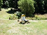
Cambon-et-Salvergues: The very start of the Agout river
-
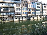
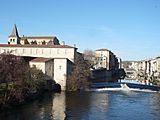
Colorful houses in Castres right by the Agout river
-
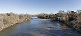
The Agout river flowing peacefully at Giroussens
-
A view of the Agout river in Castres, with the cathedral nearby
-
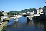
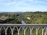
A bridge crossing the Agout river in Brassac
-
A view of the Agout river at Saint-Sulpice-la-Pointe

,_Maisons_sur_l%27Ago%C3%BBt.JPG)


_-_La_chauss%C3%A9e_du_moulin_sur_l%27Agout.jpg)
See Also
Images for kids
-
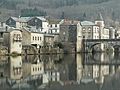
The town of Brassac next to the Agout river

