
Hérault facts for kids
Quick facts for kids
Hérault
|
|||
|---|---|---|---|

Prefecture building of the Hérault department, in Montpellier
|
|||
|
|||

Location of Hérault in France
|
|||
| Country | France | ||
| Region | Occitanie | ||
| Prefecture | Montpellier | ||
| Subprefectures | Béziers Lodève |
||
| Area | |||
| • Total | 6,101 km2 (2,356 sq mi) | ||
| Population
(2014)
|
|||
| • Total | 1,107,398 | ||
| • Rank | 21st | ||
| • Density | 181.511/km2 (470.11/sq mi) | ||
| Demonym(s) | Héraultais | ||
| Time zone | UTC+1 (CET) | ||
| • Summer (DST) | UTC+2 (CEST) | ||
| ISO 3166 code | FR-34 | ||
| Arrondissements | 3 | ||
| Cantons | 25 | ||
| Communes | 343 | ||
| Website | http://www.herault.fr/ | ||


Hérault (pronounced "Eh-roh") is a department in southern France. It is part of the Occitanie region. The department gets its name from the Hérault River.
People who live in Hérault are called Héraultais (for boys and men) or Héraultaises (for girls and women).
Contents
History of Hérault
Hérault was created in 1790 during the French Revolution. At that time, France was divided into departments. This replaced the older system of provinces. Hérault was formed from a part of the old province called Languedoc.
The department was first divided into four smaller areas called districts. These were Montpellier, Béziers, Lodève, and Saint-Pons. Montpellier was chosen as the main city, or capital.
In 1800, these districts were changed into arrondissements. Later, in 1926, the arrondissements of Lodève and Saint-Pons were removed. But Lodève became an arrondissement again in 1942.
Geography of Hérault
Hérault covers an area of about 6,101 square kilometers (2,356 square miles). It is surrounded by other departments: Aude to the southwest, Aveyron to the northwest, Tarn to the west, and Gard to the northeast. To the east and southeast, Hérault has a coastline along the Gulf of Lion, which is part of the Mediterranean Sea.
 |
Aveyron (Occitanie) |
Gard (Occitanie) |
|
|
| Tarn (Occitanie) |
Mediterranean Sea | |||
| Aude (Occitanie) |
Mediterranean Sea |
The two most important rivers in the department are the Orb and the Hérault. The Hérault River is where the department gets its name.
Climate in Hérault
The climate in Montpellier, which is in the northeast near the Mediterranean coast, is a Mediterranean climate. This means it has hot, dry summers and mild, wet winters. This type of climate is known as "Csa" in the Köppen climate classification.
Montpellier gets about 629.9 millimeters (24.8 inches) of rain each year. The rainiest month is usually October, with about 96.5 millimeters (3.8 inches) of rain. July is the driest month, with only about 15.2 millimeters (0.6 inches) of rain. On average, there are about 73 rainy days per year. December has the most rainy days (around 9.2), while July has the fewest (around 2.3).
The average temperature in Montpellier for the whole year is 15.1°C (59.2°F). July is the warmest month, with an average temperature of 24.1°C (75.4°F). January is the coolest month, with an average temperature of 7.2°C (45.0°F).
Administration of Hérault
The department is managed by the Departmental Council of Hérault. This council is based in Montpellier. Hérault is also part of the larger Occitanie region in France.
Divisions of Hérault
Hérault is divided into several administrative areas:
- There are 3 main arrondissements (like large districts).
- These arrondissements are further divided into 25 cantons.
- Within these cantons, there are 343 communes (which are like local towns or municipalities).
| INSEE code |
Arrondissement | Capital | Population (2014) |
Area (km²) |
Density (Inh./km²) |
Communes |
|---|---|---|---|---|---|---|
| 341 | Béziers | Béziers | 312,443 | 2,986.8 | 104.6 | 152 |
| 342 | Lodève | Lodève | 94,714 | 1,819.6 | 52.1 | 98 |
| 343 | Montpellier | Montpellier | 700,241 | 1,294.6 | 540.9 | 93 |
Here is a list of the 25 cantons in Hérault. These were reorganized in March 2015:
- Agde (3401)
- Béziers-1 (3402)
- Béziers-2 (3403)
- Béziers-3 (3404)
- Cazouls-lès-Béziers (3405)
- Clermont-l'Hérault (3406)
- Le Crès (3407)
- Frontignan (3408)
- Gignac (3409)
- Lattes (3410)
- Lodève (3411)
- Lunel (3412)
- Mauguio (3413)
- Mèze (3414)
- Montpellier-1 (3415)
- Montpellier-2 (3416)
- Montpellier-3 (3417)
- Montpellier-4 (3418)
- Montpellier-5 (3419)
- Montpellier - Castelnau-le-Lez (3420)
- Pézenas (3421)
- Pignan (3422)
- Saint-Gély-du-Fesc (3423)
- Saint-Pons-de-Thomières (3424)
- Sète (3425)
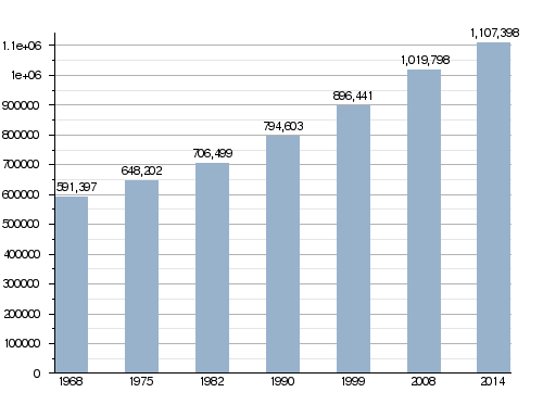
Population of Hérault
In 2014, the Hérault department had a population of 1,107,398 people. This means there were about 181.5 people living per square kilometer. The arrondissement of Montpellier is the largest, with 700,241 people. The other two arrondissements, Béziers and Lodève, had 312,443 and 94,714 people respectively.
How the population of Hérault has changed over time
Here are the communes (towns or cities) in Hérault with more than 10,000 people:
| City | Population (2014) |
Arrondissement |
|---|---|---|
| Montpellier | 275,318 | Montpellier |
| Béziers | 75,701 | Béziers |
| Sète | 44,136 | Montpellier |
| Agde | 26,111 | Béziers |
| Lunel | 24,873 | Montpellier |
| Frontignan | 22,896 | Montpellier |
| Castelnau-le-Lezl | 19,157 | Montpellier |
| Mauguio | 16,765 | Montpellier |
| Lattes | 15,963 | Montpellier |
| Mèze | 11,196 | Montpellier |
Gallery
-
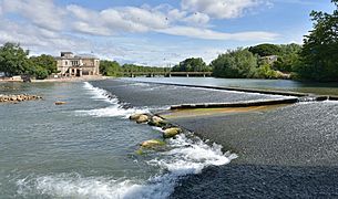
The Hérault river at Agde
-
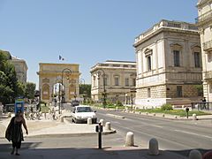
Porte du Peyrou in Montpellier
-
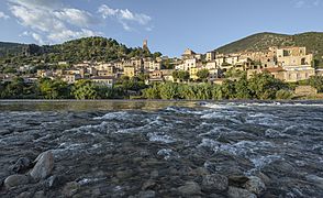
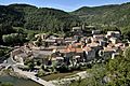
Roquebrun and Orb river


Related pages
Images for kids
-
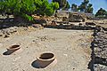
Oppidum d'Ensérune
-
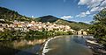
View of the Orb River in Roquebrun
-
Foal of Pézenas
-
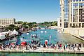
Montpellier's FISE in 2013
-
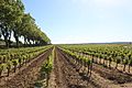
Vineyard in Adissan
-

BLMA's team in 2015
-

Montpellier Handball's team in 2016
-
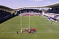
Altrad Stadium, the home stadium of Montpellier Hérault Rugby
-

Match between Montpellier Water-Polo and VK Jug in 2012
-
Tamburello's match in Notre-Dame-de-Londres
-
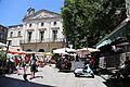
Gambetta square in Pézenas
-
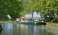
Houseboat on the Canal du Midi
-
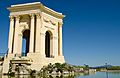
Promenade du Peyrou in Montpellier
-
View of Avène
-
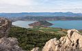
The "Lac du Salagou"
-
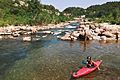
Kayaking on the Orb
-
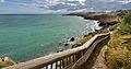
Crique de l'Anau in Sète


.jpg)


.jpg)


.jpg)

See also
 In Spanish: Hérault para niños
