Ahtanum Creek facts for kids
Quick facts for kids Ahtanum Creek |
|
|---|---|
|
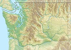
Location of the mouth of Ahtanum Creek in Washington
|
|
| Country | United States |
| State | Washington |
| Region | Yakima County |
| Cities | Union Gap, Ahtanum & Tampico |
| Physical characteristics | |
| Main source | Near Tampico, Yakima County, Washington, United States 2,027 ft (618 m) 46°31′23″N 120°51′15″W / 46.52306°N 120.85417°W |
| River mouth | Yakima River Union Gap, Yakima County, Washington, United States 950 ft (290 m) 46°31′51″N 120°28′23″W / 46.53083°N 120.47306°W |
| Basin features | |
| Basin size | 173 sq mi (450 km2) |
Ahtanum Creek is a stream that flows into the Yakima River in Washington, a state in the United States. It begins where its Middle and North Forks meet near Tampico. The creek then flows along the north side of Ahtanum Ridge. It eventually joins the Yakima River near Union Gap. A part of the creek also forms the northern border of the Yakama Indian Reservation.
The name Ahtanum comes from the Sahaptin language. This language was spoken by Native American people who lived in this area. The North Fork of the creek joins the Middle Fork. These three forks (North, Middle, and South) all start high up in the Cascade Mountains. Over time, the creek has had different official names. All of them were different spellings of "Ahtanum." The current spelling has been used since 1916. When snow melts in the spring, the creek often floods.
Ahtanum Creek: A Look at Its Past
Native American tribes, like the Yakama Tribe, lived around Ahtanum Creek for a very long time. They were there long before Europeans arrived. The group living along the creek was called Ahtanumlema. This name means "People of the water by the long hill." They were a very important group within the Yakama Tribe.
In the 1850s, two Catholic priests, Father Louis D'herbomez and Father Charles Pandosy, came to the area. They were sent by Bishop François Norbert Blanchet. Native leaders had asked for missionaries to come. Father Pandosy first worked at missions near Richland and Ellensburg.
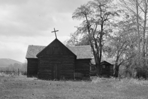
In 1852, Father Pandosy and Father D'herbomez built St. Joseph's Mission. It was located along Ahtanum Creek, near where Tampico is today. They chose this spot because it was near the main summer camp of Chief Kamiakin.
The missionaries and the Yakamas worked together. They built the first irrigation canals in the area. This helped them bring water to their crops. Chief Kamiakin and other tribal members even brought their children to the mission to be baptized. In 1854, Father Pierre-Paul Durieu took over from Father D'herbomez. Father Durieu created a dictionary of the Sahaptin language.
Sadly, the first mission was burned down in 1855. This happened during the Yakima War. U.S. soldiers thought the missionaries were helping the Yakama Tribe. The mission was rebuilt in 1867.
Union Gap was first called Yakima City. It was started in the 1860s near where Ahtanum Creek meets the Yakima River. It became the county seat in 1870. Later, in 1885, the Northern Pacific Railway built North Yakima. This new town was about four miles north of Union Gap. The railroad thought Union Gap was too swampy and too close to the hills. North Yakima (which is now called Yakima) became a city in 1886. It also became the new county seat.
In 2009, a wildfire burned about 300 acres (1.2 km2) near the North Fork of Ahtanum Creek.
How People Use Ahtanum Creek
People use water from Ahtanum Creek to water about 9,000 acres (36 km2) of farmland. This happens upstream from the gauge in Union Gap.
Fishing is a popular activity along the creek. People enjoy fly fishing, baitcasting, and spinning. The upper part of the creek's area is within the Ahtanum State Forest. The Washington State Department of Natural Resources manages this forest. It covers about 75,000 acres (300 km2) and has many campgrounds. People also enjoy seasonal hunting and snowmobiling there.
Wildlife and Nature in Ahtanum Creek
Ahtanum Creek is in the rain shadow of the Cascade Range. This means it doesn't get as much rain as other areas. Because of this, the area around the creek, called the riparian zone, is very important. It provides a home for many animals.
Some special fish that live in the creek are steelhead trout, bull trout, Chinook salmon, and coho salmon. These fish are considered endangered.
The Yakama Tribe worked on a project to help the creek near La Salle High School. They made three areas of the creek bank stronger. These areas used to wash away easily. They also planted native plants like coyote willow. Two new channels were created for the water to flow into. About 8,500 cubic yards (6,500 m3) of soil was removed from the flood plain. These changes helped connect the creek with its flood plain again. They also created safe places for young fish to grow. Between 2002 and 2006, the North Yakima Conservation District put in fish screens. These screens stop fish from swimming into water diversions.
 | James Van Der Zee |
 | Alma Thomas |
 | Ellis Wilson |
 | Margaret Taylor-Burroughs |


