Ajmer facts for kids
Quick facts for kids
Ajmer
Ajayamerū
|
|
|---|---|
|
City
|
|
|
|
|
| Nickname(s):
Heart of Rajasthan
|
|
| Country | |
| State | Rajasthan |
| District | Ajmer |
| Founded by | Ajayaraja I or Ajayaraja II |
| Named for | Ajayaraja I or Ajayaraja II |
| Government | |
| • Type | Municipal Corporation |
| • Body | Ajmer Municipal Corporation |
| Area | |
| • City | 55 km2 (21 sq mi) |
| Elevation | 480 m (1,570 ft) |
| Population
(2011)
|
|
| • City | 542,321 |
| • Density | 9,860/km2 (25,540/sq mi) |
| • Urban | 551,101 |
| Languages | |
| • Official | Hindi |
| • Additional official | English |
| • Regional | Marwari, Rajasthani |
| Time zone | UTC+5:30 (IST) |
| PIN |
305001 to 305023
|
| Telephone code | 0145, +91145 |
| Vehicle registration | RJ-01 |
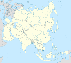
Ajmer (pronounced [ədʒmeːr]) is a cool city in the north-western Rajasthan state of India. It's like the main office for the Ajmer district and Ajmer division. Ajmer is right in the middle of Rajasthan, which is why it's called 'the Heart of Rajasthan'.
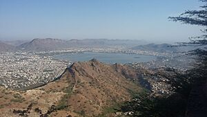
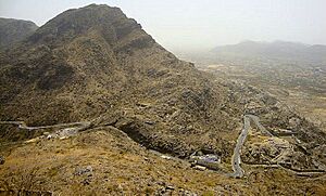
The city is surrounded by the Aravalli Mountains. Ajmer has been a local government area since 1869. It has also been chosen as a special heritage city by the Government of India.
Contents
Etymology: What's in a Name?
The city of Ajmer was first called "Ajaya Meru". This name means "invincible hill" in Sanskrit. It was given by a ruler from the Chahamana dynasty, either Ajayaraja I or Ajayaraja II. The name refers to the Taragarh Hill, where the city is built. Over time, "Ajaya Meru" became "Ajmer".
Ajmer was the capital city for the Chahamana rulers until the 12th century. Later, different groups like the Delhi Sultans and the Mughals ruled Ajmer. The city became famous for its good government and rich culture.
Other Names for Ajmer
An old Gujarati story calls the city sapādalakṣaṇa. This shows how important Ajmer was in history.
History: A Journey Through Time
Ajmer was first known as Ajayameru. It was founded in the 11th century by a Parmar Rajput ruler. Some historians think it was founded before 1113 CE. An old inscription says that King Ajayadeva (also known as Ajayaraja II) moved his home to Ajmer.
Another old text says that King Ajayaraja I built the Ajayameru fort in the 8th century. This fort is now known as the Taragarh fort. Historians believe Ajayaraja II later made the town bigger and built palaces. He also moved the capital of his kingdom to Ajmer.
In 1193, Ajmer was taken over by the Ghurids. Later, it was given back to Rajput rulers, but they had to pay tribute.
By the 15th century, the Mewar kingdom captured Ajmer. In 1506, Ajja Jhala became the Governor of Ajmer.
In 1556, the Mughal Empire took control of Ajmer after Emperor Akbar conquered it. Ajmer became an important city for the Mughals. They often visited the dargah of Moinuddin Chishti for religious reasons. The city was also used as a military base for battles against Rajput rulers.
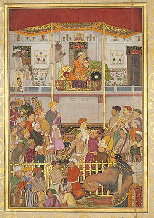
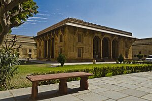
Mughal emperors and their nobles gave a lot of money to the city. They built structures like Akbar's palace and pavilions near the Ana Sagar. The children of Emperor Shah Jahan, Jahanara Begum and Dara Shikoh, were both born in Ajmer.
By the early 1700s, the Mughals started to pay less attention to Ajmer. In 1752, the Scindias took over the city. Then, in 1818, the British gained control. A local government was set up in Ajmer in 1866. During the British rule, Ajmer was an important administrative center. It had a large hospital and several smaller ones.
When India became independent in 1947, Ajmer was a separate state with its own government. In 1956, Ajmer joined Rajasthan. This created the Ajmer District.
Geography: Where is Ajmer?
Ajmer is in the northwest of India. It is surrounded by the Aravalli Mountains. The city sits on the lower parts of the Taragarh Hill. To the northwest, the Nagapathar Range protects Ajmer from the Thar Desert.
Climate: Ajmer's Weather
Ajmer has a hot, semi-dry climate. It gets over 55 centimeters (22 inches) of rain each year. Most of this rain falls during the monsoon season, from June to September. Temperatures stay quite high all year. In summer (April to early July), the average daily temperature is about 30°C (86°F).
During the monsoon, there are often heavy rains and thunderstorms. But big floods are not common. The winter months (November to February) are mild and pleasant. Average temperatures are around 15–18°C (59–64°F) with low humidity. Sometimes, it can get very cold, close to freezing.
| Climate data for Ajmer (1991–2020, extremes 1901–2020) | |||||||||||||
|---|---|---|---|---|---|---|---|---|---|---|---|---|---|
| Month | Jan | Feb | Mar | Apr | May | Jun | Jul | Aug | Sep | Oct | Nov | Dec | Year |
| Record high °C (°F) | 32.6 (90.7) |
36.8 (98.2) |
42.3 (108.1) |
44.6 (112.3) |
47.4 (117.3) |
46.4 (115.5) |
44.4 (111.9) |
42.3 (108.1) |
42.0 (107.6) |
42.0 (107.6) |
37.4 (99.3) |
34.2 (93.6) |
47.4 (117.3) |
| Mean maximum °C (°F) | 29.1 (84.4) |
32.4 (90.3) |
38.0 (100.4) |
41.9 (107.4) |
43.6 (110.5) |
43.2 (109.8) |
39.1 (102.4) |
36.0 (96.8) |
38.0 (100.4) |
37.6 (99.7) |
34.1 (93.4) |
30.1 (86.2) |
43.9 (111.0) |
| Mean daily maximum °C (°F) | 23.9 (75.0) |
27.2 (81.0) |
32.5 (90.5) |
37.6 (99.7) |
40.3 (104.5) |
38.7 (101.7) |
34.1 (93.4) |
32.0 (89.6) |
33.6 (92.5) |
34.5 (94.1) |
30.2 (86.4) |
26.1 (79.0) |
32.7 (90.9) |
| Mean daily minimum °C (°F) | 10.1 (50.2) |
13.5 (56.3) |
18.8 (65.8) |
24.4 (75.9) |
28.0 (82.4) |
27.8 (82.0) |
26.1 (79.0) |
24.8 (76.6) |
24.3 (75.7) |
21.1 (70.0) |
15.9 (60.6) |
11.4 (52.5) |
20.7 (69.3) |
| Mean minimum °C (°F) | 5.4 (41.7) |
7.8 (46.0) |
17.4 (63.3) |
17.4 (63.3) |
21.8 (71.2) |
22.2 (72.0) |
22.7 (72.9) |
22.5 (72.5) |
21.5 (70.7) |
16.2 (61.2) |
10.7 (51.3) |
6.3 (43.3) |
5.2 (41.4) |
| Record low °C (°F) | −2.8 (27.0) |
−1.1 (30.0) |
2.2 (36.0) |
9.4 (48.9) |
14.3 (57.7) |
14.7 (58.5) |
14.4 (57.9) |
18.9 (66.0) |
14.6 (58.3) |
7.8 (46.0) |
2.8 (37.0) |
−0.6 (30.9) |
−2.8 (27.0) |
| Average rainfall mm (inches) | 4.9 (0.19) |
7.3 (0.29) |
3.1 (0.12) |
6.6 (0.26) |
20.4 (0.80) |
61.0 (2.40) |
182.2 (7.17) |
180.6 (7.11) |
86.7 (3.41) |
15.6 (0.61) |
1.1 (0.04) |
1.8 (0.07) |
571.4 (22.50) |
| Average rainy days | 0.4 | 0.7 | 0.4 | 0.9 | 1.7 | 3.8 | 8.8 | 9.2 | 4.1 | 0.9 | 0.1 | 0.2 | 31.2 |
| Average ultraviolet index | 5 | 6 | 7 | 9 | 9 | 8 | 7 | 7 | 7 | 6 | 6 | 5 | 7 |
| Source 1: India Meteorological Department Climate of Ajmer | |||||||||||||
| Source 2: Weather Atlas | |||||||||||||
Demographics: People of Ajmer
| Religions in Ajmer | ||||
|---|---|---|---|---|
| Religion | Percent | |||
| Hindus | 83.53% | |||
| Muslims | 11.58% | |||
| Jains | 2.50% | |||
| Sikhs | 0.94% | |||
| Others | 0.18% | |||
| Historical population | ||
|---|---|---|
| Year | Pop. | ±% |
| 1891 | 68,800 | — |
| 1901 | 73,800 | +7.3% |
| 1911 | 86,200 | +16.8% |
| 1921 | 113,200 | +31.3% |
| 1931 | 119,500 | +5.6% |
| 1941 | 147,300 | +23.3% |
| 1951 | 196,300 | +33.3% |
| 1961 | 231,200 | +17.8% |
| 1968 | 265,200 | +14.7% |
| 1971 | 264,300 | −0.3% |
| 1981 | 374,400 | +41.7% |
| 1991 | 402,700 | +7.6% |
| 2001 | 485,197 | +20.5% |
| 2011 | 542,321 | +11.8% |
In 2011, Ajmer city had a population of 542,321 people. If you include the areas around the city, the population was 551,101.
For every 1,000 males, there were 947 females in the city. About 86.52% of people in Ajmer could read and write. For males, this was 92.08%, and for females, it was 80.69%.
Ajmer's population grew by 18.48% in the decade leading up to 2011.
Tourism: Places to Explore in Ajmer
Ajmer has many amazing places to visit!
- Pushkar: This town is just a few kilometers from Ajmer. It's a very important place for tourists and pilgrims. Pushkar is famous for its lake and the 14th-century Brahma Temple. This temple is special because it's one of the few major temples dedicated to the god Brahma.
- Taragarh Fort: This is said to be India's oldest hill fort. It stands very high up, about 2,855 feet above sea level. The fort has strong walls, about 20 feet thick, made of huge stone blocks. It was the main fort for the Chauhan rulers. King Ajaypal Chauhan built it on Taragarh Hill, overlooking Ajmer. In 1832, the British turned it into a hospital for their soldiers. Inside the fort, there is a shrine of a Muslim saint, Saiyid Husain.
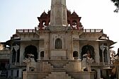
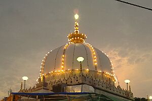
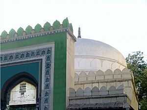
- Ajmer Sharif Dargah: This is a famous shrine of Khwaja Moinuddin Chishti. It's located at the bottom of Taragarh hill. The shrine has many white marble buildings around two courtyards. One big gate was given by the Nizam of Hyderabad. There's also the Akbari Mosque, built by the Mughal emperor Shah Jahan. It holds the saint's domed tomb. Emperor Akbar and his queen used to walk here every year from Agra. About 125,000 pilgrims visit this place every day.
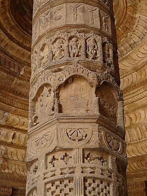
- Adhai Din Ka Jhonpra: This means "shed of two-and-a-half days." It's an old monument near Ajmer Sharif Dargah. It was originally a Sanskrit college. After a battle, it was changed into a mosque in the 12th century.
- Mayo College: This famous college was started in 1875. It was meant to educate the sons of important Indian rulers and nobles. It was known as "Indian Eton" because many Indian princes studied here. The main building is made of white marble and looks beautiful.
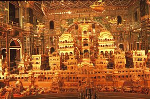
- Soni Ji Ki Nasiyaan: This is a beautiful Jain temple built in the late 1800s. Its main room, called "City of Gold" (Swarna Nagari), shows a detailed model of Ayodhya made from 1,000 kg of gold!
- Akbari Fort & Museum: This museum was once the home of Prince Salīm, Emperor Akbar's son. Today, it has a collection of Mughal and Rajput armor and sculptures. It's a great example of Mughal architecture. Emperor Akbar started building it in 1570. This is where Salim, as Emperor Jahangir, allowed the British East India Company to trade with India.
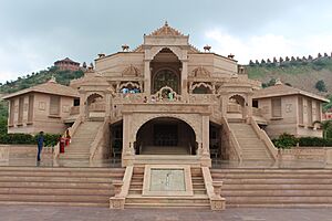
- Nareli Jain Temple: This is a newer Jain temple complex with fourteen temples. It's known for its unique architecture and detailed stone carvings. It blends traditional and modern styles.
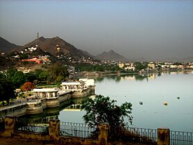
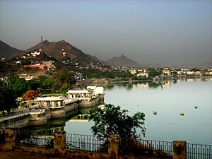
- Ana Sagar Lake: This is a historic man-made lake built by Maharaja Anaji (1135–1150 CE). Near the lake is the Daulat Bagh, a garden created by Emperor Jahangir. Emperor Shah Jahan later added five beautiful pavilions, called the Baradari, by the lake.
- Lake Foy Sagar: This is a lovely artificial lake created in 1892. It was built to help people during a time of famine. It offers great views of the Aravali mountains and migrating birds.
- Prithviraj Smark: This monument is dedicated to Prithviraj Chauhan. It's on the way to Taragarh Fort. Here, you can see a life-size statue of King Prithviraj Chauhan riding a horse.
- Tomb of Khwaja Husain Ajmeri: This is the tomb of Khwaja Husain Ajmeri. He was a grandson of Khwaja Moinuddin Chishty. His tomb is located near the Sola Khamba, behind the Shahjahani Mosque at Dargah Sharif.
- Manibandh : Also known as Chamunda Mata Mandir, this is one of the 108 Shakti Pithas. It's on Gayatri hills near Pushkar, about 11 km from Ajmer.
- Sri Nimbark Peeth : This is an important religious center located in Salemabad. It is the main seat of the Sri Nimbarka Sampradaya tradition.
Transportation: Getting Around Ajmer
Air Travel
The Kishangarh Airport is the closest airport to Ajmer, about 25 km away. It opened in 2017 and has regular flights to cities like Delhi, Mumbai, and Hyderabad. This airport is now one of the main and busiest airports in Rajasthan.
The Jaipur International Airport is the nearest international airport, about 135 km from Ajmer.
Rail Travel
The Ajmer Junction is the main train station in the city. It was built a long time ago during the British colonial period.
Education: Learning in Ajmer
Ajmer has many schools and colleges. Mayo College is a very well-known college here. The regional office for the CBSE is also located in Ajmer.
|
See also
 In Spanish: Ajmer para niños
 | James Van Der Zee |
 | Alma Thomas |
 | Ellis Wilson |
 | Margaret Taylor-Burroughs |


