
Alburgh (town), Vermont facts for kids
Quick facts for kids
Alburgh, Vermont
|
|
|---|---|

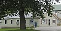
Church in Alburgh
|
|
_highlighted.svg)
Location in Grand Isle County and the state of Vermont.
|
|

Alburgh (town), Vermont
Location in Vermont

Alburgh (town), Vermont
Location in the United States
|
|
| Country | United States |
| State | Vermont |
| County | Grand Isle |
| Communities | Alburgh Alburgh Springs Alburgh Center East Alburgh South Alburgh |
| Area | |
| • Total | 48.8 sq mi (126.4 km2) |
| • Land | 29.2 sq mi (75.5 km2) |
| • Water | 19.7 sq mi (51.0 km2) |
| Elevation | 124 ft (38 m) |
| Population
(2020)
|
|
| • Total | 2,106 |
| • Density | 66.6/sq mi (25.7/km2) |
| Time zone | UTC-5 (Eastern (EST)) |
| • Summer (DST) | UTC-4 (EDT) |
| ZIP code |
05440
|
| Area code(s) | 802 |
| FIPS code | 50-00625 |
| GNIS feature ID | 1456120 |
Alburgh (which used to be called Alburg) is a town in Grand Isle County, Vermont, United States. It was started in 1781 by a person named Ira Allen. In 2020, about 2,106 people lived there.
Alburgh is special because it's on a piece of land called the Alburgh Tongue. This land sticks out from Canada into Lake Champlain. It's also the only way to drive across Lake Champlain to New York state if you're north of Addison, Vermont.
Contents
Why Alburgh's Name Changed
The town's first name was "Alburgh." But in 1891, the United States Board on Geographic Names suggested changing it to "Alburg." This was to make all town names ending in "-burgh" end in "-burg" instead. They wanted to make names more standard.
Then, in April 2006, the town decided to change its name back to "Alburgh." Most people voted for this change on their town meeting day. The Vermont Department of Libraries, which handles Vermont place names, approved the request.
How Alburgh Was Settled by Europeans
Long ago, in 1733, a strip of land near what is now Alburgh was given to a French lord named François Foucault. This land was between Missisquoi Bay and the Richelieu River. Other lands were also given out, but people didn't settle on them.
A surveyor named Janvrin Dufresne checked the land in 1737. He reported that the areas given out were not settled. Foucault asked for more land in 1739. He had started a small village called Missiskouy with six people.
By 1741, the land grants were taken back because no one had settled them. But Foucault's request was accepted in 1743. He asked for even more land in 1744, covering the whole peninsula. This was approved. However, by 1747, all European settlers had left the peninsula.
After the French and Indian War ended in 1763, Great Britain took over the land from France. A British general, James Murray, bought these lands. His nephew then leased the land to Colonel Henry Caldwell in 1774.
Alburgh was officially mapped out on February 23, 1781. Ira Allen and 64 other people helped with this. Allen paid for the mapping. The town's name probably comes from "Allensburgh."
In 1781, Ira Allen helped decide the border between Vermont and New York. This placed the Alburgh Tongue in Vermont. In 1783, the border between Canada and the United States was set. This made Vermont's claim to the land clear.
Alburgh's Geography
Alburgh is a unique place. It has a total area of about 48.8 square miles (126.4 square kilometers). About 29.2 square miles (75.5 square kilometers) is land. The rest, about 19.7 square miles (51.0 square kilometers), is water.
Alburgh is one of only a few places in the United States that isn't directly connected to the rest of the country by land. It's like an "exclave" in some ways. However, there are bridges connecting Alburgh to Rouses Point, New York, and Swanton, Vermont. There's also a bridge to North Hero island. This means Alburgh is not truly cut off.
Isle La Motte is an island located to the southwest of Alburgh. Alburgh also has a beautiful place called Alburgh Dunes State Park. It has one of the longest and most natural beaches on Lake Champlain.
Population Information
| Historical population | |||
|---|---|---|---|
| Census | Pop. | %± | |
| 1790 | 446 | — | |
| 1800 | 750 | 68.2% | |
| 1810 | 1,106 | 47.5% | |
| 1820 | 1,172 | 6.0% | |
| 1830 | 1,239 | 5.7% | |
| 1840 | 1,344 | 8.5% | |
| 1850 | 1,568 | 16.7% | |
| 1860 | 1,793 | 14.3% | |
| 1870 | 1,716 | −4.3% | |
| 1880 | 1,614 | −5.9% | |
| 1890 | 1,390 | −13.9% | |
| 1900 | 1,474 | 6.0% | |
| 1910 | 1,211 | −17.8% | |
| 1920 | 1,491 | 23.1% | |
| 1930 | 1,609 | 7.9% | |
| 1940 | 1,623 | 0.9% | |
| 1950 | 1,402 | −13.6% | |
| 1960 | 1,123 | −19.9% | |
| 1970 | 1,271 | 13.2% | |
| 1980 | 1,352 | 6.4% | |
| 1990 | 1,362 | 0.7% | |
| 2000 | 1,952 | 43.3% | |
| 2010 | 1,998 | 2.4% | |
| 2020 | 2,106 | 5.4% | |
| U.S. Decennial Census | |||
In 2000, there were 1,952 people living in Alburgh. There were 791 households, and 529 of them were families. The town had about 66.6 people per square mile.
Most people in Alburgh were White (96.67%). A smaller number were Native American (1.95%) or Asian (0.15%). About 1.23% of people were from two or more races. A very small number (0.20%) were Hispanic or Latino.
About 31.2% of households had children under 18 living with them. More than half (55.4%) were married couples. About 26.2% of households had people living alone.
The average age in Alburgh was 38 years old. About 25.4% of the population was under 18. About 14.0% were 65 years or older.
The average income for a household in Alburgh was $33,148. For families, it was $39,783. About 12.8% of the people in Alburgh lived below the poverty line. This included 18.4% of those under 18.
Famous People from Alburgh
- Jeptha Bradley (1802–1862), who was an important government official in Vermont. He also worked for the U.S. Customs Service in Alburgh.
- Barbour Lewis (1818–1893), who became a U.S. congressman for Tennessee. He was born in Alburgh.
- Norman Albert Mott (1855–1920), who was a member of the Mississippi Legislature. He was also born in Alburgh.
Images for kids
-
Post office
-
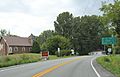
Sign on US2


See also
 In Spanish: Alburgh (Vermont) para niños
