Alt, Greater Manchester facts for kids
Quick facts for kids Alt |
|
|---|---|
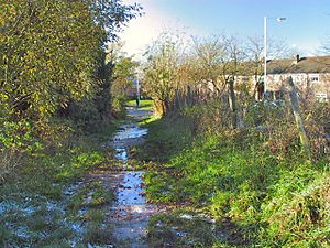
 Bridle path from County End |
|
| OS grid reference | SD944033 |
| Metropolitan borough | |
| Metropolitan county | |
| Region | |
| Country | England |
| Sovereign state | United Kingdom |
| Post town | OLDHAM |
| Postcode district | OL8 |
| Dialling code | 016 |
| Police | Greater Manchester |
| Fire | Greater Manchester |
| Ambulance | North West |
| EU Parliament | North West England |
| UK Parliament |
|
Alt is a cool area in Greater Manchester, England. It's partly like the countryside and partly like a town. You can find it right on the edge of two towns: Oldham and Ashton-under-Lyne.
Alt used to be a separate local area called a civil parish. This was part of the Limehurst Rural District until 1954. After that, Alt was split between Oldham and Ashton-under-Lyne.
The Alt Estate is a big group of houses built in the 1950s. It's near an old village called Alt Fold. Another housing area, the Holts Estate (also known as Holts Village), is also in Alt. These estates are in the Oldham part of Alt.
Contents
What's in a Name?
The name Alt comes from an old language called Brittonic. It means "a cliff" or "a steep hill." So, Alt is named after its hilly landscape! You can find similar words in Scottish Gaelic and Welsh.
A Look Back in Time
Alt has a long history! It's part of the old Ashton-under-Lyne area. People might have lived here even in prehistoric times, like the Bronze Age. This is because a flint tool from that time was found nearby.
During the Roman period, the land was probably cleared for farming. But around AD 550, forests grew back, suggesting fewer people lived here. The land was cleared again later, around AD 610-740 and then around AD 850.
Early Settlements
In AD 1086, Alt was likely a small area within the Ashton parish. It was first written about in the 1200s. The name Alt might also refer to Alder trees, which were once called 'owlers' locally.
There were two old villages, or hamlets, in Alt. Alt Fold was where Sommerfield View, Alt Lane, and Alt Fold Drive meet today. Pitses was at the junction of Holts Lane and Abbey Hills Road. An old historian described Pitses as being "surrounded by pools of water" in the early 1800s.
For many years, Alt was mostly farmland. Farmers grew crops in strips of land as part of a shared farming system. There might have been some areas for animals to graze too.
Coal Mining and Modern Development
People started mining coal in Alt as early as the 1700s. There were coal pits in Alt and Fairbottom. The name Pitses might even come from these early coal pits!
When the Limehurst Rural District was removed in 1954, Oldham was able to build more houses in Alt. This led to the creation of the Alt Estate, along with schools and playing fields. Even though Alt Fold was an ancient area, it was completely cleared in the late 1960s to make way for new developments.
Old Buildings to See
South of the Alt Estate, along Alt Lane, you can find some old buildings. Two of these are special because they are Grade II listed. This means they are historically important! They are Alders Farmhouse and a group of cottages from the early 1800s called 'Ten Houses'.
Local Places and Activities
Alt has its own primary school, Alt Academy, which serves the Alt Estate.
If you like golf, the Oldham Golf Club is also located in the Alt area.
Getting Around Alt
Local buses help people get around Alt.
- First Greater Manchester runs service 425. This bus goes to Holts Village and to Fitton Hill, passing through Glodwick and Oldham.
- Manchester Community Transport provides service 408. This bus goes to Oldham via Glodwick and to Stalybridge via Hurst Cross.
 | Kyle Baker |
 | Joseph Yoakum |
 | Laura Wheeler Waring |
 | Henry Ossawa Tanner |


