Ashton-under-Lyne facts for kids
Quick facts for kids Ashton-under-Lyne |
|
|---|---|
|
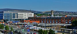
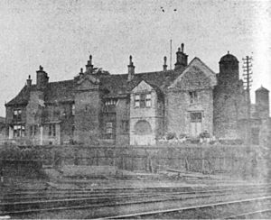
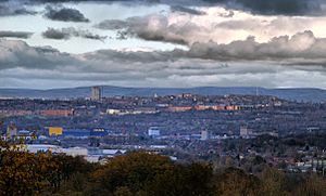
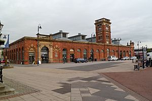
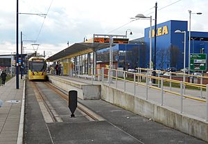
Clockwise, from top:Ashton-under-Lyne town centre; Portland Basin; Market Hall; St Michael and All Angels' Church; Ashton Town Hall |
|
| Population | 48,604 (2021 census) |
| • Density | 12,374 per mi² (4,777 per km²) |
| OS grid reference | SJ931997 |
| • London | 160 mi (257 km) SSE |
| Metropolitan borough | |
| Metropolitan county | |
| Region | |
| Country | England |
| Sovereign state | United Kingdom |
| Post town | ASHTON-UNDER-LYNE |
| Postcode district | OL6, OL7 |
| Dialling code | 0161 |
| Police | Greater Manchester |
| Fire | Greater Manchester |
| Ambulance | North West |
| EU Parliament | North West England |
| UK Parliament |
|
Ashton-under-Lyne is a busy market town in Tameside, Greater Manchester, England. About 48,604 people lived here in 2021. It's located on the north side of the River Tame. The town is also near the Pennines hills, about 6 miles (9.7 km) east of Manchester.
People have lived in Ashton-under-Lyne since the Stone Age and Bronze Age. Even Vikings were active here! The name "Ashton" likely comes from an old Anglo-Saxon word. It means "settlement by ash trees." The "under-Lyne" part might mean "under the elm trees" or "under the Pennines."
In the Middle Ages, Ashton-under-Lyne was a small village. It was given a special permission, called a royal charter, in 1414. This allowed it to hold markets and fairs. For a long time, it was mostly a farming area.
Everything changed when the cotton industry arrived in 1769. Factories were built, and the town grew very quickly. By the mid-1800s, Ashton was a major mill town. It had many new canals and railways. These helped transport cotton and coal. In 1847, it became a municipal borough, which gave it more local power.
Later, in the mid-1900s, it became harder for Ashton's factories to compete. Cheaper goods from other countries led to a decline in heavy industries. But Ashton-under-Lyne is still a busy place for shopping and trade. Its outdoor market is one of the biggest in the UK. The town centre also has large shopping centres like Ashton Arcades and a big IKEA store.
Recently, Ashton-under-Lyne has seen many new developments. In 2018, a new college campus, council offices, and a library opened. The outdoor market also got new stalls. In 2019, work started on a new transport hub. This makes it easier to get around by bus and Metrolink tram. The new hub opened in August 2020.
Contents
History of Ashton-under-Lyne
Early Times and Old Names
We know people lived here a very long time ago. Tools from the Mesolithic and Neolithic periods have been found. These tools are from the Stone Age. A skull from the Bronze Age was also found in Ashton Moss. This shows activity from around 1,320 to 970 BC.
An old earth wall called Nico Ditch ends in Ashton Moss. It was likely a border in the 8th or 9th century. Some stories say it was built in one night. This was to defend against Viking invaders.
The name "Ashton" comes from an old Anglo-Saxon word. It means "settlement by ash trees." The "under-Lyne" part is a bit of a mystery. It might mean "under the elm trees." Or it could mean "under the line" of the Pennines hills. This suggests Ashton became a settlement after the Romans left Britain in the 400s.
Medieval Life and the Black Knight
Ashton was first mentioned in the 1100s. A family called Assheton took care of the area. Ashton Old Hall was their main home. It was a very grand house for the 1300s. In 1414, the town got a royal charter. This allowed it to hold markets and fairs. This made Ashton a market town.
A famous story tells of Sir Ralph de Assheton. He was known as the Black Knight. People said he was a cruel ruler. After he died, locals would parade a dummy of him. They would then shoot and burn it. This tradition continued into the 1830s.
The Assheton family owned the area until 1514. Later, the Earls of Stamford took over in 1758. Even though they didn't live there, they helped the town's textile industry grow. In the 1700s, Ashton was rebuilt with a grid pattern of roads. Not much of the old town remains.
Industrial Revolution and Cotton Mills
For a long time, people in Ashton made cloth at home. But the Industrial Revolution changed everything. Factories were built, and Ashton became a famous mill town. From 1773 to 1905, 75 cotton mills were built here.
The cotton industry grew fast until the Lancashire Cotton Famine (1861–1865). This happened during the American Civil War. Many workers came to Ashton for jobs. Some housing estates were built just for them. One example was Oxford Mills in 1845. It had baths, a library, and a reading room.
In 1832, a cholera outbreak happened. This was due to a poor water supply and bad drainage. A new workhouse was built in 1850. It later became part of Tameside General Hospital. Railways also came to Ashton. The Sheffield, Ashton-under-Lyne and Manchester Railway opened in 1845.
Later Years and Modern Changes
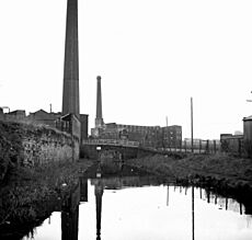
In the late 1800s, many public buildings were constructed. These included the market hall, town hall, and library. Ashton Moss Colliery had the deepest mine shaft in the world in 1882. It was 870 metres (2,850 ft) deep.
Ashton's cotton industry declined after the 1920s. Many mills closed down. On June 13, 1917, a factory making explosives caught fire. This caused a huge explosion. It destroyed much of the west end of town. At least 41 people died and about 100 were hurt.
In 1974, Ashton became part of the new Metropolitan Borough of Tameside. In 2004, the Victorian market hall was badly damaged by a fire. A temporary market was set up. The market was rebuilt and reopened in 2008.
How Ashton-under-Lyne is Governed
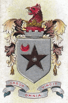
Ashton-under-Lyne has been part of Lancashire since the 1100s. It used to be one large area. In 1847, it became a municipal borough. This gave it its own local government.
Over the years, Ashton's borders changed a bit. In 1927, Hurst Urban District was added. Other nearby areas joined later. Since 1956, Ashton has been twinned with Chaumont, France. This means they are friendly partner towns.
In 1974, Ashton became part of the Metropolitan Borough of Tameside. This is part of Greater Manchester. Ashton-under-Lyne is now split into four areas called wards. These are Ashton Hurst, Ashton St. Michaels, Ashton St Peters, and Ashton Waterloo.
Since 1832, Ashton has had its own Member of Parliament (MP). This person represents the town in the UK Parliament. Currently, Angela Rayner has been the MP since 2015.
Geography of Ashton-under-Lyne
 |
Failsworth | Oldham | Mossley |  |
| Droylsden | Hartshead | |||
| Audenshaw | Dukinfield | Stalybridge |
Ashton-under-Lyne is about 160 miles (257 km) north of London. It sits on the north bank of the River Tame. The town is on hilly land near the Pennines. Its highest point is about 1,000 feet (305 m) above sea level.
Ashton is 6.2 miles (10.0 km) east of Manchester city centre. It is surrounded by other towns like Audenshaw, Droylsden, and Stalybridge. There isn't much open green space between them. Ashton has a mild, wet climate, like most of the UK.
The ground beneath Ashton is mostly coal. This was used for coal mining. There are also layers of sand, gravel, and clay. Ashton Moss, a peat bog, is to the west. The River Tame forms part of the southern border.
Ashton's buildings are like many English towns. There are homes around a market square and high street. The town centre is where most of the shops are. Older streets are narrow. Newer ones are wider with bigger houses. Areas within Ashton include Cockbrook, Hurst, and Waterloo.
People of Ashton-under-Lyne
| Ashton-under-Lyne compared | |||
|---|---|---|---|
| 2001 UK census | Ashton-under-Lyne | Tameside | England |
| Total population | 43,236 | 213,043 | 49,138,831 |
| White | 82.3% | 91.2% | 91% |
| Asian | 11.2% | 5.6% | 4.6% |
| Black | 0.3% | 1.2% | 2.3% |
In 2001, Ashton-under-Lyne had 43,236 people. There were slightly more females than males. About 30.9% of adults were single. 50.0% were married.
Many people in Ashton did not have formal qualifications in 2001. This was similar to Tameside. But it was higher than the average for England. About 12% had a university degree or similar qualification. This was lower than the national average of 20%.
In 1700, only about 550 people lived in Ashton. The town grew a lot in the 1700s. People moved from the countryside for jobs. In the early 1800s, Irish immigrants also came. They were escaping a terrible famine.
The textile industry created many jobs. Ashton's population grew by over 400% between 1801 and 1861. It went from 6,500 to 34,886 people. The population dropped a bit in the 1860s. This was due to the cotton famine.
Religion in Ashton-under-Lyne
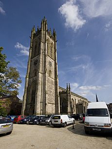
St Michael and All Angels' Church is a very old church. It dates back to at least 1262. It has been rebuilt several times. In 1795, it was one of only two churches in the Tameside area.
Many new churches and religious buildings were built in the 1800s. By the end of that century, there were 44 Anglican churches. There were also 138 chapels for other Christian groups. These included Catholic, Congregationalist, and Methodist churches.
In the 1800s, a preacher named John Wroe tried to make Ashton-under-Lyne a "new Jerusalem." He started the Christian Israelite Church. Ashton was its main base from 1822 to 1831. Wroe wanted to build a wall around the town. The wall was never built, but four gatehouses were.
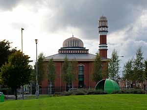
In 2001, most Ashton residents were Christian (68.5%). About 6.1% were Muslim. 5.0% were Hindu. And 0.2% were Buddhist. A higher percentage of Hindus and Muslims lived in Ashton than the average for England. As of 2013, there were six mosques in the town.
Economy and Work
| Ashton-under-Lyne compared | |||
|---|---|---|---|
| 2001 UK census | Ashton-under-Lyne | Tameside | England |
| Population of working age | 30,579 | 152,313 | 35,532,091 |
| Full-time employment | 41.0% | 43.5% | 40.8% |
| Part-time employment | 11.3% | 11.5% | 11.8% |
| Self employed | 5.9% | 6.5% | 8.3% |
| Unemployed | 4.1% | 3.3% | 3.3% |
| Retired | 12.2% | 13.3% | 13.5% |
In medieval times, farming was very important in Ashton. By the 1700s, making textiles was also a big part of the town's economy. When the Industrial Revolution started, the textile industry grew very fast. It kept growing until the cotton famine in the 1860s. After that, it stayed steady until the 1920s. Then, it declined as overseas markets closed.
Coal has been mined in Ashton since at least the 1600s. Demand for coal increased in the late 1700s and early 1800s. This led to more coal mining. The coal was sent by canal to Manchester. The industry started to decline in the late 1800s. By 1904, only one coal mine was still open.
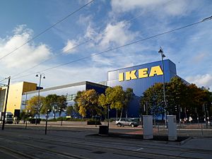
Ashton town centre grew a lot in the Victorian era. Many old buildings are still there. The town centre is a protected area. Ashton has an outdoor market that started in the Middle Ages. It has about 180 stalls and is open six days a week. The farmers' market is the biggest in the region.
The Ashton Arcades shopping centre opened in 1995. It has two floors and is 140,000-square-foot (13,000 m2). In 2006, IKEA opened its first town-centre store in Ashton. It created 500 new jobs. The store opened on October 19, 2006. It is 296,000 square feet (27,500 m2) and was the tallest IKEA in Britain at the time.
Ashton Leisure Park has a 14-screen cinema and a bowling alley. The St Petersfield area of Ashton was redeveloped. It created 2,000 jobs. This project aimed to create a business area.
In 2001, most people in Ashton worked in manufacturing (22.7%) or retail (18.6%). Many also worked in health and social care (11.3%). The town had a higher rate of people working in construction than the national average. Ashton's unemployment rate was 4.1%. This was a bit higher than the national rate of 3.3%.
Culture and Fun
Sports Teams
Ashton-under-Lyne has two main football teams. They are Ashton United F.C. and Curzon Ashton F.C.. Ashton United was the first team in the Manchester area to win an FA Cup match. They beat Turton 3–0 in 1883. They play at Hurst Cross. Curzon Ashton has been playing in the National League North since 2015. This is the highest level in their history. They play at the Tameside Stadium.
Other sports places include Richmond Park Athletics Stadium. It has a running track and facilities for field events. It is home to the East Cheshire Harriers. Ashton Cricket Club has won the Central Lancashire Cricket League twice.
Famous Places and Landmarks
The Portland Basin warehouse is now a museum. It opened in 1985. The museum shows the history of Tameside. The basin is where three canals meet: the Ashton Canal, the Huddersfield Narrow Canal, and the Peak Forest Canal. This spot has been used for filming TV shows like Coronation Street.
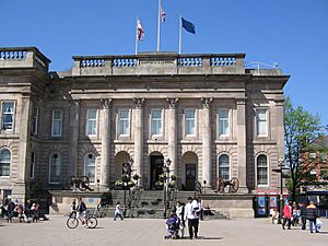
Ashton Town Hall was built in 1840. It was the first purpose-built town hall in Tameside. It has classical features like columns. It was made bigger in 1878. The Old Street drill hall was finished in 1887.
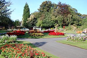
Ashton has five parks. Three of them have Green Flag Awards. Stamford Park was the first park to open. It is on the border with Stalybridge. It opened in 1873. Local cotton workers campaigned for 17 years to get it. Between 60,000 and 80,000 people came to its opening. The park has a boating lake. It also has a memorial to Rayner Stephens. He worked for fair wages and better working conditions.
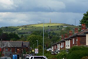
Hartshead Pike is a stone tower on a hill. It looks over Ashton and Oldham. The current building was built in 1863. From the top of the hill, you can see far away. You might even see the Jodrell Bank Observatory.
The Witchwood is a pub that has been a music venue since the 1960s. Famous bands like Muse have played there. In 2004, it was almost torn down. But a campaign by locals saved it.
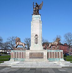
The main Ashton-under-Lyne War Memorial is in Memorial Gardens. It has a central stone monument. On top is a statue of a soldier and "Peace." It remembers the 1,512 people from Ashton who died in World War I. It also remembers the 301 who died in World War II. The monument was unveiled in 1922.
Media and News
Local news and TV shows come from BBC North West and ITV Granada. These are the regional TV channels.
You can listen to local radio stations like BBC Radio Manchester and Capital Manchester and Lancashire. There's also Tameside Radio, which is a community station. It broadcasts from Ashton on 103.6 FM.
The local newspaper is the Tameside Reporter. It is published every Thursday.
Getting Around Ashton-under-Lyne
Roads and Highways
In 1732, a special law allowed a new road to be built. This was a turnpike road from Manchester to Cheshire. It passed through Ashton-under-Lyne. Turnpikes collected tolls from travellers. This money was used to fix the roads. More turnpikes were built in the late 1700s and early 1800s. The last one in Tameside closed in 1884. Today, Ashton is served by the M60 motorway.
Canals for Transport
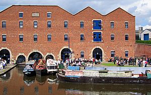
Ashton-under-Lyne became a hub for three canals in the 1790s. This was because it was important for coal mining. The Ashton Canal was built first, from 1792 to 1797. It connected Manchester to Ashton. The Peak Forest Canal was built from 1794 to 1805. It connected the Portland Basin to the Peak District. The Huddersfield Narrow Canal was built from 1794 to 1811. It allowed trade between Manchester and Hull.
When railways came in the 1800s, canals became less important. Railways were faster and cheaper. By the mid-1900s, no more goods were carried on the canals. The Huddersfield Canal was restored and reopened in 2001. Now, all three canals are used for leisure.
Trains and Stations
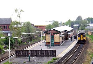
The main train station in Ashton is Ashton-under-Lyne railway station. It opened in 1846. It has regular trains to Manchester and Huddersfield.
Ashton used to have three train stations. Only one remains today. The other two, Park Parade and Oldham Road, closed in the 1950s.
Trams and Buses
In 1881, horse-drawn trams started running through Ashton. They went between Stalybridge and Audenshaw. Later, electric trams were used. The first bus service in Ashton started in 1923. Buses became more popular than trams. The last electric tram service in Ashton ran in 1938.
Trams returned to Ashton in October 2013. The Manchester Metrolink tram system opened a new line. The Ashton-under-Lyne tram stop is in the town centre. It is the end of the line that goes to Manchester Piccadilly. There are also other tram stops nearby, like Ashton West and Ashton Moss.
Education in Ashton-under-Lyne
As of 2019, Ashton-under-Lyne has ten nursery schools. It also has sixteen primary schools. There are two secondary schools. In 2006, the council started a plan to improve education. They opened six new secondary schools.
One of the changes was to close two schools. These were Hartshead Sports College and Stamford Community High School. They were replaced by a new academy. This new school, now called Great Academy Ashton, opened in 2008.
The other secondary school is St Damian's RC Science College. It was founded in 1963. It teaches about 800 students aged 11–16. A new building for the school opened in 2011.
Ashton Sixth Form College is for older students. It has 1,650 students aged 16–18. Tameside College also offers further education. It has campuses in Ashton-under-Lyne and other towns.
Public Services
In the early 1800s, Ashton needed a new water supply. The river was polluted, and wells weren't enough. A private company started piping water in 1825. But many homes still lacked proper drainage. Today, United Utilities manages water and waste water.
The first power station in Tameside was built in 1899. It provided electricity for the area.
Home Office policing in Ashton is handled by the Greater Manchester Police. Their main office for Tameside is in Ashton. Public transport is managed by Transport for Greater Manchester. The Greater Manchester Fire and Rescue Service provides fire and rescue services. They have a station on Slate Lane.
Tameside General Hospital is a large NHS hospital. It is on the edge of town. The North West Ambulance Service provides emergency medical transport.
See also
 In Spanish: Ashton-under-Lyne para niños
 | Laphonza Butler |
 | Daisy Bates |
 | Elizabeth Piper Ensley |


