
Werneth Low facts for kids
Quick facts for kids Werneth Low |
|
|---|---|

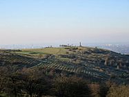
Werneth Low, showing the cenotaph, and the Greater Manchester Urban Area in the background.
|
|
| Highest point | |
| Elevation | 279 m (915 ft) |
| Prominence | c. 112 m |
| Geography | |

Werneth Low
Location in Greater Manchester
|
|
| Location | Greater Manchester, England |
| Parent range | Pennines |
| OS grid | SJ968930 |
| Topo map | OS Landranger 109 |
Werneth Low (pronounced WUR-nəth) is a cool hill in Greater Manchester, England. It's part of the Pennines mountain range. This hill sits right on the edge of Stockport and Tameside. It reaches a height of about 279 meters (915 feet).
You'll find several villages around the sides of Werneth Low. These include Woodley, Greave, Gee Cross, Mottram, and Romiley.
Even though it's called a "low," it's actually a hill! In northern England, "low" is just another word for a hill. So, don't let the name fool you.
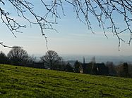
Werneth Low gives you amazing views of the whole Greater Manchester Urban Area. On a clear day, you can even spot the Winter Hill transmitting station. If you look south, you might see Stockport town centre, parts of Wythenshawe, and even the Welsh Mountains!
Most of Werneth Low is looked after by two groups. These are the Hyde War Memorial Trust and Tameside Council. The Trust helps organize special events like Remembrance Day services. It was created to protect Werneth Low for the people of Hyde. It also serves as a lasting memory for the 710 men from Hyde who died in World War I.
From the top of Werneth Low, you can see many famous buildings. These include Manchester's Deansgate Square and the Beetham Tower. You might also spot the Oldham Civic Centre. If you look from the south-western side, you can even see the huge radio telescope at Jodrell Bank Observatory.
Contents
Discovering Werneth Low's Past
Ancient Finds on the Hill
People have found some really old items on Werneth Low. These include a flint knife and a stone mace head from the Bronze Age. That's a time from thousands of years ago!
There's also a place called Hangingbank. This might have been an Iron Age farmstead. It dates back to the first thousand years BC. It had two ditches around it, like a fence.
Roman Connections
A Roman road probably crossed Werneth Low a long time ago. This road would have connected Melandra to Astbury. However, experts haven't found the exact path of this road yet.
There's also proof of Roman activity on the hill. A piece of Roman pottery was found at Hangingbank. It dates back to the 2nd century AD. This suggests the farmstead stopped being used around that time. There might even have been a temporary Roman camp here.
What's in a Name?
The name Werneth comes from an old Welsh word, verno. This word means 'alder tree'. So, Werneth Low basically means 'the place where alder trees grow'.
Remembering History: The War Memorial and Park
In 1920, a farm and its land were bought by the Hyde Borough Council. This was for a special purpose. In 1921, Hyde's main war memorial was officially opened. It stands on Werneth Low to honor those who served.
From 1962 to 1968, a Royal Observer Corps post was active here. This group helped warn people about enemy aircraft. They also watched for nuclear attacks on the United Kingdom.
In the late 1980s, a big effort was made to create Werneth Low country park. This park covers about 80 hectares (200 acres). It was officially opened in 1980. Many groups worked together to make this park happen.
Getting to Werneth Low
Werneth Low used to have a bus service, number 304. This bus ran on Mondays, Wednesdays, and Saturdays. But since January 31, 2010, the bus route changed. Now, Werneth Low doesn't have any public transport.
Gallery
-
Croft Field with Werneth Low's visitors' centre in the background.
-
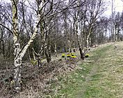
Woodland near Hanging Bank
-
From Higham Lane looking north.
-
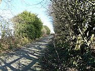
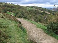
Footpath to Hanging Bank.
-
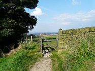
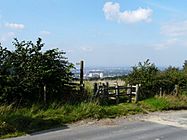
Gate to Rye Field.
-
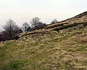
Werneth Low's Hanging Bank.
-
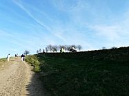
Towards the top of Hacking Knife.
-
Looking east from Werneth Low towards Mottram with the hills of the Peak District in the background.
-
Looking west along the Low, with the Hyde Cenotaph in the background.
-
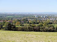
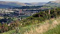
Looking north-west from Werneth Low towards Manchester city centre.
-
Looking north-west along the top of the Low.
-
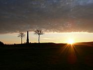
Sunrise from the top of Werneth Low.


