
Andrews, North Carolina facts for kids
Quick facts for kids
Andrews, North Carolina
|
||
|---|---|---|

Main Street
|
||
|
||

Location of Andrews, North Carolina
|
||
| Country | United States | |
| State | North Carolina | |
| County | Cherokee | |
| Established | 1890 | |
| Incorporated | 1905 | |
| Named for | Col. Alexander Boyd Andrews | |
| Area | ||
| • Total | 1.72 sq mi (4.46 km2) | |
| • Land | 1.72 sq mi (4.46 km2) | |
| • Water | 0.00 sq mi (0.00 km2) | |
| Elevation | 1,805 ft (550 m) | |
| Population
(2020)
|
||
| • Total | 1,667 | |
| • Density | 968.62/sq mi (373.93/km2) | |
| Time zone | UTC-5 (Eastern (EST)) | |
| • Summer (DST) | UTC-4 (EDT) | |
| ZIP code |
28901
|
|
| Area code(s) | 828 | |
| FIPS code | 37-01380 | |
| GNIS feature ID | 2405151 | |

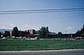
Andrews is a small town located in Cherokee County, North Carolina, in the United States. In 2020, about 1,667 people lived there. The town is named after Colonel Alexander Boyd Andrews, who helped bring the railroad to the area.
.jpg)
Contents
History of Andrews
Before Europeans arrived, the Valley River area was home to the Muscogee people. They built special platform mounds in the middle of their towns. There were at least 14 of these mounds in the area where Andrews is now. By the 1700s, the Cherokee people moved into the area and took over these towns. Many of the towns kept their original names.
Andrews was once the site of two important Cherokee towns called Tomotla and Konohete. The meaning of Tomotla is not known today. But Konohete, or Gu'nahitun'ya, means "Long Place" or "Long Valley." One of the mounds, called the Andrews Mound, was still there until 1975. Sadly, it was removed by the landowner after it was added to a list of important historical places. Other mounds in the area were also destroyed over time.
The area was first known as Jamesville, then the Whitaker Settlement. This name honored an early settler, James Whittaker. The Old Tatham House, built in 1833, is the oldest building still standing in the county. In 1852, the first factory in Cherokee County, a tannery, was started near Andrews. The town's first school was a log building built in the early 1880s. In the late 1880s, Colonel Alexander Boyd Andrews bought land to build a supply center for the railroad. Trains started coming to Andrews in 1891.
How the Town Was Established
.jpg)
In 1905, Andrews officially became a town. David Samuel Russell was chosen as its first mayor. Some historic buildings in Andrews, like the Franklin Pierce Cover House, First Baptist Church, and Walker's Inn, are listed on the National Register of Historic Places. The Andrews Public School opened in 1906, and classes began in 1907. This school building was used until 1961.
After some African-American families moved from Cumming, Georgia, in 1912, some came to Andrews. They started a community called Happytop. A Carnegie library was built in Andrews in 1914. It was later replaced by the current Andrews Public Library building in 1979. The library joined the Nantahala Regional Library system in 1940.
Andrews was also the home of the Wilhide brothers, Robert M. and Wilfred W. Wilhide. They were pilots in the U.S. Marine Corps during World War II. Both brothers were lost during missions near Okinawa. A memorial for them can be found in the Valleytown cemetery and at Veterans Memorial Park in Andrews.
In 1920, the Peavine Railroad was finished, connecting Andrews to Hayesville. It mostly carried lumber and was taken apart in 1951. Passenger train service to Andrews ended in 1948.
Andrews in Recent Times
.jpg)

The town's first hospital was started by Dr. Van Gorder. In 1956, a larger hospital called the District Memorial Hospital was built. It closed in 2003 and was later taken down. Today, people in Andrews can go to Erlanger Western Carolina Hospital in Peachtree, which is about 12 miles away.
Industrial Opportunities, Inc. (IOI) started in 1974. This group helps adults with disabilities find jobs making different products. IOI moved to Andrews in 2003. Their factory building was once home to the H.D. Lee company, which made clothing. Other factories in Andrews included Baker Furniture and Owenby Manufacturing.
In 1976, the West End Plaza shopping center opened. Another shopping center, Andrews Town Centre, opened in 1990. A new four-lane highway was built around Andrews in the late 1970s, making travel easier. The town's water system was also improved over the years. In 2018-2019, Andrews hosted the last "Possum Drop" event in North Carolina.
Mayors of Andrews
Andrews has had several mayors since it became a town:
- David Samuel Russell (1905–c.1928)
- J.H. Christy (1929–)
- D.S. Russell (1931–)
- D.H. Tillitt (c.1939)
- R.T. Heaton (c.1943)
- Percy B. Ferebee (c.1961–1966)
- Ty Burnette (1971–1985)
- Mitch Rhinehardt (2001–)
- Johnny Brown
- Nancy Curtis (2013–2017)
- James Reid (2017–present)
Geography of Andrews
Andrews is located in the northeastern part of Cherokee County. It sits on the south side of the Valley River. This river flows into the Hiwassee River, which is part of the larger Tennessee River system.
Major roads like U.S. Routes 19, 74, and U.S. Route 129 go around the northern edge of the town. These highways connect Andrews to other towns like Topton (8 miles northeast) and Murphy (15 miles southwest), which is the county seat.
According to the United States Census Bureau, Andrews covers a total area of about 4.2 square kilometers (1.72 square miles), all of which is land.
The area around Andrews is called Valleytown Township. It is surrounded by Graham County to the north, Clay County to the south, and Macon County to the east. Other towns in this area include Marble and Topton.
Climate in Andrews
| Climate data for Andrews, North Carolina, 1991–2020 normals, extremes 1909–2008 | |||||||||||||
|---|---|---|---|---|---|---|---|---|---|---|---|---|---|
| Month | Jan | Feb | Mar | Apr | May | Jun | Jul | Aug | Sep | Oct | Nov | Dec | Year |
| Record high °F (°C) | 78 (26) |
81 (27) |
86 (30) |
90 (32) |
96 (36) |
100 (38) |
100 (38) |
98 (37) |
98 (37) |
94 (34) |
88 (31) |
76 (24) |
100 (38) |
| Mean daily maximum °F (°C) | 50.0 (10.0) |
54.4 (12.4) |
61.9 (16.6) |
69.7 (20.9) |
77.3 (25.2) |
83.7 (28.7) |
86.2 (30.1) |
86.0 (30.0) |
81.6 (27.6) |
72.4 (22.4) |
61.2 (16.2) |
53.4 (11.9) |
69.8 (21.0) |
| Daily mean °F (°C) | 38.4 (3.6) |
41.5 (5.3) |
48.3 (9.1) |
55.6 (13.1) |
63.9 (17.7) |
71.1 (21.7) |
74.3 (23.5) |
73.4 (23.0) |
68.6 (20.3) |
57.9 (14.4) |
47.3 (8.5) |
41.3 (5.2) |
56.8 (13.8) |
| Mean daily minimum °F (°C) | 26.7 (−2.9) |
28.6 (−1.9) |
34.8 (1.6) |
41.6 (5.3) |
50.6 (10.3) |
58.5 (14.7) |
62.4 (16.9) |
60.8 (16.0) |
55.7 (13.2) |
43.4 (6.3) |
33.5 (0.8) |
29.1 (−1.6) |
43.8 (6.6) |
| Record low °F (°C) | −19 (−28) |
−11 (−24) |
−4 (−20) |
15 (−9) |
23 (−5) |
33 (1) |
42 (6) |
41 (5) |
26 (−3) |
16 (−9) |
0 (−18) |
−4 (−20) |
−19 (−28) |
| Average precipitation inches (mm) | 5.79 (147) |
5.87 (149) |
5.42 (138) |
4.67 (119) |
5.51 (140) |
5.57 (141) |
5.02 (128) |
5.46 (139) |
4.85 (123) |
3.47 (88) |
5.40 (137) |
6.08 (154) |
63.11 (1,603) |
| Average precipitation days (≥ 0.01 in) | 9.9 | 9.6 | 11.2 | 9.7 | 10.9 | 11.5 | 11.9 | 11.2 | 8.3 | 7.5 | 9.9 | 10.8 | 122.4 |
| Source 1: NOAA (precip/precip days 1981–2010) | |||||||||||||
| Source 2: XMACIS2 | |||||||||||||
Population of Andrews
| Historical population | |||
|---|---|---|---|
| Census | Pop. | %± | |
| 1910 | 936 | — | |
| 1920 | 1,634 | 74.6% | |
| 1930 | 1,748 | 7.0% | |
| 1940 | 1,520 | −13.0% | |
| 1950 | 1,397 | −8.1% | |
| 1960 | 1,404 | 0.5% | |
| 1970 | 1,384 | −1.4% | |
| 1980 | 1,621 | 17.1% | |
| 1990 | 2,551 | 57.4% | |
| 2000 | 1,602 | −37.2% | |
| 2010 | 1,781 | 11.2% | |
| 2020 | 1,667 | −6.4% | |
| 2022 (est.) | 1,690 | −5.1% | |
| U.S. Decennial Census | |||
2020 Census Information
In 2020, the town of Andrews had 1,667 people living there. These people lived in 714 households, with 400 of them being families.
| Race | Number | Percentage |
|---|---|---|
| White (non-Hispanic) | 1,388 | 83.26% |
| Black or African American (non-Hispanic) | 21 | 1.26% |
| Native American | 25 | 1.5% |
| Other/Mixed | 94 | 5.64% |
| Hispanic or Latino | 139 | 8.34% |
2010 Census Information
In 2010, the total population of Andrews was 1,781 people. They lived in 780 households, and 452 of these were family homes. The town had about 1,090 people per square mile.
Transportation in Andrews
The Western Carolina Regional Airport is a public airport located about 2 miles (3.2 km) west of downtown Andrews.
Andrews used to have railroad service from 1891 until the 1980s. The Great Smoky Mountains Railroad offered passenger trips from Dillsboro, North Carolina to Andrews from 1988 until 2010.
Law Enforcement

The Andrews Police Department is located in a stone building built in the 1940s. This building also served as the town hall until 2023. The police department works to keep the town safe for everyone.
Education in Andrews

The town of Andrews has three schools that are part of the Cherokee County School System:
- Andrews Elementary School
- Andrews Middle School
- Andrews High School
Until the early 1960s, all Andrews schools were located close to each other. A map from 1935 shows the school buildings on Walnut Street (now Jean Christy Avenue) and Fourth Street. The current high school and elementary school buildings appeared on maps starting in 1975.
.jpg)

Andrews Elementary School (AES) serves students from Pre-Kindergarten through 5th grade. The current school building was built in 1951. It has been expanded twice. In 1975, new classrooms, a cafeteria, a library, and a separate building for Pre-K were added. The school's most recent expansion was in 2003, when a gymnasium was added.
Andrews High School (AHS) serves students from 9th through 12th grade. The current high school building was built in 1963. From 1963 to 1999, Andrews High School included both junior high and senior high students.
In 1998, a new campus was built for Andrews Middle School. This school opened on August 9, 1999, and serves middle school students.
Before 1969, Andrews had its own school district, separate from the county. Andrews was the first town in Cherokee County to have a school bus in 1926. The individual school districts later joined with Cherokee County Schools in 1969.
Andrews City Schools Superintendents
- Isham Barney Hudson (1935–1951)
- Charles O. Frazier (c.1962–1969)
After the school districts merged in 1969, John Jordan became the superintendent for all of Cherokee County.
Media
Andrews used to have its own weekly newspaper called the Andrews Journal. It was published from 1959 until January 1, 2019. At that time, it joined with the Cherokee Scout newspaper in Murphy. Now, Andrews does not have its own newspaper. The mayor started offering a quarterly e-newsletter to keep residents informed.
Notable people
- Rick Blaylock – songwriter for the song Prop Me Up Beside the Jukebox (If I Die)
- Dave Bristol – a manager in Major League Baseball
- Charles Frazier – an author who won the National Book Award, grew up in Andrews
- Dr. Dan Lunsford – president of Mars Hill University from 2002 to 2018
- Jeffrey Postell - a law enforcement officer and politician
Images for kids
-
District Memorial Hospital on Whitaker Lane, around 1979.
.jpg)
See also
 In Spanish: Andrews (Carolina del Norte) para niños
