
Marble, North Carolina facts for kids
Quick facts for kids
Marble, North Carolina
|
|
|---|---|
.jpg) |
|

Marble, North Carolina
Location in North Carolina
|
|
| Country | United States |
| State | North Carolina |
| County | Cherokee County, North Carolina |
| Area | |
| • Total | 1.10 sq mi (2.84 km2) |
| • Land | 1.10 sq mi (2.84 km2) |
| • Water | 0.00 sq mi (0.00 km2) |
| Elevation | 1,680 ft (510 m) |
| Population
(2020)
|
|
| • Total | 278 |
| • Density | 253.65/sq mi (97.89/km2) |
| Time zone | UTC-5 (Eastern (EST)) |
| • Summer (DST) | UTC-4 (EDT) |
| ZIP codes |
28905
|
| Area code(s) | 828 |
| FIPS code | 37-41220 |
| GNIS feature ID | 2628642 |
Marble is a small community in Cherokee County, North Carolina, in the United States. It's called a 'census-designated place' (CDP) because the government tracks its population. In 2020, about 278 people lived there.
Contents
A Look at Marble's Past
First People: The Cherokee Nation
Long ago, before settlers arrived, the land that is now Cherokee County was home to the Cherokee people. These Native Americans lived in the southeastern United States, mainly in Georgia, the Carolinas, and eastern Tennessee.
The Cherokee were known as one of the "Five Civilized Tribes." This name was given to them because they adopted some cultural and technological practices from European-Americans. The county's name, Cherokee, comes from these original inhabitants.
How Cherokee County Was Formed
In 1791, two important people, Colonel David Vance and General William Lee Davidson, asked the North Carolina House of Commons to create a new county. They wanted to combine parts of Burke County and Rutherford County.
The new county was first going to be called "Union." But its name was changed to "Buncombe" to honor Col. Edward Buncombe, a hero from the Revolutionary War. This new county was created on January 14, 1792. It was so big that people often called it the "State of Buncombe." About 1,000 people lived there at the time.
Later, in 1808, the western part of Buncombe County became Haywood County. Then, in 1838, Macon County was formed from the western side of Haywood County. Finally, in 1849, Cherokee County was created from Macon County.
Why is it Called Marble?
Marble got its name because of the many marble quarries in the area. A quarry is a place where stone is dug out of the ground. Today, none of these quarries are still working, and they have all filled up with water.
Life in Marble
Population and People
| Historical population | |||
|---|---|---|---|
| Census | Pop. | %± | |
| 2020 | 278 | — | |
| U.S. Decennial Census | |||
In 2010, there were 321 people living in Marble. Out of these, 162 were male and 159 were female. The population density was about 293 people for every square mile.
Jobs and Money
Many people in Marble work in different types of jobs. About 19% work in management or professional fields. Another 19% work in the service industry. About 17% have jobs in sales or office work. Around 15% work in construction, mining, and maintenance. The rest, about 28%, work in production and transportation.
In 2000, a small number of people, about 1.7%, were unemployed. The average household income was around $28,553 per year.
Learning in Marble
Schools and Colleges Nearby
Marble is close to Tri-County Community College. This college has campuses in Peachtree, Robbinsville, and even one in Marble itself.
Public Schools for Kids
The public schools in Marble are part of the Cherokee County Schools system. This system is managed by the Cherokee County Board of Education. As of 2024, the main office for Cherokee County Schools is located in the building that used to be the elementary school in Marble.
Before 2017, children in Marble went to Marble Elementary School. This school taught students from pre-kindergarten up to 5th grade. Since 2017, students from Marble attend Andrews Elementary, Middle, and High School in the nearby town of Andrews.
Getting Around Marble
Main Roads
Marble is located along US 19/129/74. This highway runs between the towns of Andrews and Murphy. Airport Road (SR 1428) also goes through Marble. This road used to be part of US 19 until 1979. Another road, Slow Creek Road (141), goes south towards a hospital in Peachtree.
Local Airport
The Western Carolina Regional Airport (also known as the Murphy Airport or Andrews-Murphy Airport) is about 4.5 miles east of Marble. It's a convenient airport for the area.
Marble's Natural Surroundings
Land and Scenery
Marble is located in the southeastern United States, in the far western part of North Carolina. It's about halfway between Atlanta, Georgia and Knoxville, Tennessee. The community is nestled in the Blue Ridge Mountains. This mountain setting helps Marble keep its rural feel. You can find lots of wildlife here, like bears, deer, and even elk that have been brought back to the area.
The total area of Marble is about 2.8 square kilometers (1.1 square miles).
Weather and Climate
Marble has a humid subtropical climate. This means it has hot, humid summers and mild winters. Sometimes, winters can get cold, but usually they are not too harsh compared to other parts of the country.
In July, the average high temperature is around 85°F (29°C). The average low is about 55°F (12.8°C). Temperatures can sometimes go above 100°F (38°C). January is the coldest month, with an average high of 48°F (9°C) and a low of 33°F (0.6°C).
Marble gets a lot of rain throughout the year, about 55.9 inches (1,420 mm) annually. Heavy snowstorms, or blizzards, are rare but can happen. For example, a big storm in March 1993, called the 1993 Storm of the Century, affected the entire Eastern United States.
| Month | Jan | Feb | Mar | Apr | May | Jun | Jul | Aug | Sep | Oct | Nov | Dec |
|---|---|---|---|---|---|---|---|---|---|---|---|---|
| Average High Fº(Cº) |
|
|
|
|
|
|
|
|
|
|
|
|
| Average Low Fº(Cº) |
|
|
|
|
|
|
|
|
|
|
|
|
| Precipitation Inches(mm) |
|
|
|
|
|
|
|
|
|
|
|
|
Culture and Community
Fun Events and Celebrations
Every two years, the Andrews-Murphy Airport, which is about 4 miles northeast of Marble, hosts the Celebration of Flight air show. It's a big event where you can see many different types of aircraft, from old vintage planes to modern high-tech ones.
Religion in the Area
Religion has always been an important part of life in the Appalachian region, where Marble is located. Most people in Marble and nearby communities are Christian. Many churches belong to the Baptist faith. Some local churches include Marble Springs Baptist Church, Emanuel Baptist Church, Fair-view Church, and Kingdom Hall-Jehovah's Witness.
News and Entertainment
Marble and the surrounding area have a few local television stations. There are also many local radio stations that play different kinds of music, sports, news, and talk shows. Plus, there are three local newspapers.
One local TV station is W31AN (Channel 31), based in Murphy.
There are eight local radio stations that serve Marble. Some are based in Murphy, like WCVP-AM (600), WCNG-FM (102.7), and WKRK-AM (1320). Others are in nearby towns like Robbinsville (WCVP-FM 95.9) and Franklin (WFSC-AM 1050, WPFJ-AM 1480, WFQS-FM 91.3, and WNCC 96.7).
The only newspaper in Cherokee County is the Cherokee Scout, which is based in Murphy.
Well-Known People from Marble
- Lloyd R. Welch, who was the fourth Principal Chief of the Eastern Band of Cherokee Indians.
- Roger West, a local politician.
Nearby Towns and Cities
Images for kids
-
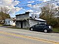
An old store in Marble, North Carolina.
See also
 In Spanish: Marble (Carolina del Norte) para niños
