Arlington Ridge, Virginia facts for kids
Quick facts for kids
Arlington Ridge, Virginia
|
|
|---|---|

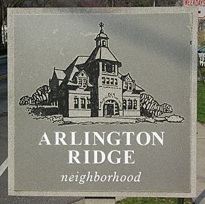
Arlington Ridge Community Sign
|
|
| Country | |
| State | |
| County | |
| Time zone | UTC-5 (EST) |
| • Summer (DST) | UTC-4 (EDT) |
| ZIP Codes |
22202
|
| Area code(s) | 703 |
| Police District | 2D |
| Parking Zones | 01, 1B, 1C |
| Civic Associations | Arlington Ridge Civic Association |
| Firestation | Station 5 – Jefferson District / Aurora Highlands |
| Library | Aurora Hills Library |
| Parks | 19th Road South Park; Fort Scott Park; Oakcrest Park; South Ives Streen Park; James W. Haley Park; Prospect Hills Park |
Arlington Ridge is a neighborhood in Arlington County, Virginia. It is located near important landmarks. To its north is The Pentagon, and to its west is the Army Navy Country Club. The city of Alexandria is to its south.
The main road here is Arlington Ridge Road. This road is known for its large houses and high elevation. From here, you can see great views of Washington, D.C. and the areas around it.
Arlington Ridge has two important historical sites. The first is the Hume School, which is on the National Register of Historic Places. It now holds the Arlington Historical Society and Museum. The second is Fort Scott, an Arlington County Historic District. Today, Fort Scott is a park.
Contents
- Geography of Arlington Ridge
- Hume School: A Historic Building
- The Little Tea House Restaurant
- Prospect Hill: A Key Viewpoint
- Fort Albany: A Civil War Defense
- Fort Scott: Protecting the Capital
- Revolutionary War History
- Arlington Ridge and the Civil War
- Arlington Ridge Road: A Changing Path
- Solving Parking Problems
- Arlington Ridge in Movies
Geography of Arlington Ridge
Arlington Ridge is a slightly raised area of land. It stretches from just above Alexandria north towards Georgetown. Parts of the ridge were flattened to build the Pentagon and Shirley Highway. Scientists think this ridge might have been the edge of the Potomac River long ago.
Hume School: A Historic Building
The Hume School was built in 1891. It is the oldest school building in Arlington County, Virginia. It was used as a school until 1958. Now, it is home to the Arlington Historical Society. This building is listed on the National Register of Historic Places.
The Little Tea House Restaurant
The Little Tea House Restaurant was a famous spot on Arlington Ridge Road. It opened in 1920 and closed in 1963. The building was later taken down for new apartments. Many famous people visited the restaurant. These included Eleanor Roosevelt, Amelia Earhart, and Oliver Wendell Holmes.
The restaurant was known for its beautiful gardens and views. It was also one of the first places in Arlington where people of different backgrounds could meet. Gertrude Crocker started the restaurant. She wanted to be independent and her own boss. Later, Gertrude Allison took over the business. For a while, it was called Allison's Little Tea House.
A postcard from the restaurant described it as a place for "gracious eating." It had old brass, copper, and rare cookbooks. A small stone tower is the only part of the Little Tea House still standing today. It is now used as a maintenance building. This tower reminds people of the area's rich history.
Prospect Hill: A Key Viewpoint

At the northern end of Arlington Ridge is Prospect Hill. This is an important historical site in Arlington County. A sign at Prospect Hill tells its story:
The large house that used to be here was built in 1841. It was owned by James Roach, a successful builder. He supplied materials for many big projects, like the Aqueduct Bridge. His property was damaged during the building of Fort Runyon and Fort Albany in 1861. The house was torn down in 1965.
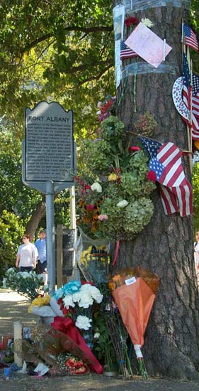
Prospect Hill offers a clear view of the Pentagon and the Washington, D.C., skyline. This makes it a popular spot for photographers. After the September 11 attacks, many photos of the damaged Pentagon were taken from here. People also created a temporary memorial with flowers at this spot.
Because of its high location, Prospect Hill was a good place for defense during the Civil War. It was chosen as the site for Fort Albany.
Fort Albany: A Civil War Defense
Fort Albany was a Civil War fort built on Prospect Hill. It was part of the defenses for Washington, D.C. during the war. No parts of the fort remain today. However, its location is a designated historic site in Arlington County. A sign at the site explains:
Fort Albany was built in May 1861. It was an earthwork fort designed to protect the approach to the Long Bridge. It had walls 429 yards long and could hold 12 guns. Even after other forts were built nearby, Fort Albany's powerful guns supported them. The land where the fort stood was changed during the building of the Henry G. Shirley Memorial Highway in 1942.
Fort Scott: Protecting the Capital
Fort Scott was built by the Union Army in May 1861. It was a small, separate fort designed to protect the southern side of Washington's defenses. It was named after General Winfield Scott, a leader in the Army. Fort Scott was one of many forts built to keep the capital safe. Later, it became an inner fort when more defenses were built further west. The fort's perimeter was 313 yards, and it had spots for 8 guns.
Today, Fort Scott is recognized as an Historic District.
Revolutionary War History
Army Navy Drive separates the Arlington Ridge community from the Army Navy Country Club. This road used to be called Old Georgetown Road.
In September 1781, Continental Army troops marched along this road. They were led by George Washington and French General Rochambeau. They were on their way to Yorktown, Virginia. There, they won a major victory against the British in the Siege of Yorktown during the American Revolutionary War.
Arlington Ridge and the Civil War
Arlington Ridge played a special role in the Civil War:
- It was the first Confederate-held land captured by the Union Army.
- It was the longest-held Confederate territory during the war.
- It was the final gathering place for many Union Army soldiers.
Capturing The Ridge
Arlington Ridge was very important because it was high up and close to Washington, D.C.. If the Confederate Army had controlled it, they could have easily attacked the capital. On May 23, 1861, Virginia voted to leave the Union. The next day, Union troops crossed the Potomac River to take control of Arlington Heights.
To the south, Colonel Elmer E. Ellsworth led his troops to capture Alexandria, Virginia. He saw a Confederate flag flying from the Marshall House Inn. Ellsworth went to remove the flag, but the inn owner shot and killed him. The owner was then killed by a Union soldier.
To the north, Colonel Orlando B. Wilcox led his troops. They landed near what is now Arlington National Cemetery. Wilcox and his men quickly took over the Lee/Custis House. This was the home of General Robert E. Lee, who had recently left the Union Army. Wilcox then moved south and met Ellsworth's men. Together, they secured Arlington Heights. This was the Union's first successful capture of Confederate land.
Once the Union controlled the area, engineers quickly built forts to protect Washington. These forts became the first line of defense for the capital. One of these forts, Fort Scott, was built on the highest point of The Ridge. Today, a park stands on this site.
Final Army Encampment
Near the end of the Civil War, on May 23 and 24, 1865, a large military parade was held in Washington, D.C.. Most of the major units of the Union Army took part. They camped on Arlington Ridge before the parade. After the parade, many soldiers were sent home. For many, Arlington Ridge was their last camp during the war.
Arlington Ridge Road: A Changing Path
Arlington Ridge Road used to be called the Alexandria-Georgetown Road. Today, it runs from South Glebe Road to Army Navy Drive. Before the The Pentagon and Shirley Highway (now Interstate 395) were built, Arlington Ridge Road was a main road that went all the way to Rosslyn.
From the 1890s to the 1920s, electric trolleys ran in Arlington. One of these trolley lines, the East Arlington Branch Line, traveled along a part of Arlington Ridge Road. This section is now inside Arlington National Cemetery.
In 1934, a plan was made to change the road system. This plan aimed to expand Arlington National Cemetery by removing the part of Arlington Ridge Road next to it. The plan was approved, but not much happened for a while.
In 1941, a new plan was made. It included a new route to the south, which became the Shirley Highway. When the U.S. entered World War II, construction sped up. Arlington Ridge Road was shortened to its current length. In the 1980s, the road was made even smaller, from four lanes to two. Sidewalks and grass areas were added.
Solving Parking Problems
The nearby area of Crystal City has many people who drive to work. To avoid paying for parking or because there wasn't enough space, many commuters parked on the streets of Arlington Ridge and Aurora Hills. This caused problems for the people living there.
Starting in 1968, the local groups in Arlington Ridge and Aurora Hills asked Arlington County for help. A special parking rule was created. Its goal was to:
- Reduce dangerous traffic from people parking on residential streets.
- Protect neighborhoods from pollution, noise, and trash from these cars.
- Make it easier for residents to get to their homes.
- Keep the neighborhoods peaceful and safe for everyone, especially children.
Crystal City fought these rules in court for many years. But in 1977, the United States Supreme Court made a final decision. This decision meant that communities across the country could now protect their streets from too much commuter parking. This was thanks to the efforts of the people of Arlington Ridge and Aurora Hills.
Arlington Ridge in Movies
The 1987 movie No Way Out starts with a long aerial shot. It flies over the National Mall, then The Pentagon, and finally down Arlington Ridge Road. It ends at a house where the main character is being questioned. In this scene, you can clearly see the Hume School, along with other famous landmarks.
 | Aaron Henry |
 | T. R. M. Howard |
 | Jesse Jackson |


