
Ashmore, Queensland facts for kids
Quick facts for kids AshmoreGold Coast, Queensland |
|||||||||||||||
|---|---|---|---|---|---|---|---|---|---|---|---|---|---|---|---|

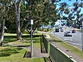
Lions Park along Currumburra Road, 2022
|
|||||||||||||||

Ashmore
Location in Gold Coast, Australia
|
|||||||||||||||
| Population | 12,415 (2021 census) | ||||||||||||||
| • Density | 1,826/km2 (4,730/sq mi) | ||||||||||||||
| Established | 1972 | ||||||||||||||
| Postcode(s) | 4214 | ||||||||||||||
| Area | 6.8 km2 (2.6 sq mi) | ||||||||||||||
| Time zone | AEST (UTC+10:00) | ||||||||||||||
| Location |
|
||||||||||||||
| LGA(s) | City of Gold Coast | ||||||||||||||
| State electorate(s) | Southport | ||||||||||||||
| Federal Division(s) | Moncrieff | ||||||||||||||
|
|||||||||||||||
Ashmore is a suburb located on the Gold Coast in Queensland, Australia. It is part of the City of Gold Coast. In 2021, Ashmore was home to 12,415 people.
Contents
Ashmore's Past
Ashmore has an interesting history. In the late 1800s, the land around Ashmore and Benowa was used for farming. There was even a sugar manufacturing plant here.
In the 1970s, a man named Jim Donellon bought land and started building homes. This new area became known as Ashmore Village. The Ashmore Plaza Shopping Centre also opened around this time.
Many schools opened in Ashmore during the late 1970s and 1980s:
- Ashmore State School opened on 23 January 1978.
- Trinity Lutheran Primary School started on 27 January 1981.
- Bellevue Park State School opened on 24 January 1983. It was originally in Southport but is now part of Ashmore.
- Trinity Lutheran College opened its secondary school campus on 28 January 1987. Later, in 2002, the primary and secondary schools joined together to form one college.
Ashmore officially became a named suburb on 1 December 1982.
Who Lives in Ashmore?
Ashmore is a growing suburb with many people from different backgrounds.
- In 2011, there were 11,586 people living here.
- The average age of people in Ashmore was 40 years old.
- Most people (about 65.7%) were born in Australia.
- Other people came from countries like New Zealand (9.2%), England (4.9%), and Japan (1.1%).
- English is the main language spoken at home (82.9%). Other languages include Japanese, Korean, and German.
The population has continued to grow:
- In 2016, Ashmore had 11,910 people.
- By 2021, the population reached 12,415 people.
Ashmore's Natural Environment
Before Ashmore was developed, it had many natural areas. There were tall forests with trees like blackbutt. These forests are now very rare in Queensland.
The area where Royal Pines resort is now used to have large forests and wetlands. These wetlands were like mini Kakadu! They had lilypads, swamp rainforests, and old paperbark trees. Many birds lived there, including jabiru (a type of stork), magpie geese, and spoonbills.
Over the years, much of the natural land has been cleared for buildings and farms. Today, only small parts of the original natural areas remain.
Schools in Ashmore
Ashmore has several schools for young people:
- Ashmore State School is a government primary school for students from Prep to Year 6. It is located on Currumburra Road.
- Bellevue Park State School is another government primary school for Prep to Year 6 students. You can find it on Sapium Road.
- Trinity Lutheran College is a private school. It has two campuses:
- The Prep to Year 5 campus is on Cotlew Street.
- The Years 6 to 12 campus is on Ashmore Road.
While Ashmore has primary schools, there isn't a government high school right in the suburb. Students usually go to nearby high schools like Keebra Park State High School in Southport, Benowa State High School in Benowa, or Nerang State High School in Nerang.
The Gold Coast Institute of TAFE also has a campus in Ashmore. It offers vocational training for older students.
Shopping and Services
Ashmore has great places to shop and find services.
- The main shopping area is on Southport-Nerang Road. Here you'll find the Ashmore City Shopping Centre.
- There are also many factory outlet stores where you can buy well-known brands at lower prices.
- You can also find a local florist for flowers.
The Gold Coast City Council provides a mobile library service. This special library bus visits Ashmore Village Park (BMX Park) on Currumburra Road every two weeks.
Ashmore Uniting Church is a place of worship located at 144 Cotlew Street.
Getting Around Ashmore
Ashmore has public transport mainly through bus services.
- Several bus routes run through the suburb, connecting it to other parts of the Gold Coast.
- The number 741 bus travels between Australia Fair and Broadbeach South Station. It goes along Cotlew Street, Freda Street, and Heeb Street.
- The 738 bus runs every half hour between Griffith University and Broadbeach South Station. It also passes through Ashmore.
Major roads that help people get around Ashmore include:
- Cotlew Street
- Ashmore Road
- Currumburra Road
- Heeb Street
- Wardoo Street
- Benowa Road
- Nerang-Southport Road
Images for kids
-
Lions Park along Currumburra Road, 2022
