Athabasca County facts for kids
Quick facts for kids
Athabasca County
|
||
|---|---|---|

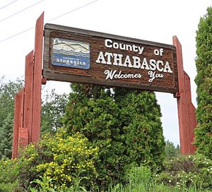
Welcome sign
|
||
|
||

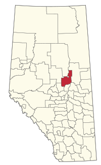
Location within Alberta
|
||
| Country | Canada | |
| Province | Alberta | |
| Region | Northern Alberta | |
| Planning region | Upper Athabasca | |
| Established | 1947 | |
| Incorporated | 1959 (County) | |
| Area
(2021)
|
||
| • Land | 6,111.3 km2 (2,359.6 sq mi) | |
| Population
(2021)
|
||
| • Total | 6,959 | |
| • Density | 1.1/km2 (3/sq mi) | |
| Time zone | UTC−7 (MST) | |
| • Summer (DST) | UTC−6 (MDT) | |
Athabasca County is a special type of local government area called a municipal district. It is located in north central Alberta, Canada. You can find it northeast of the city of Edmonton.
This area is part of what is known as Census Division No. 13. Before December 1, 2009, it had a slightly different name: the County of Athabasca No. 12.
Exploring Athabasca County's Geography
Communities and Localities in Athabasca County
Athabasca County is home to many different communities. These include towns, villages, and hamlets. They are all part of the county's landscape.
Urban Municipalities Near Athabasca County
These are towns and villages that are surrounded by Athabasca County. They have their own local governments.
- Villages
- Summer Villages
Summer villages are small communities. Many people visit them for holidays, especially in the summer.
- Bondiss
- Island Lake
- Island Lake South
- Mewatha Beach
- South Baptiste
- Sunset Beach
- West Baptiste
- Whispering Hills
Hamlets Within Athabasca County
Hamlets are smaller communities. They are directly governed by Athabasca County.
- Hamlets
- Atmore
- Breynat
- Caslan
- Colinton
- Donatville
- Ellscott
- Grassland
- Meanook
- Perryvale
- Rochester
- Wandering River
Localities and Lakes in Athabasca County
Localities are places that might not be official towns or hamlets. They are still recognized areas within the county.
- Localities
- Amber Valley
- Amesbury
- Athabasca Acres
- Athabasca Landing Settlement
- Balay Subdivision
- Baptiste Lake
- Big Coulee
- Blue Jay
- Century Estates
- Coolidge
- Dakin
- Deep Creek
- Frains
- Glenshaw
- Grosmont
- Kinikinik
- Lahaieville
- Lincoln
- Lyall Subdivision
- McNabb's
- Meadowbrook
- Meanock
- O'Morrow
- Paxson
- Pine Grove Estates
- Pleasant View
- Prosperity
- Richmond Park
- Sarrail
- Sawdy
- Spruce Valley
- West Wind Trailer Park
- White Gull
- Lakes
Understanding Athabasca County's Population
How Many People Live in Athabasca County?
Every few years, Statistics Canada counts how many people live in different areas. This is called a census. It helps us understand how communities are growing or changing.
In the 2021 Census, Athabasca County had a population of 6,959 people. These people lived in 2,832 homes. This number was a bit lower than in 2016.
In 2016, the county had 7,869 people living there. This was a small increase from 2011, when the population was 7,662.
What is Population Density?
Population density tells us how many people live in each square kilometer of land. It helps us know if an area is crowded or spread out.
Athabasca County covers a large area of about 6,111.3 square kilometers. In 2021, the population density was about 1.1 people per square kilometer. This means it's a very spread-out area with lots of open space.
 | James Van Der Zee |
 | Alma Thomas |
 | Ellis Wilson |
 | Margaret Taylor-Burroughs |


