Atkinsons Dam, Queensland facts for kids
Quick facts for kids Atkinsons DamQueensland |
|||||||||||||||
|---|---|---|---|---|---|---|---|---|---|---|---|---|---|---|---|

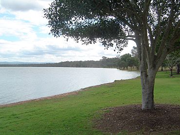
The shores of Lake Atkinson, 2011
|
|||||||||||||||
| Population | 191 (2021 census) | ||||||||||||||
| • Density | 7.15/km2 (18.5/sq mi) | ||||||||||||||
| Postcode(s) | 4311 | ||||||||||||||
| Area | 26.7 km2 (10.3 sq mi) | ||||||||||||||
| Time zone | AEST (UTC+10:00) | ||||||||||||||
| Location | |||||||||||||||
| LGA(s) | Somerset Region | ||||||||||||||
| State electorate(s) | Nanango | ||||||||||||||
| Federal Division(s) | Blair | ||||||||||||||
|
|||||||||||||||
Atkinsons Dam is a small rural area in Queensland, Australia. It is located within the Somerset Region. In 2021, about 191 people lived in Atkinsons Dam.
About Atkinsons Dam
The area of Atkinsons Dam is mostly covered by a large body of water. This water is known as Atkinson Dam (or Lake Atkinson).
The northern edge of this area is marked by a waterway called Buaraba Creek. This creek is a smaller stream that flows into Lockyer Creek.
History of the Area
A school once stood in Atkinsons Dam. It was called Atkinson's Lagoon Provisional School. This school first opened its doors on August 6, 1885.
Later, on January 1, 1909, it became a State School. However, the school eventually closed down in 1968. It was located near where Atkinsons Dam Road and Rocky Creek Road meet today.
Schools for Kids
There are no schools directly in Atkinsons Dam. Children living here usually go to primary schools in nearby towns.
- Coominya State School is to the north-east.
- Mount Tarampa State School is to the south-east.
- Kentville State School is to the south.
For high school, students often attend Lowood State High School. This school is located in the town of Lowood, which is to the south-east.
Fun Things to Do
Atkinson Dam Park is a great place to visit. It is located on the northern side of Lake Atkinson.
There is also a boat ramp available. This ramp is off Atkinson Dam Road. It allows people to launch their boats into the lake. The South East Queensland Water Corporation manages this boat ramp and the lake.
 | Ernest Everett Just |
 | Mary Jackson |
 | Emmett Chappelle |
 | Marie Maynard Daly |


