Beaver Hills (Alberta) facts for kids
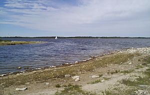
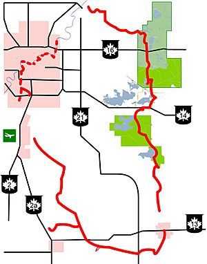
The Beaver Hills are a special area of rolling hills and forests in Central Alberta, just east of Edmonton. They are also known as the Beaver Hills Moraine or the Cooking Lake Moraine. This region covers about 1,572 square kilometers (about 607 square miles). It has a unique "knob and kettle" landscape, which means it has many small hills and dips filled with lakes.
The Beaver Hills are spread across five different counties: Strathcona, Leduc, Beaver, Lamont, and Camrose. Unlike the areas around them, the Beaver Hills are mostly undeveloped. They are protected by places like Elk Island National Park, the Cooking Lake–Blackfoot Provincial Recreation Area, and Miquelon Lake Provincial Park.
Nature in the Beaver Hills

The "hills" in the Beaver Hills are not very tall. They are just a bit higher than the land around them. This area looks rough and bumpy because of how it was formed during the end of the last ice age. When the glaciers melted, they left behind lots of gravel and boulders, creating the hills and hollows that filled with water to become lakes.
The plants and trees here are typical of a "dry mixedwood boreal forest". This is a special type of forest that sits between the main boreal forest to the north and the open grasslands to the south. Because of this mix, you can find animals from both the boreal forest and the grasslands living here. For example, you might see moose, black bears, and Canada lynx (from the forest). You might also spot sharp-tailed grouse and mule deer (from the grasslands). Nearby, you'll find Beaverhill Lake to the east and the North Saskatchewan River to the north.
People of the Beaver Hills
Indigenous Peoples and Fur Trade
For a long time, the Beaver Hills were an important place for Indigenous peoples who traveled between the open plains and the hills. It was a perfect spot to rest, hunt, fish, and gather resources. Because this area was not plowed for farming like other regions, many old archaeological sites remain. For example, over 200 Native sites have been found in Elk Island Park alone.
The Sarcee people were among the first known groups to live here after Europeans arrived. Later, before the year 1800, Cree people moved in from the east and became the main group in the area. The Cree called this region Amiskwaciy, which means "beaver hills" in their language. This is where the name "Beaver Hills" comes from!
The Cree people hunted and trapped animals like beaver to trade with European fur companies. They also continued their traditional hunting, gathering, and fishing. They even learned how to hunt buffalo using special techniques like buffalo pounds. Over time, many beavers and other animals were hunted out. Because of this, the Cree stopped living in the area permanently, but they still traveled through it.
Important trails used by Indigenous peoples and fur traders ran along the edges of the Beaver Hills. These included the Victoria Trail to the north and the Battle River Trail to the south. European explorers and mapmakers mentioned the Beaver Hills early on. Peter Fidler sketched them in 1793, and David Thompson's map in 1814 showed them as a safe place for both the Sarcee and Cree. Later, the Palliser Expedition in the 1850s and Joseph Tyrrell in the 1880s also wrote about this unique region.
 | Aurelia Browder |
 | Nannie Helen Burroughs |
 | Michelle Alexander |


