Bella Bella, British Columbia facts for kids
Quick facts for kids
Bella Bella
Waglisla
|
|
|---|---|

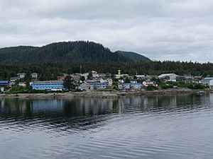
Bella Bella from the water
|
|
| Nickname(s):
The Rock
|
|
| Country | |
| Province | BC/BCE |
| Regional district | Central Coast |
| First settled | 7800–7000 BCE |
| Area | |
| • Total | 5.83 km2 (2.25 sq mi) |
| Elevation | 21 m (69 ft) |
| Population
(2021)
|
|
| • Total | 1,193 |
| • Density | 204.5/km2 (530/sq mi) |
| Time zone | UTC–8:00 |
| • Summer (DST) | UTC–7:00 (Pacific Daylight Time) |
| Postal code |
V0T 1Z0
|
| Area codes | 250, 778 236 |
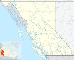
Bella Bella, also known as Waglisla, is a special community in British Columbia, Canada. It is the main home of the Heiltsuk people. This community is located on the east side of Campbell Island. It is part of the beautiful Central Coast region.
Bella Bella is about 181 kilometers (113 miles) north of Port Hardy on Vancouver Island. It's also about 144 kilometers (90 miles) west of Bella Coola. The community sits on Lama Passage, which is part of the Inside Passage. This passage is a busy water highway for boats, ships, and ferries. It connects the area to northern British Columbia and even Alaska. For the Heiltsuk people, Bella Bella is like their national capital.
The community was founded between 1897 and 1903. It has grown into an important center for the Heiltsuk Nation.
Contents
History of Bella Bella
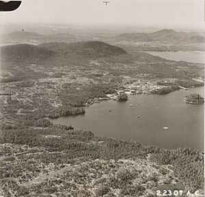
Bella Bella is a village of the Heiltsuk people on Campbell Island. Today, it is the main Heiltsuk community in their traditional lands. The village was first located at McLoughlin Bay. This is south of where Bella Bella is now. The community moved between 1898 and the early 1900s.
Heiltsuk stories say the move happened because of a disagreement. A store owner owned the land of the old Hudson's Bay Company fort. He would not let the community grow on his land. So, the entire community decided to move. They chose a larger site, which is where Bella Bella is today.
In the early days, Bella Bella had new European-style houses. It also had a boardwalk. By 1903, the new town was well-established. It had a hospital, a mission house, and a school. The school was also used as a church.
Methodist missionaries played a big role back then. They were like leaders, doctors, and teachers. They helped set up the first hospital and school. The hospital in Bella Bella today grew from that early missionary hospital.
The Name Game: Bella Bella vs. Waglisla
The name Bella Bella has an interesting history. It was first linked to the Heiltsuk people. It was used for the community where the Hudson's Bay Company built Fort McLoughlin. This fort was open from 1832 to 1842. When the fort closed, the village stayed.
Later, a trader bought the land where the fort had been. He ran a store there in the late 1800s. His store also had a post office called Bella Bella. When the Heiltsuk people moved to the current site of Bella Bella, the store closed. The post office then moved to a cannery across the channel. After that, it moved again to a small non-Indigenous community called Shearwater.
When the Heiltsuk started their own postal service, the name Bella Bella was already taken. So, they used the name Waglisla instead. Waglisla means "river on the beach" in the Heiltsuk language. After many years, the Heiltsuk successfully got the name Bella Bella back for their post office. This change happened in 2007. Because of this history, you might see Bella Bella marked in different places on old maps.
Important Moments in Bella Bella's History
- 1897–1903: The Heiltsuk community moves from McLoughlin Bay (also called Old Bella Bella) to the current village site.
- 1903: The new village of Bella Bella (Waglisla) is well-established after the move.
- 1993: The Heiltsuk host the 'Qatuwas Canoe Festival. Many traditional canoes from different First Nations paddle to Bella Bella. It's a week of sharing culture and traditions.
- 1997: A big court case called R. v. Gladstone happens. The highest court in Canada says the Heiltsuk have a special right to fish for herring. This right includes selling herring.
- 2014: A second 'Qatuwas festival is held in Bella Bella.
- 2015: A disagreement happens over herring fishing. The Heiltsuk are worried about the herring population. They also disagree with the government's fishing plans. The Heiltsuk occupy a local government office for four days. The situation calms down when everyone agrees to talk about future fishing plans.
- June 30, 2015: A special ceremony called a Potlatch takes place in Bella Bella. It confirms a peace agreement between the Heiltsuk and Haida Nations. This agreement builds on an older peace treaty from 1852.
What is Bella Bella Like Today?
Bella Bella has a population of about 1,193 people (as of 2021). It is the largest community on the Central Coast north of Queen Charlotte Strait. Like many small coastal towns, Bella Bella has faced challenges. The closing of fish canneries and less need for coastal shipping made its port less important.
However, things have improved. BC Ferries now offers regular ferry services. Pacific Coastal Airlines has flights from Vancouver through Port Hardy. There are also flights from Bella Bella (Campbell Island) Airport to Klemtu and Ocean Falls.
Bella Bella offers many services for its residents. These include a large general store and the Bella Bella Community School. There are also restaurants like Alexa's and the Koeye Cafe. The Thistalalh Memorial Library is a great place to read. The community has an RCMP police station. A court visits every 1.5 months. There is also the Bella Bella Medical Clinic with doctors and a nurse. The ƛ̓uxválásu̓ilas (pronounced kwil-valas-iwaylas) Heiltsuk Hospital (formerly R.W. Large Memorial Hospital) has a pharmacy.
Nature Around Bella Bella
How Bella Bella Was Formed
The land around Bella Bella has a cool geological history. About 13 million years ago, hot melted rock pushed up from deep inside the Earth. This created what are called mafic dike swarms. These formations were made by the Anahim hotspot. A hotspot is a very hot spot deep inside the Earth that melts rock. At that time, this part of North America was directly over the hotspot. Today, the Anahim hotspot is in central British Columbia at Nazko Cone.
Bella Bella's Weather
Bella Bella has a mild and wet climate, typical of the British Columbia coast.
| Climate data for Bella Bella (Dryad Point Lighthouse) (1981–2010) | |||||||||||||
|---|---|---|---|---|---|---|---|---|---|---|---|---|---|
| Month | Jan | Feb | Mar | Apr | May | Jun | Jul | Aug | Sep | Oct | Nov | Dec | Year |
| Record high °C (°F) | 17.5 (63.5) |
16.4 (61.5) |
22.5 (72.5) |
25.0 (77.0) |
31.3 (88.3) |
31.5 (88.7) |
30.5 (86.9) |
31.5 (88.7) |
27.5 (81.5) |
22.0 (71.6) |
17.5 (63.5) |
17.5 (63.5) |
31.5 (88.7) |
| Mean daily maximum °C (°F) | 6.5 (43.7) |
7.3 (45.1) |
9.0 (48.2) |
11.5 (52.7) |
14.5 (58.1) |
17.0 (62.6) |
19.0 (66.2) |
19.4 (66.9) |
16.7 (62.1) |
12.3 (54.1) |
8.3 (46.9) |
6.5 (43.7) |
12.3 (54.2) |
| Daily mean °C (°F) | 4.2 (39.6) |
4.7 (40.5) |
6.0 (42.8) |
8.1 (46.6) |
11.0 (51.8) |
13.5 (56.3) |
15.4 (59.7) |
15.9 (60.6) |
13.6 (56.5) |
9.8 (49.6) |
6.1 (43.0) |
4.4 (39.9) |
9.4 (48.9) |
| Mean daily minimum °C (°F) | 2.0 (35.6) |
2.1 (35.8) |
3.0 (37.4) |
4.6 (40.3) |
7.3 (45.1) |
9.9 (49.8) |
11.8 (53.2) |
12.3 (54.1) |
10.3 (50.5) |
7.3 (45.1) |
3.9 (39.0) |
2.2 (36.0) |
6.4 (43.5) |
| Record low °C (°F) | −14.0 (6.8) |
−16.5 (2.3) |
−10.0 (14.0) |
−2.8 (27.0) |
1.5 (34.7) |
4.5 (40.1) |
6.4 (43.5) |
7.5 (45.5) |
2.4 (36.3) |
−7.0 (19.4) |
−19.0 (−2.2) |
−13.0 (8.6) |
−19.0 (−2.2) |
| Average precipitation mm (inches) | 279.7 (11.01) |
210.5 (8.29) |
209.2 (8.24) |
203.3 (8.00) |
156.9 (6.18) |
143.3 (5.64) |
117.1 (4.61) |
145.4 (5.72) |
208.0 (8.19) |
333.5 (13.13) |
347.2 (13.67) |
274.5 (10.81) |
2,628.6 (103.49) |
| Average snowfall cm (inches) | 10.7 (4.2) |
16.0 (6.3) |
3.7 (1.5) |
1.5 (0.6) |
0.1 (0.0) |
0.0 (0.0) |
0.0 (0.0) |
0.0 (0.0) |
0.0 (0.0) |
0.3 (0.1) |
2.3 (0.9) |
10.6 (4.2) |
45.1 (17.8) |
| Average precipitation days (≥ 0.2 mm) | 23.1 | 19.7 | 23.2 | 21.1 | 20.0 | 18.4 | 16.2 | 16.4 | 19.5 | 24.2 | 24.9 | 24.2 | 250.9 |
| Average snowy days (≥ 0.2 cm) | 2.6 | 2.3 | 1.9 | 0.85 | 0.19 | 0.0 | 0.0 | 0.0 | 0.0 | 0.27 | 1.2 | 3.0 | 12.3 |
| Source: Environment and Climate Change Canada | |||||||||||||
 | William M. Jackson |
 | Juan E. Gilbert |
 | Neil deGrasse Tyson |


