Birtley, Tyne and Wear facts for kids
Quick facts for kids Birtley |
|
|---|---|
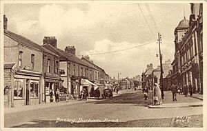
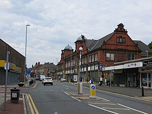 Durham Road, Birtley |
|
| Population | 8,367 (2011.Ward) |
| OS grid reference | NZ271563 |
| Metropolitan borough | |
| Metropolitan county | |
| Region | |
| Country | England |
| Sovereign state | United Kingdom |
| Post town | Chester Le Street |
| Postcode district | DH2, DH3 |
| Dialling code | 0191 |
| Police | Northumbria |
| Fire | Tyne and Wear |
| Ambulance | North East |
| EU Parliament | North East England |
| UK Parliament |
|
Birtley is a town located in the Metropolitan Borough of Gateshead, in Tyne and Wear, England. It sits just south of Gateshead and is connected to Chester-le-Street, which is in County Durham.
For a long time, until 1974, Birtley and nearby areas like Barley Mow, Vigo, and Portobello were part of County Durham. Then, they became part of Tyne and Wear, under the Gateshead council. Birtley is now part of a larger urban area that includes places like Chester-le-Street, Washington, Houghton le Spring, Hetton le Hole, and Sunderland.
In 2011, about 8,367 people lived in the Birtley area of Gateshead.
In September 2024, Prince William visited Birtley. He came to see the Birtley Swimming Centre as it reopened.
Contents
Discovering Birtley's Past
Elisabethville: A Special Village
During World War I, a unique village called Elisabethville was built in Birtley. This area was a special home for Belgian refugees. These refugees worked at the Royal Ordnance Factory, helping with the war effort.
Elisabethville was a community of about 6,000 people. They lived in hostels and small cottages. After the war ended, most of the Belgian residents returned home. Later, the village was taken down and replaced with new, permanent homes. You can learn more about this interesting history in the book The Birtley Belgians.
The Angel of the North Sculpture
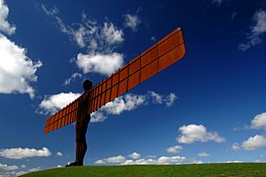
Just north of Birtley, you can find the famous Angel of the North sculpture. This huge artwork was created by Antony Gormley and finished in February 1998. It stands on high ground where an old coal mine, called the 'Betty Ann Pit', used to be. It's a very well-known landmark!
Places of Worship in Birtley
Birtley has several churches for different faiths. There is also a large cemetery with a chapel and a place for cremations.
- St Joseph's (Roman Catholic): This church was built in 1843. It was designed in an early Gothic style by John Dobson.
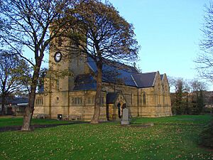
- St John the Evangelist (Church of England)
- Birtley Methodist Church
- Kingdom Hall of Jehovah's Witnesses: This building is shared by three groups from Birtley, Washington, and Chester-le-Street.
Getting Around Birtley
Road Connections
The main road through Birtley is the A167. This road runs all the way from Topcliffe in North Yorkshire to the north of Newcastle upon Tyne. It's the same road that crosses the famous Tyne Bridge.
The A167 used to be part of the historic Great North Road and the main A1. However, a bypass was built in the 1960s to make travel faster.
Railway History
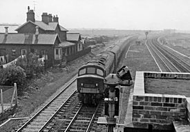
The main East Coast railway line runs just west of Birtley. In the past, mainline trains used to stop at Birtley's own station. However, Birtley railway station closed on 5 December 1955. The Station Hotel, which opened in 1868, also closed in 1971.
See also
 In Spanish: Birtley (Tyne y Wear) para niños
 | Jackie Robinson |
 | Jack Johnson |
 | Althea Gibson |
 | Arthur Ashe |
 | Muhammad Ali |


