Bongaree, Queensland facts for kids
Quick facts for kids BongareeBribie Island, Queensland |
|||||||||||||||
|---|---|---|---|---|---|---|---|---|---|---|---|---|---|---|---|
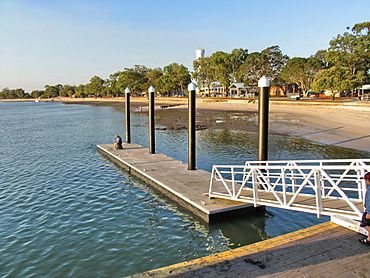
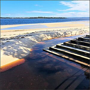
Bongaree Jetty looking north, 2006
|
|||||||||||||||
| Population | 8,162 (2021 census) | ||||||||||||||
| • Density | 995/km2 (2,580/sq mi) | ||||||||||||||
| Postcode(s) | 4507 | ||||||||||||||
| Area | 8.2 km2 (3.2 sq mi) | ||||||||||||||
| Time zone | AEST (UTC+10:00) | ||||||||||||||
| Location |
|
||||||||||||||
| LGA(s) | City of Moreton Bay | ||||||||||||||
| State electorate(s) | Pumicestone | ||||||||||||||
| Federal Division(s) | Longman | ||||||||||||||
|
|||||||||||||||
Bongaree is a lovely suburb located on Bribie Island in Queensland, Australia. It's part of the City of Moreton Bay. Bongaree is on the western side of the island, right next to the beautiful Pumicestone Passage. In 2021, about 8,162 people called Bongaree home.
Contents
Exploring Bongaree's Geography
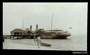
Bongaree is found on the south-western tip of Bribie Island. It sits at the northern end of Moreton Bay. The Bribie Island Bridge connects Bongaree to Sandstone Point on the mainland. This bridge is the only way to drive onto Bribie Island.
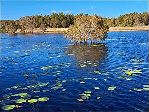
Buckleys Hole Conservation Park
The southern part of Bongaree is home to the Buckleys Hole Conservation Park. This park is about 88 hectares (217 acres) in size. It has many different landscapes, including a freshwater lagoon, woodlands, and open forests. It's a great spot for bushwalking and fishing.
A Look Back at Bongaree's History
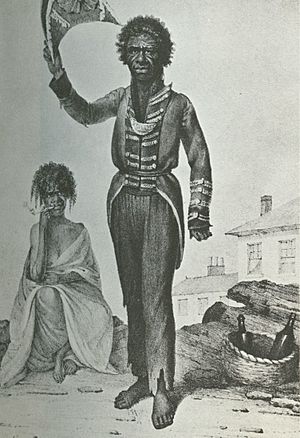
The name "Bongaree" comes from an Aboriginal explorer named Bungaree. He sailed with Matthew Flinders on his trips to explore the Australian coastline.
Early Schools and Churches
In 1891, a school opened at the Bribie Island Aboriginal Mission. A provisional school also opened in 1908 but closed soon after.
The first Methodist church services were held in 1923 under a gum tree. Later, a church building was moved to Bongaree in 1929. A new, larger church was opened in 1986.
Bribie Island Provisional School started in 1924. It became Bribie Island State School in 1925.
Anglican residents decided to build a church in 1927. It was named St Peter the fisherman. This church was dedicated in 1928. Over the years, it was renovated and later replaced with a new, larger church building in 2008.
In 1947, three old Army huts were moved to Bongaree. They became a Catholic church, a hall, and a priest's home. This journey was very difficult, taking four weeks! The church was opened in 1948. It was built to honor two young airmen who died during World War II.
The Bribie Bridge and Modern Times
The Bribie Bridge was built between 1961 and 1963. It officially opened on October 19, 1963. For a while, you had to pay a small fee (a toll) to cross the bridge.
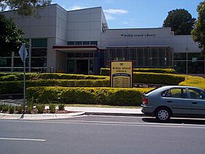
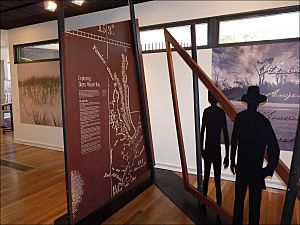
The Bribie Island library opened in Bongaree in 1976. It was updated in 2016. Bribie Island State High School opened its doors in 1989. The Bribie Island Seaside Museum, a great place to learn about local history, opened in 2010.
Who Lives in Bongaree?
In 2011, Bongaree had 6,524 people, with an average age of 62. By 2016, the population grew to 6,947. In the most recent count in 2021, Bongaree had 8,162 residents.
Schools in Bongaree
Bongaree has excellent schools for young people.
Bribie Island State School
Bribie Island State School is a government primary school. It teaches students from Prep (kindergarten) to Year 6. In 2018, it had 647 students. The school also has a special education program.
Bribie Island State High School
Bribie Island State High School is a government secondary school. It teaches students from Year 7 to Year 12. In 2018, there were 1,189 students. This school also offers a special education program.
Places to Visit and Services
Bribie Island Library
The Moreton Bay City Council runs the Bribie Island Library. It's a great place to find books, movies, and learn new things.
Churches in Bongaree
- St Peter's Anglican Church is located on Banya Street.
- The Little Flower Catholic Church is on First Avenue.
- Bribie Island Uniting Church is on Webster Street.
- Bribie Island Baptist Church is on Cotterill Avenue.
- Bribie Island Church of Christ is on Foley Street.
- Bribie Christian Outreach Centre (also known as the Awesome Bribie Island Church) is on Toorbul Street.
Fun Attractions
The Bribie Island Seaside Museum is a fantastic place to visit. It's located on South Esplanade. Here, you can learn all about the history of Bribie Island and the surrounding area.
 | James Van Der Zee |
 | Alma Thomas |
 | Ellis Wilson |
 | Margaret Taylor-Burroughs |


