
Bribie Island facts for kids
|
Native name:
Yarun
|
|
|---|---|

A NASA Landsat image of Bribie Island
|
|

Bribie Island
Location in Queensland
Location of Bribie Island
|
|
| Geography | |
| Location | Coral Sea |
| Coordinates | 26°57′54″S 153°07′30″E / 26.965°S 153.125°E |
| Area | 148 km2 (57 sq mi) |
| Length | 34 km (21.1 mi) |
| Width | 8 km (5 mi) |
| Administration | |
|
Australia
|
|
| State | Queensland |
| Local Government Areas | City of Moreton Bay & Sunshine Coast Region |
| Demographics | |
| Population | 18,189 (2016) |

Bribie Island is a beautiful sand island off the coast of Queensland, Australia. It's the smallest of three big sand islands that protect the northern part of Moreton Bay, Queensland. The other two are Moreton Island and North Stradbroke Island. Bribie Island is about 34 kilometers (21 miles) long and 8 kilometers (5 miles) wide at its widest point. The traditional name for the island, used by the Joondaburri people, is Yarun.
Bribie Island is very close to the mainland. It's separated by a calm waterway called Pumicestone Passage. The side of the island facing the ocean has small waves. This is because Moreton Island and sandbanks protect it from strong winds. The side facing the mainland is very calm with white sandy beaches.
Most of Bribie Island is a national park or forestry land, meaning it's not built up. The southern part of the island has towns like Bongaree, Woorim, Bellara, and Banksia Beach. A bridge connects the island to the mainland at Sandstone Point. This bridge was finished in 1963.
Buckley's Hole, at the very south of the island, is a special place for birds. Many different bird species live and visit there.
In January 2022, the ocean broke through the narrow northern tip of the island. This happened because of Cyclone Seth and a very high tide. It created a new passage about 200 meters (656 feet) wide. This event has raised concerns for people living on the nearby mainland at Golden Beach.
Contents
Geography of Bribie Island
.jpg)
Bribie Island is made of sand, just like the coastal areas on the mainland. The sand has formed two large, low hills that stretch towards the north-west.
Towns and Areas
When you cross the bridge from the mainland, the first town you reach is Bellara. Other towns on the southern part of the island include:
- Woorim: This town is on the ocean side, about 7 kilometers (4.3 miles) from Bellara.
- Bongaree: Located at the southern end of the island, on the calm passage side.
- Banksia Beach and White Patch: These are further north in the developed area, also on the passage side.
The undeveloped northern part of the island includes two other areas: Welsby and Bribie Island North.
Most of the towns on Bribie Island are part of the City of Moreton Bay. However, Bribie Island North is part of the Sunshine Coast Region.
Getting Around
Caboolture Bus Lines offers bus services around Bribie Island. There are also routes that connect the island to Caboolture and Morayfield on the mainland. These bus services are often timed to connect with Queensland Rail trains to and from Brisbane.
Animals and Plants
Bribie Island is home to lots of different wildlife. You might see kangaroos, wallabies, emus, and various types of snakes. Green tree frogs and dingoes also live here. Sometimes, these animals wander from the national park into the towns.
Pumicestone Passage, the water between the island and the mainland, is a protected marine park. It's a safe home for amazing sea creatures like dugongs, turtles, and dolphins. You can also find many mangrove forests in this area.
On the island itself, you'll mostly see eucalyptus forests, banksia plants, and heathlands.
Bribie Island is a great place for birdwatching, with about 350 different bird species. These include honeyeaters, lorikeets, waterbirds, and birds of prey. Flying foxes (also called fruit bats) visit the island. There are also several types of small insect-eating bats. Flying foxes help pollinate plants and spread seeds. Insect-eating bats help control mosquito populations.
Buckley's Hole, at the southern tip of the island, became an environmental park in 1992. It's a very important habitat for birds.
National Park


The Bribie Island National Park covers about 55.8 square kilometers (21.5 square miles). This is almost a third of the island's total area. Many people think the national park covers most of the undeveloped parts of the island. However, much of the island's center is actually made up of pine tree plantations. These areas are usually closed to the public.
If you want to drive into the national park, you need a permit. Vehicle access is mainly through the Beach Access Track at Woorim or the Ranger Station at Whitepatch.
Island History
First People
The first people to live on Bribie Island were the Djindubari people. They were part of the larger Gubbi Gubbi group from South-East Queensland. When Matthew Flinders visited in 1799, there were many Aboriginal people living on the island. However, by 1891, very few remained.
Joondaburri Way of Life
The Joondaburri people lived a rich life on the island. They used the land and sea for food, following the seasons.
- In winter, they caught mullet fish. They even trained dolphins to help herd the fish into nets! Bream and tailor fish were also caught.
- In summer, they found mud crabs and oysters. They also hunted dugongs. Summer whiting and flathead fish were caught with spears or nets.
- They gathered Bungwall Fern for its starchy roots all year round.
- Kangaroo, eels, and carpet snakes were also important food sources.
Oysters were a very important food. Their shells formed huge piles called "middens," some many meters thick. Early settlers later used these shells for lime. A big midden was near Bongaree jetty, and another huge one was at White Patch.
James Cook, 1770
On May 17, 1770, Lieutenant James Cook sailed past the island in his ship, the HM Bark Endeavour. He saw the Glass House Mountains to the west of the island. He named them "Glass Houses" because their shape reminded him of glass factories in England. Cook named the nearby water "Glass House Bay."
Matthew Flinders, 1799
On July 16, 1799, Captain Matthew Flinders sailed south from Glass House Bay. He went between Moreton Island and the mainland, along the southern shore of Bribie Island. He landed on Bribie Island, thinking it was the mainland. He met a group of Aboriginal people on the beach. The meeting was peaceful at first. But when one man tried to take Flinders' hat, things changed. Flinders and his crew returned to their boat. As they left, the man threw a spear, which missed. Flinders fired his gun, and the Aboriginal people ran away. Flinders named this spot "Point Skirmish."
Flinders spent 15 days in the area. He explored the mainland side of the passage and climbed Mt. Beerburrum to get a better view. It was later discovered that this land was actually an island.
19th Century
.jpg)
The name Bribie might come from a convict named Bribie or Breiby. He collected materials for making baskets on the island in the 1830s. However, some historians believe the name might come from a Joondaburri Elder named Bribé, who lived around 1830.
In 1890, a mission station was set up on Bribie Island to help Aboriginal people. It had a school and dormitories. But by 1892, the mission faced money problems and the land was swampy. So, it was closed, and the residents moved to Myora Mission on North Stradbroke Island.
World War II Defenses

During World War II, from 1939 to 1943, special forts and defenses were built on Bribie Island. These were part of a plan to protect South East Queensland from attacks. They also helped train Australian soldiers. Other defenses were built on Moreton Island and at Caloundra. All these forts worked together to protect Moreton Bay.
In 1939, before the war started, it was decided to place large guns on northern Bribie Island. These guns were meant to guard the main shipping channel. The guns had a range of about 19 kilometers (12 miles).
After Japan attacked Pearl Harbor in December 1941, construction of the forts on Bribie Island sped up. By April 1942, the gun placements were almost finished. The total cost for the concrete structures of Fort Bribie was about £55,000.
In 1942, Japanese forces landed in Papua New Guinea. This made people in Queensland very worried. More soldiers and bigger guns were sent to Bribie Island. New forts were built at Skirmish Point on southern Bribie Island.
American soldiers also came to Australia during the Pacific War. There was a belief that a plan existed to defend Australia only south of Brisbane, known as the "Brisbane Line." However, this was never an official policy.
At Fort Bribie, the Royal Australian Navy used special huts to control underwater mines. These mines were placed in the North West Channel to detect and stop enemy submarines. If a submarine was detected, the mines could be exploded. The mines weighed about 1,430 kilograms (3,150 pounds). They were never detonated during the war.
After World War II
The Bribie Island library opened in 1976. It was updated in 2016.
On December 14, 2020, a very high tide broke through the northern tip of the island, causing a lot of damage. Then, on January 2, 2022, Cyclone Seth and another king tide created a new, wide passage through the island's northern tip. This new opening allows ocean waves to reach the mainland at Golden Beach, which is a concern for local residents.
Special Places
Bribie Island has some places that are important for their history. These are called heritage-listed sites. One example is the Bribie Island Second World War Fortifications.
Famous People
The artist Ian Fairweather lived on Bribie Island for many years. A park on the island is named after him.
Some famous rugby league players grew up on Bribie Island. These include Jack Reed and Matt Gillett.
Bribie Island Bridge

The current bridge connecting Bribie Island to the mainland was very special when it was built. It was the longest concrete bridge of its kind in Australia. The bridge is 831.4 meters (2,728 feet) long. It cost £520,000 and opened on October 19, 1963. The Premier of Queensland, Frank Nicklin, officially opened it.
There are plans to build a second bridge to Bribie Island. A study in 2015 suggested building the new bridge about 15 meters (49 feet) north of the existing one. The exact start date for construction has not been announced yet.
In early 2023, the Queensland Government made plans for the new bridge. It would have four lanes for cars and wider paths for walking and cycling. The Moreton Bay City Council also suggested turning the old bridge into a "green" bridge. This would mean replacing the car lanes with shared paths for bikes and walkers, and adding plants. This idea came about because demolishing the 60-year-old bridge would be very expensive.
Water Supply
There has been a suggestion to build a desalination plant on Bribie Island. A desalination plant takes salt out of seawater to make fresh drinking water. Some people are against this idea because of environmental worries. Others think it would be good for the island's water supply.
Things to Do and Places to Go

Bribie Island has many places for shopping and fun.
- The main shopping center is in Bellara. It has a Woolworths supermarket and a Target store. There's also another Woolworths at Banksia Beach.
- You can find many other shops like hardware stores, medical centers, and food places around the island.
- There are two large hotels: the Bribie Island Hotel in Bellara and the Blue Pacific Hotel in Woorim.
- Many people enjoy visiting local clubs. These include the Bribie Island Citizens and RSL Club, two bowls clubs in Bongaree, and the Surf Life Saving Club at Woorim.
- There's a golf club in Woorim, and a newer one at Banksia Beach.
- A small movie theater opened in 1997.
The House of Happiness is a special holiday place for children with disabilities. It has 88 beds and is located in Woorim.

The Moreton Bay City Council runs a library in Bongaree. They also operate the Bribie Island Aquatic Leisure Centre. Bribie Jetty at Bongaree is a popular spot for recreation and fishing.
News and Media
The local newspaper, the Bribie Weekly, stopped being published in June 2020.
Schools
Bribie Island has two primary schools and one high school.
- Bribie Island State School is in Bongaree and opened in 1924.
- Banksia Beach State School opened in 1992.
- Bribie Island State High School opened in 1989. Before then, high school students traveled to Caboolture. The high school now has over 1,000 students.
Who Lives Here
In 2006, about 16,209 people lived on Bribie Island.
- About 48% were males and 52% were females.
- About 1.6% of the population were Indigenous people.
- About 13.6% of the people were children aged 0–14 years.
- A large number, about 50.3%, were people aged 55 years and older.
- The average age of people on the island was 55 years.
- Most residents (75.7%) were born in Australia. Others came from England (6.6%), New Zealand (4.0%), and other countries.
See also
 In Spanish: Isla Bribie para niños
Images for kids
-
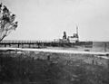
Passenger steamship service, 1912
